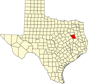
Anderson County, Texas
Anderson ni nkhalwe panji muzi uwo ukusangika mu nthavwa panji state ya Texas,mu charu cha United States of America,ku Amerika Wakumpoto.Unandi wa ŵanthu ni 58,402,ndipo ukulu wa malo ni 1,071 sq mi (2,774 km2).Mpando wa muzi uwu ni Palestine.
Anderson County | |
|---|---|
County | |
 The Anderson County Courthouse in Palestine | |
 Location within the U.S. state of Texas | |
 Texas's location within the U.S. | |
| Coordinates: 31°49′N 95°39′W / 31.81°N 95.65°W | |
| Country | |
| State | |
| Founded | March 24, 1846 |
| Named for | Kenneth L. Anderson |
| Seat | Palestine |
| Largest city | Palestine |
| Area | |
| • Total | 1,078 sq mi (2,790 km2) |
| • Land | 1,063 sq mi (2,750 km2) |
| • Water | 15 sq mi (40 km2) 1.4% |
| Population (2020) | |
| • Total | 57,922 |
| • Density | 54/sq mi (21/km2) |
| Time zone | UTC−6 (Central) |
| • Summer (DST) | UTC−5 (CDT) |
| Congressional district | 5th |
| Website | www |
This article uses material from the Wikipedia chiTumbuka article Anderson County, Texas, which is released under the Creative Commons Attribution-ShareAlike 3.0 license ("CC BY-SA 3.0"); additional terms may apply (view authors). Content is available under CC BY-SA 4.0 unless otherwise noted. Images, videos and audio are available under their respective licenses.
®Wikipedia is a registered trademark of the Wiki Foundation, Inc. Wiki chiTumbuka (DUHOCTRUNGQUOC.VN) is an independent company and has no affiliation with Wiki Foundation.