List Of Airports In Yukon

This is a list of airports in Yukon.

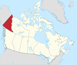
It includes all Nav Canada certified and registered water and land airports, aerodromes and heliports in the Canadian territory of Yukon. Airport names in italics are part of the National Airports System.
List Of Airports In Yukon
Yukon

List of airports and heliports

List Of Airports In Yukon 
Whitehorse/Cousins Airport
List Of Airports In Yukon 
Erik Nielsen Whitehorse International Airport
List Of Airports In Yukon 
Watson Lake Airport
List Of Airports In Yukon 
Old Crow Airport
List Of Airports In Yukon 
Faro Airport

The list is sorted by the name of the community served; click the sort buttons in the table header to switch listing order.

Community   Airport name   ICAO   TC LID   IATA   Coordinates  
Beaver Creek Beaver Creek Airport CYXQ YXQ 62°24′37″N 140°52′03″W / 62.41028°N 140.86750°W / 62.41028; -140.86750 (Beaver Creek Airport)
Braeburn Lodge Braeburn Airport (Cinnamon Bun Airstrip) CEK2 61°29′04″N 135°46′35″W / 61.48444°N 135.77639°W / 61.48444; -135.77639 (Braeburn Airport)
Burwash Landing Burwash Airport CYDB YDB 61°22′14″N 139°02′24″W / 61.37056°N 139.04000°W / 61.37056; -139.04000 (Burwash Airport)
Carcross Carcross Airport CFA4 60°10′27″N 134°41′52″W / 60.17417°N 134.69778°W / 60.17417; -134.69778 (Carcross Airport)
Carcross Carcross Water Aerodrome CEB7 60°11′00″N 134°42′00″W / 60.18333°N 134.70000°W / 60.18333; -134.70000 (Carcross Water Aerodrome)
Carmacks Carmacks Airport CEX4 62°06′39″N 136°10′42″W / 62.11083°N 136.17833°W / 62.11083; -136.17833 (Carmacks Airport)
Chapman Lake Chapman Aerodrome CEZ2 64°54′13″N 138°16′39″W / 64.90361°N 138.27750°W / 64.90361; -138.27750 (Chapman Aerodrome)
Dawson City Dawson City Airport CYDA YDA 64°02′32″N 139°07′48″W / 64.04222°N 139.13000°W / 64.04222; -139.13000 (Dawson City Airport)
Eagle Plains Finlayson Lake Airport CFT3 61°41′29″N 130°46′26″W / 61.69139°N 130.77389°W / 61.69139; -130.77389 (Finlayson Lake Airport)
Eagle Plains Wiley Aerodrome CAJ2 66°29′28″N 136°34′24″W / 66.49111°N 136.57333°W / 66.49111; -136.57333 (Wiley Aerodrome)
Faro Faro Airport CZFA ZFA 62°12′27″N 133°22′33″W / 62.20750°N 133.37583°W / 62.20750; -133.37583 (Faro Airport)
Fort Selkirk Fort Selkirk Aerodrome CFS3 62°46′06″N 137°23′05″W / 62.76833°N 137.38472°W / 62.76833; -137.38472 (Fort Selkirk Aerodrome)
Haines Junction Haines Junction Airport CYHT YHT 60°47′21″N 137°32′44″W / 60.78917°N 137.54556°W / 60.78917; -137.54556 (Haines Junction Airport)
Hyland Hyland Airport CFT5 61°31′26″N 128°16′11″W / 61.52389°N 128.26972°W / 61.52389; -128.26972 (Hyland Airport)
La Biche River La Biche River Airport CFP6 60°07′45″N 124°02′55″W / 60.12917°N 124.04861°W / 60.12917; -124.04861 (La Biche River Airport)
Macmillan Pass Macmillan Pass Airport CFC4 63°10′34″N 130°12′13″W / 63.17611°N 130.20361°W / 63.17611; -130.20361 (Macmillan Pass Airport)
Mayo Mayo Airport CYMA YMA 63°36′59″N 135°52′06″W / 63.61639°N 135.86833°W / 63.61639; -135.86833 (Mayo Airport)
McQuesten McQuesten Airport CFP4 63°36′18″N 137°33′49″W / 63.60500°N 137.56361°W / 63.60500; -137.56361 (McQuesten Airport)
Minto Minto Landing Aerodrome CML7 62°35′38″N 136°52′27″W / 62.59389°N 136.87417°W / 62.59389; -136.87417 (Minto Landing Aerodrome)
Minto Mine Minto Aerodrome CMN4 62°36′17″N 137°13′19″W / 62.60472°N 137.22194°W / 62.60472; -137.22194 (Minto Aerodrome)
Ogilvie River Ogilvie Aerodrome CFS4 65°40′00″N 138°07′00″W / 65.66667°N 138.11667°W / 65.66667; -138.11667 (Ogilve Aerodrome)
Old Crow Old Crow Airport CYOC YOC 67°34′14″N 139°50′21″W / 67.57056°N 139.83917°W / 67.57056; -139.83917 (Old Crow Airport)
Pelly Crossing Pelly Crossing Airport CFQ6 62°50′15″N 136°31′40″W / 62.83750°N 136.52778°W / 62.83750; -136.52778 (Pelly Crossing Airport)
Pine Lake Pine Lake Aerodrome CFY5 60°06′11″N 130°56′01″W / 60.10306°N 130.93361°W / 60.10306; -130.93361 (Daughney Aerodrome)
Ross River Ross River Airport CYDM XRR 61°58′14″N 132°25′20″W / 61.97056°N 132.42222°W / 61.97056; -132.42222 (Ross River Airport)
Silver City Silver City Airport CFQ5 61°01′44″N 138°24′27″W / 61.02889°N 138.40750°W / 61.02889; -138.40750 (Silver City Airport)
Teslin Teslin Airport CYZW YZW 60°10′23″N 132°44′30″W / 60.17306°N 132.74167°W / 60.17306; -132.74167 (Teslin Airport)
Tincup Wilderness Lodge Tincup Lake Water Aerodrome CEF9 61°44′56″N 139°14′45″W / 61.74889°N 139.24583°W / 61.74889; -139.24583 (Tincup Lake Water Aerodrome)
Twin Creeks Twin Creeks Airport CFS7 62°37′10″N 131°16′13″W / 62.61944°N 131.27028°W / 62.61944; -131.27028 (Twin Creeks Airport)
Watson Lake Watson Lake Airport CYQH YQH 60°06′59″N 128°49′21″W / 60.11639°N 128.82250°W / 60.11639; -128.82250 (Watson Lake Airport)
Watson Lake Watson Lake Water Aerodrome CEJ9 60°07′00″N 128°47′00″W / 60.11667°N 128.78333°W / 60.11667; -128.78333 (Watson Lake Water Aerodrome)
Whitehorse Erik Nielsen Whitehorse International Airport CYXY YXY 60°42′34″N 135°04′08″W / 60.70944°N 135.06889°W / 60.70944; -135.06889 (Erik Nielsen Whitehorse International Airport)
Whitehorse Whitehorse/Cousins Airport CFP8 60°48′29″N 135°10′38″W / 60.80806°N 135.17722°W / 60.80806; -135.17722 (Whitehorse/Cousins Airport)
Whitehorse Whitehorse Water Aerodrome CEZ5 60°41′28″N 135°02′13″W / 60.69111°N 135.03694°W / 60.69111; -135.03694 (Whitehorse Water Aerodrome)

Defunct airports

Community   Airport name   ICAO   TC LID   IATA   Coordinates  
Dawson City Dawson City Water Aerodrome CEG7 64°04′00″N 139°26′00″W / 64.06667°N 139.43333°W / 64.06667; -139.43333 (Dawson City Water Aerodrome)
Faro Faro/Johnson Lake Water Aerodrome CFC9 62°12′12″N 133°23′33″W / 62.20333°N 133.39250°W / 62.20333; -133.39250 (Faro/Johnson Lake Water Aerodrome)
Haines Junction Haines Junction/Pine Lake Water Aerodrome CFE8 60°48′10″N 137°29′27″W / 60.80278°N 137.49083°W / 60.80278; -137.49083 (Haines Junction/Pine Lake Water Aerodrome)
Teslin Teslin Water Aerodrome CEE9 60°10′00″N 132°46′00″W / 60.16667°N 132.76667°W / 60.16667; -132.76667 (Teslin Water Aerodrome)

References

Tags:

List Of Airports In Yukon List of airports and heliportsList Of Airports In Yukon Defunct airportsList Of Airports In YukonAerodromeAirportHeliportNational Airports SystemNav CanadaProvinces and territories of CanadaYukon

🔥 Trending searches on Wiki English:

John CenaErin BrockovichOshi no KoWorld Snooker ChampionshipMay 1Brownie (folklore)Guardians of the Galaxy Vol. 3Elizabeth OlsenEFL ChampionshipMarvel Cinematic UniverseKatherine HeiglYouTube KidsMrs. DavisKrysten RitterKylian MbappéJennifer AnistonJames MarsdenOlivia WildeBlood MeridianLily TomlinList of Rick and Morty episodes2023 Badminton Asia ChampionshipsJawan (film)Barry HumphriesBook Review IndexGuy Ritchie's The CovenantSuccession (TV series)Tottenham Hotspur F.C.Edward VIIChristina Aistrup HansenSteven YeunJesusTina TurnerEnglish football league systemJimmy ButlerKnights of the Zodiac (film)Sacramento KingsKarl LagerfeldChester Bennington2010 Northumbria Police manhuntNick JonasMarisa TomeiMark WahlbergSarah SnookChristian BaleBruce WillisTurkeyTracy PollanRusso brothersNikola JokićBarack ObamaWednesday (TV series)Isiah ThomasJoey LawrenceRob LoweSisu (film)Ronnie O'SullivanSeven deadly sinsKailer YamamotoFast & FuriousJohn LennonYellowjackets (TV series)Katy PerryEd SheeranHenry VIIIJennifer CoolidgeMillie Bobby BrownThe MandalorianCallum WilsonArsenal F.C.Al Nassr FCMichael JordanSergio PérezOlivia MunnKristin ChenowethElon MuskMinecraft🡆 More