H. H. Benedict Range
The H.
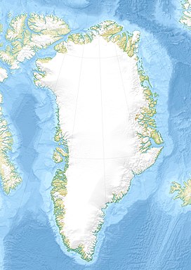
H. Benedict Range or H. H. Benedict Mountains (Danish: H. H. Benedict Bjerge) is a mountain range in Peary Land, Northern Greenland. Administratively this range is part of the Northeast Greenland National Park.
| H. H. Benedict Range | |
|---|---|
| H. H. Benedict Bjerge | |
 Map of Northern Ellesmere Island and far Northern Greenland. | |
| Highest point | |
| Peak | Stjernebannertinde |
| Elevation | 1,433 m (4,701 ft) |
| Listing | List of mountain ranges of Greenland |
| Dimensions | |
| Length | 60 km (37 mi) E/W |
| Width | 30 km (19 mi) N/S |
| Geography | |
| Country | Greenland |
| Region | Peary Land |
| Range coordinates | 83°20′N 33°0′W / 83.333°N 33.000°W |
| Parent range | Roosevelt Range |
| Geology | |
| Age of rock | Precambrian, Silurian |
The H. H. Benedict range is part of the northernmost mountain system in the world. The area where its ridges rise is barren and uninhabited.
History
The mountain chain was named by Robert Peary after Henry H. Benedict (1844–1935), one of the founding members of the Peary Arctic Club in New York. Besides his financial support Mr Benedict had gifted a pianola for the entertainment of the members of the expedition.
Peary saw the range from a distance, but didn't explore it. Aerial surveys begun by Lauge Koch in the 1920s mapped the area and Danish surveyors named some features. Only in 1996 did an expedition climb the highest point of the range.
Geography
The H. H. Benedict Range is a subrange of the Roosevelt Range. Its highest peak is 1,433 m (4,701 ft) high Stjernebannertinde, a conspicuous summit.
The range is located in Northern Peary Land, stretching north of the Frederick E. Hyde Fjord. The valleys between the mountains are filled with glaciers, the largest of which are the Borup Glacier, Moore Glacier and Ydun Glacier.
The H. H. Benedict Range runs roughly from east to west in Johannes V. Jensen Land east of the Mary Peary Peaks. The Daly Range (Daly Bjerge) rises to the east, between the eastern end of the H. H. Benedict Range and the Wandel Sea.
Geology
In the same manner as the Roosevelt Range the H. H. Benedict Range is part of the Caledonian orogeny extending eastward from north Ellesmere Island.
 |
See also
References
External links
This article uses material from the Wikipedia English article H. H. Benedict Range, which is released under the Creative Commons Attribution-ShareAlike 3.0 license ("CC BY-SA 3.0"); additional terms may apply (view authors). Content is available under CC BY-SA 4.0 unless otherwise noted. Images, videos and audio are available under their respective licenses.
®Wikipedia is a registered trademark of the Wiki Foundation, Inc. Wiki English (DUHOCTRUNGQUOC.VN) is an independent company and has no affiliation with Wiki Foundation.
