Cam Ranh
Cam Ranh (ⓘ) is a city in Southern Khánh Hòa Province, in the South Central Coast region of Vietnam.
Cam Ranh Thành phố Cam Ranh | |
|---|---|
| Cam Ranh City | |
.jpg) A resort in Cam Ranh | |
 Seal | |
 Cam Ranh Location of in Vietnam  Cam Ranh Cam Ranh (Southeast Asia)  Cam Ranh Cam Ranh (Asia) | |
| Coordinates: 11°54′49″N 109°8′13″E / 11.91361°N 109.13694°E | |
| Country | |
| Province | Khánh Hòa |
| Founded |
|
| Capital | Cam Ranh |
| Area | |
| • Total | 316 km2 (122 sq mi) |
| Population (2019) | |
| • Total | 138.510 |
| • Density | 438/km2 (1,130/sq mi) |
| Time zone | UTC+7 (Indochina Time) |
| Climate | Aw |
| Website | https://camranh.khanhhoa.gov.vn/english |
History
Cam Ranh, known in the ancient Ede language as Kăm Mran, is a land closely associated with the development of the Champa culture. Since ancient times, Cam Ranh has been an important military and economic location of the Champa kingdom. During this period, Cam Ranh was a bustling commercial center, with many merchants from neighboring countries coming to trade. The land of Cam Ranh was also home to many ethnic minorities, primarily Cham, Ede, and Raglai people.
In 1939, the French colonial government established the Ba Ngòi Administrative Agency, which was subordinate to the Khánh Hòa province. This agency included parts of the Vĩnh Xương and Ninh Thuận districts. During this period, Cam Ranh was built by the French into an important military base, with many fortifications being built, including Cam Ranh Airport.
After 1954, Cam Ranh became a part of the Khánh Hòa province of South Vietnam. The South Vietnamese government continued to develop Cam Ranh into an important military base, with many new facilities being built, including Cam Ranh Military Station.
In the Vietnam War, Cam Ranh was a major military stronghold of the United States and the South Vietnamese government. The US military built Cam Ranh Air Base into a major military base, with many fortifications being built.
After 1975, Cam Ranh was renamed Cam Ranh town, which is subordinate to the Khánh Hòa province. On December 23, 2010, the Government issued Resolution 65/NQ-CP to establish the city of Cam Ranh based on the entire area and population of Cam Ranh town.
Geography
It is the second-largest city in the province, after Nha Trang. It is located on Cam Ranh Bay. As of 2009 the city had a population of 121,050 and covered an area of 316 km2.
-
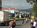 Street in Cam Ranh
 -
 Post office


Infrastructure
- Cam Ranh International Airport
- Ba Ngòi Port
Climate
Cam Ranh has a tropical savanna climate (Köppen climate classification: As).
| Climate data for Cam Ranh | |||||||||||||
|---|---|---|---|---|---|---|---|---|---|---|---|---|---|
| Month | Jan | Feb | Mar | Apr | May | Jun | Jul | Aug | Sep | Oct | Nov | Dec | Year |
| Record high °C (°F) | 33.3 (91.9) | 33.0 (91.4) | 34.5 (94.1) | 37.1 (98.8) | 39.0 (102.2) | 38.7 (101.7) | 39.0 (102.2) | 39.0 (102.2) | 37.5 (99.5) | 37.7 (99.9) | 33.5 (92.3) | 32.5 (90.5) | 39.0 (102.2) |
| Mean daily maximum °C (°F) | 28.3 (82.9) | 29.6 (85.3) | 31.0 (87.8) | 32.4 (90.3) | 33.4 (92.1) | 33.5 (92.3) | 33.4 (92.1) | 33.7 (92.7) | 32.4 (90.3) | 30.6 (87.1) | 29.2 (84.6) | 28.0 (82.4) | 31.3 (88.3) |
| Daily mean °C (°F) | 24.5 (76.1) | 25.1 (77.2) | 26.4 (79.5) | 28.1 (82.6) | 29.0 (84.2) | 29.1 (84.4) | 28.8 (83.8) | 28.9 (84.0) | 28.0 (82.4) | 26.8 (80.2) | 26.0 (78.8) | 24.9 (76.8) | 27.2 (81.0) |
| Mean daily minimum °C (°F) | 21.9 (71.4) | 22.1 (71.8) | 23.3 (73.9) | 24.8 (76.6) | 25.7 (78.3) | 25.8 (78.4) | 25.5 (77.9) | 25.6 (78.1) | 24.9 (76.8) | 24.2 (75.6) | 23.6 (74.5) | 22.7 (72.9) | 24.2 (75.6) |
| Record low °C (°F) | 14.4 (57.9) | 16.4 (61.5) | 17.1 (62.8) | 18.6 (65.5) | 21.5 (70.7) | 21.1 (70.0) | 21.3 (70.3) | 21.0 (69.8) | 21.6 (70.9) | 19.3 (66.7) | 18.7 (65.7) | 15.7 (60.3) | 14.4 (57.9) |
| Average rainfall mm (inches) | 24.4 (0.96) | 10.0 (0.39) | 38.0 (1.50) | 35.3 (1.39) | 89.4 (3.52) | 68.2 (2.69) | 53.9 (2.12) | 56.2 (2.21) | 167.1 (6.58) | 248.8 (9.80) | 319.6 (12.58) | 164.9 (6.49) | 1,324.5 (52.15) |
| Average rainy days | 5.6 | 2.6 | 3.1 | 4.0 | 8.9 | 8.5 | 8.6 | 9.1 | 13.5 | 15.8 | 14.8 | 11.6 | 105.9 |
| Average relative humidity (%) | 74.5 | 75.0 | 76.1 | 76.4 | 75.7 | 74.1 | 73.6 | 73.9 | 78.7 | 80.8 | 79.1 | 75.6 | 76.1 |
| Mean monthly sunshine hours | 214.7 | 237.0 | 272.0 | 266.4 | 255.5 | 224.0 | 234.6 | 230.9 | 199.0 | 182.5 | 169.5 | 164.7 | 2,640.9 |
| Source: Vietnam Institute for Building Science and Technology | |||||||||||||
Gallery
-
 City Center for Political and Cultural Activities
 -
 Headquarters of Cam Ranh City People's Committee
 -
 Roundabout at the intersection of Hùng Vương Avenue and August 22 Street


References
External links

This article uses material from the Wikipedia English article Cam Ranh, which is released under the Creative Commons Attribution-ShareAlike 3.0 license ("CC BY-SA 3.0"); additional terms may apply (view authors). Content is available under CC BY-SA 4.0 unless otherwise noted. Images, videos and audio are available under their respective licenses.
®Wikipedia is a registered trademark of the Wiki Foundation, Inc. Wiki English (DUHOCTRUNGQUOC.VN) is an independent company and has no affiliation with Wiki Foundation.