File:Callelongue port.jpg

Size of this preview: 676 × 600 pixels. Other resolutions: 271 × 240 pixels | 541 × 480 pixels | 866 × 768 pixels | 1,154 × 1,024 pixels | 2,308 × 2,048 pixels | 3,948 × 3,503 pixels.
Original file (3,948 × 3,503 pixels, file size: 2.9 MB, MIME type: image/jpeg)
This is a file from the Wikimedia Commons and may be used by other projects. Information from its description page there is shown below. Commons is a freely licensed media file repository. |
Summary
| Camera location | | View this and other nearby images on: OpenStreetMap |
|---|
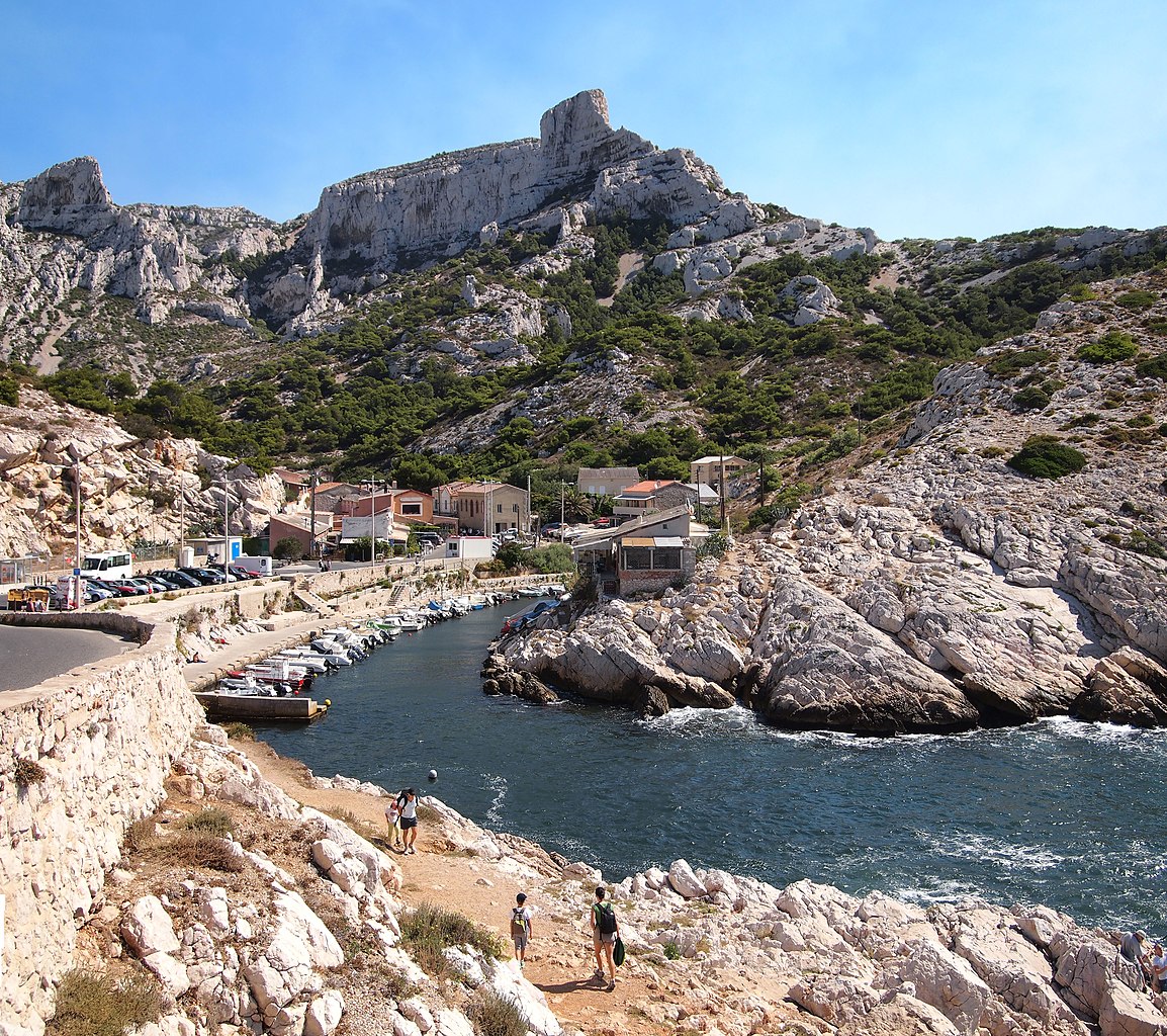
| Description | English: Callelongue port in Marseille. Suomi: Callelonguen satama Marseillen kalkkikivikallioilla. This photograph was taken with an Olympus E-PL1 |
| Date | |
| Source | Own work |
| Author | Tiia Monto |
 | NOTE: This image is a panorama consisting of multiple frames that were merged or stitched in software. As a result, this image necessarily underwent some form of digital manipulation. These manipulations may include blending, blurring, cloning, and colour and perspective adjustments. As a result of these adjustments, the image content may be slightly different from reality at the points where multiple images were combined. This manipulation is often required due to lens, perspective, and parallax distortions. |
Licensing
I, the copyright holder of this work, hereby publish it under the following license:
This file is licensed under the Creative Commons Attribution-Share Alike 3.0 Unported license.
- You are free:
- to share – to copy, distribute and transmit the work
- to remix – to adapt the work
- Under the following conditions:
- attribution – You must give appropriate credit, provide a link to the license, and indicate if changes were made. You may do so in any reasonable manner, but not in any way that suggests the licensor endorses you or your use.
- share alike – If you remix, transform, or build upon the material, you must distribute your contributions under the same or compatible license as the original.
This image has been assessed using the Quality image guidelines and is considered a Quality image. |
File history
Click on a date/time to view the file as it appeared at that time.
| Date/Time | Thumbnail | Dimensions | User | Comment | |
|---|---|---|---|---|---|
| current | 20:06, 18 September 2012 | | 3,948 × 3,503 (2.9 MB) | Kulmalukko | User created page with UploadWizard |
File usage
The following page uses this file:
Global file usage
The following other wikis use this file:
- Usage on fi.wikipedia.org
- Usage on fr.wikipedia.org
- Usage on fr.wiktionary.org
- Usage on pl.wikivoyage.org
Metadata
🔥 Popular: Main PageSpecial:SearchWiki Travel:AboutWiki Travel:HelpMoroccoList of country calling codesAshburn (Virginia)Special:RecentChangesSnorkelingJapanWiki Travel:Travellers' pubEuropeNorth AmericaPan-American HighwayUnited States of AmericaNew York CityLagunaLabuan BajoEastern IndiaThailandWiki Travel:Requested articlesSpecial:MyTalkQuezon City/CubaoAsiaDestinationsUnited KingdomSeychellesItalyCaviteNorth East ScotlandAmerican Industry TourUNESCO World Heritage listPortugalMuvattupuzhaTurkeyAddis AbabaSingaporeColumbia (Missouri)Port BlairParisJohor BahruGrand Trunk RoadAluvaTurkmenistanAfricaGermanyBahrainAustraliaTokyoBohemiaWestern IndiaNoidaPhrasebooksTorres del Paine National ParkMidwestSouth (United States of America)Southern CaliforniaPadangChinaTbilisiMussoorieCanadaOceaniaBaliUSADriving in FinlandCookstownBarcelonaFranceKish IslandKolkata/EsplanadeAgbokim WaterfallsAlicantePeruDanubeIstanbulPorto-NovoUzbekistanNorway