File:Asia-Pacific map1.png
Jump to navigation
Jump to search

Size of this preview: 800 × 352 pixels. Other resolutions: 320 × 141 pixels | 640 × 282 pixels | 1,427 × 628 pixels.
Original file (1,427 × 628 pixels, file size: 19 KB, MIME type: image/png)
Captions
Captions
Asia map
Summary[edit]
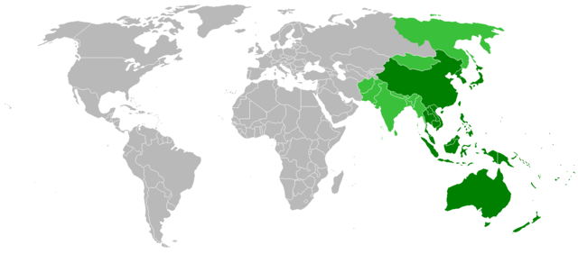
| Description | Map showing countries within the Asia-Pacific region. The definition of the region is fairly ambiguous. |
| Date | |
| Source | Image:BlankMap-World.png |
| Author | ASDFGH |
Licensing[edit]
| I, the copyright holder of this work, release this work into the public domain. This applies worldwide. In some countries this may not be legally possible; if so: I grant anyone the right to use this work for any purpose, without any conditions, unless such conditions are required by law. |
File history
Click on a date/time to view the file as it appeared at that time.
| Date/Time | Thumbnail | Dimensions | User | Comment | |
|---|---|---|---|---|---|
| current | 11:23, 19 July 2022 | | 1,427 × 628 (19 KB) | Weaveravel (talk | contribs) | As per Asia-Pacific eng article |
| 18:10, 10 November 2008 |  | 1,427 × 628 (31 KB) | ASDFGHJ (talk | contribs) | == Summary == {{Information |Description=Map showing countries within the Asia-Pacific region. The definition of the region is fairly ambiguous. |Source=Image:BlankMap-World.png |Date=10th November, 20 |
You cannot overwrite this file.
File usage on Commons
There are no pages that use this file.
File usage on other wikis
The following other wikis use this file:
- Usage on cs.wikipedia.org
- Usage on de.wikipedia.org
- Usage on es.wikipedia.org
- Usage on ja.wikipedia.org
- Usage on ms.wikipedia.org
- Usage on ps.wikipedia.org
- Usage on tl.wikipedia.org
- Usage on uk.wikipedia.org
- Usage on wuu.wikipedia.org
- Usage on zh-min-nan.wikipedia.org
- Usage on zh.wikipedia.org