File:United Arab Emirates location map.svg

Original file (SVG file, nominally 1,228 × 1,056 pixels, file size: 152 KB)
Captions
Captions
Summary[edit]
| Description |
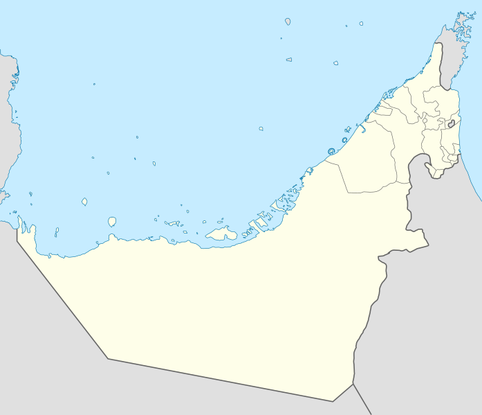
Deutsch: Positionskarte der Vereinigten Arabischen Emirate
Quadratische Plattkarte, N-S-Streckung 109 %. Geographische Begrenzung der Karte:
Equirectangular projection, N/S stretching 109 %. Geographic limits of the map:
|
|
| Date | ||
| Source |
Own work, using
|
|
| Author | NordNordWest | |
| Permission (Reusing this file) |
This file is licensed under the Creative Commons Attribution-Share Alike 3.0 Germany license.
 This file is licensed under the Creative Commons Attribution-Share Alike 3.0 Germany license.
|
|
| Other versions |
|


|
This map has been made or improved in the German Kartenwerkstatt (Map Lab). You can propose maps to improve as well.
|
File history
Click on a date/time to view the file as it appeared at that time.
| Date/Time | Thumbnail | Dimensions | User | Comment | |
|---|---|---|---|---|---|
| current | 09:19, 3 March 2018 | | 1,228 × 1,056 (152 KB) | Shahin (talk | contribs) | Reverted to version as of 14:50, 6 August 2013 (UTC) |
| 09:18, 3 March 2018 |  | 1,228 × 1,056 (151 KB) | Shahin (talk | contribs) | 2017 update | |
| 14:50, 6 August 2013 |  | 1,228 × 1,056 (152 KB) | Chipmunkdavis (talk | contribs) | Reverted to version as of 09:37, 5 May 2013 Google maps also shows a little bend | |
| 14:45, 6 August 2013 |  | 1,228 × 1,056 (238 KB) | Chipmunkdavis (talk | contribs) | Reverting to version with border that matches http://www.emirates.org/the_country.html | |
| 09:37, 5 May 2013 |  | 1,228 × 1,056 (152 KB) | NordNordWest (talk | contribs) | Reverted to version as of 14:16, 14 August 2012; location maps never get labelled | |
| 07:46, 5 May 2013 |  | 1,228 × 1,056 (212 KB) | Fatemi (talk | contribs) | Reverted to version as of 07:40, 5 May 2013 | |
| 07:44, 5 May 2013 |  | 1,228 × 1,056 (212 KB) | Fatemi (talk | contribs) | labled | |
| 07:40, 5 May 2013 |  | 1,228 × 1,056 (212 KB) | Fatemi (talk | contribs) | new version | |
| 14:16, 14 August 2012 |  | 1,228 × 1,056 (152 KB) | NordNordWest (talk | contribs) | c | |
| 20:02, 2 November 2009 |  | 1,228 × 1,056 (238 KB) | NordNordWest (talk | contribs) |
You cannot overwrite this file.
File usage on Commons
The following 11 pages use this file:
- User:NordNordWest/Gallery/Location maps
- File:Abu Dhabi in United Arab Emirates.svg
- File:Ajman in United Arab Emirates.svg
- File:Ajman location map (UAE).svg
- File:Dubai in United Arab Emirates.svg
- File:Fujairah in United Arab Emirates.svg
- File:Ras al-Khaimah in United Arab Emirates.svg
- File:Sharjah in United Arab Emirates.svg
- File:Sharjah location map (UAE).svg
- File:Umm al-Quwain in United Arab Emirates.svg
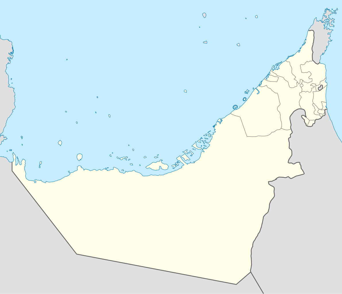
- File:United Arab Emirates relief location map.jpg
.svg)
.svg)
File usage on other wikis
The following other wikis use this file:
- Usage on af.wikipedia.org
- Usage on als.wikipedia.org
- Usage on ar.wikipedia.org
- كأس آسيا 1996
- الدوري الإماراتي للمحترفين
- قالب:خريطة مواقع الإمارات العربية المتحدة
- كأس العالم للأندية 2010
- الدوري الإماراتي 2010–11
- كأس العالم تحت 17 سنة لكرة القدم 2013
- الدوري الإماراتي 2011–12
- كأس آسيا 2019
- بطولة العالم للشباب لكرة القدم 2003
- الدوري الإماراتي 2012–13
- كأس العالم للأندية 2017
- كأس العالم للأندية 2018
- جزيرة زركوه
- جزيرة دينا
- جزيرة قرنين
- جزيرة عش
- جزيرة غاغة
- نهائي كأس العالم للأندية 2018
- كأس العالم للأندية 2021
- الدوري الإماراتي للمحترفين 2021–22
- كأس السوبر السعودي 2024
- الدوري الإماراتي 2023–24
- دوري الدرجة الأولى الإماراتي 2015–16
- Usage on ast.wikipedia.org
- Dubái
- The World
- Burj Al Arab
- Burj Khalifa
- Abu Dhabi
- Guggenheim Abu Dhabi
- Marina 101
- Princess Tower
- 23 Marina
- Circuitu Yas Marina
- Módulu:Mapa de llocalización/datos/Emiratos Árabes Xuníos
- Módulu:Mapa de llocalización/datos/Emiratos Árabes Xuníos/usu
- Aeropuertu Internacional de Dubái
- Aeropuertu Internacional d'Abu Dhabi
- Aeropuertu Internacional de Sharjah
- Base Aérea d'Al Dhafra
View more global usage of this file.