File:Tettstedet Oslo 2005.png
Jump to navigation
Jump to search

Size of this preview: 800 × 458 pixels. Other resolutions: 320 × 183 pixels | 640 × 366 pixels | 985 × 564 pixels.
Original file (985 × 564 pixels, file size: 154 KB, MIME type: image/png)
Captions
Captions
Add a one-line explanation of what this file represents
Summary[edit]
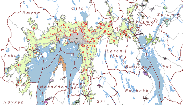
| Description | Map of tettstedet Oslo made by Statistisk Sentralbyrå based on data of 01.01.2005. |
| Date | |
| Source | http://www.ssb.no/emner/01/01/20/tettstedkart/fylke0203.pdf |
| Author | Statistisk sentralbyrå (Statistics Norway). |
| Permission (Reusing this file) |
Statistics Norway freely permits saving, printing, copying and spreading of the material on this web site (text, tables and figures). Statistics Norway must be credited when using the material. ( |
Norsk bokmål: Kilde: Statistisk sentralbyrå. Kartet er beskåret av meg.
Bruk av SSBs materiale:
Statistisk sentralbyrå gir tillatelse til at materiale på dette nettstedet (tekst, statistiske tabeller og figurer) fritt kan lagres elektronisk, skrives ut, mangfoldiggjøres og videreformidles. Tillatelsen forutsetter henvisning til kilden stoffet er hentet fra (kilde: Statistisk sentralbyrå). Kildehenvisning skal angis i direkte tilknytning til hver tabell og figur som benyttes. (Tatt fra [1])
English: Source: Statistics Norway. The map is cropped by me, Jorunn.
Using Statistics Norways material:
Statistics Norway freely permits saving, printing, copying and spreading of the material on this web site (text, tables and figures). Statistics Norway must be credited when using the material. (Translation of [2])Licensing[edit]

|
The copyright holder of this file allows anyone to use it for any purpose, provided that the copyright holder is properly attributed. Redistribution, derivative work, commercial use, and all other use is permitted. |
|
|
File history
Click on a date/time to view the file as it appeared at that time.
| Date/Time | Thumbnail | Dimensions | User | Comment | |
|---|---|---|---|---|---|
| current | 22:48, 9 July 2006 | | 985 × 564 (154 KB) | Jorunn (talk | contribs) | {{Information |Description= Map of tettstedet Oslo made by Statistisk Sentralbyrå based on data of 01.01.2005. |Source= http://www.ssb.no/emner/01/01/20/tettstedkart/fylke0203.pdf |Date=2005 |Author=Statistisk sentralbyrå (Statistics Norway). |Permissi |
You cannot overwrite this file.
File usage on Commons
There are no pages that use this file.
File usage on other wikis
The following other wikis use this file:
- Usage on bxr.wikipedia.org
- Usage on el.wikipedia.org
- Usage on en.wikipedia.org
- Usage on eu.wikipedia.org
- Usage on fi.wikipedia.org
- Usage on nn.wikipedia.org
- Usage on no.wikipedia.org
- Usage on pa.wikipedia.org
- Usage on sr.wikipedia.org
- Usage on sv.wikipedia.org
- Usage on vi.wikipedia.org
- Usage on zh.wikipedia.org