File:Protected areas by percentage per country.png
Jump to navigation
Jump to search
Size of this preview: 800 × 351 pixels. Other resolutions: 320 × 140 pixels | 640 × 281 pixels | 1,425 × 625 pixels.
Original file (1,425 × 625 pixels, file size: 52 KB, MIME type: image/png)
Captions
Captions
Add a one-line explanation of what this file represents

|
File:Protected areas by percentage per country.svg is a vector version of this file. It should be used in place of this PNG file when not inferior.
File:Protected areas by percentage per country.png → File:Protected areas by percentage per country.svg
For more information, see Help:SVG. |
 |
Summary[edit]
| Description |
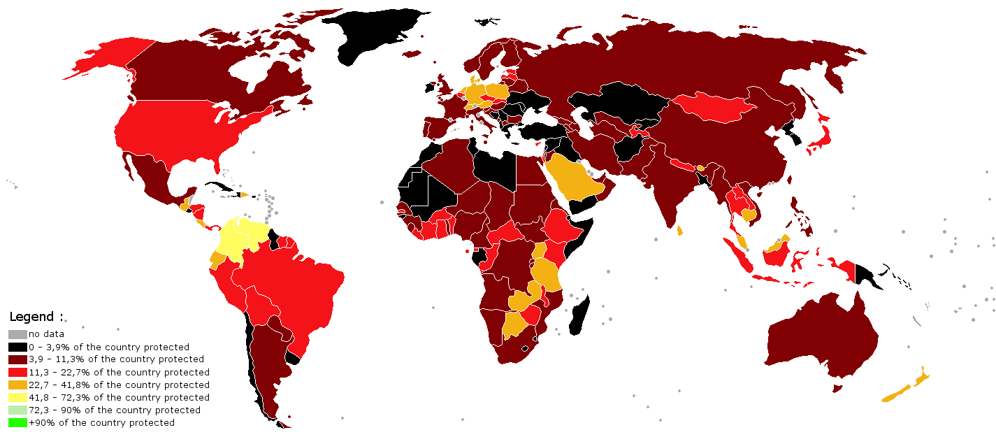
English: World map indicating the percentage of the country under protection. The map was made using the BlankMap-World-V6 and the data from 2005 AD from this map made by Kyle Dietrich. Note that the map does use much gap difference between the colors; perhaps a better map can be made in time using this data |
| Date | |
| Source | Own work |
| Author | Genetics4good |
Licensing[edit]
I, the copyright holder of this work, hereby publish it under the following license:
This file is licensed under the Creative Commons Attribution-Share Alike 3.0 Unported license.
- You are free:
- to share – to copy, distribute and transmit the work
- to remix – to adapt the work
- Under the following conditions:
- attribution – You must give appropriate credit, provide a link to the license, and indicate if changes were made. You may do so in any reasonable manner, but not in any way that suggests the licensor endorses you or your use.
- share alike – If you remix, transform, or build upon the material, you must distribute your contributions under the same or compatible license as the original.
File history
Click on a date/time to view the file as it appeared at that time.
| Date/Time | Thumbnail | Dimensions | User | Comment | |
|---|---|---|---|---|---|
| current | 14:46, 31 January 2014 | | 1,425 × 625 (52 KB) | Genetics4good (talk | contribs) | User created page with UploadWizard |
You cannot overwrite this file.
File usage on Commons
The following page uses this file:
File usage on other wikis
The following other wikis use this file:
- Usage on ar.wikipedia.org
- Usage on bn.wikipedia.org
- Usage on gl.wikipedia.org
- Usage on hy.wikipedia.org
- Usage on ka.wikipedia.org
- Usage on ko.wikipedia.org
- Usage on ne.wikipedia.org
- Usage on pl.wikipedia.org
- Usage on pt.wikipedia.org
- Usage on rm.wikipedia.org
- Usage on tr.wikipedia.org
- Usage on vi.wikipedia.org