File:Paris department relief location map.jpg
Jump to navigation
Jump to search

Size of this preview: 800 × 521 pixels. Other resolutions: 320 × 208 pixels | 640 × 417 pixels | 1,024 × 667 pixels | 1,371 × 893 pixels.
Original file (1,371 × 893 pixels, file size: 281 KB, MIME type: image/jpeg)
Captions
Captions
Add a one-line explanation of what this file represents
Summary[edit]
| Title |
Blank physical map of the city and department of Paris, France |
|||||||||
| Description |
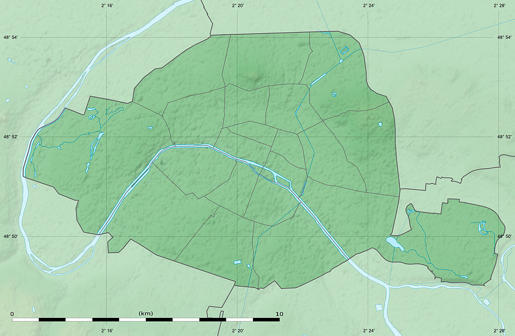
English: Blank physical map of the city and department of Paris, France, as in January 2011, for geo-location purpose, with distinct boundaries for departments and arrondissements.
Français : Carte physique vierge de la ville et département de Paris, France, tel qu'en janvier 2011, destinée à la géolocalisation, avec limite distincte des départements et arrondissements. |
|||||||||
| Date | ||||||||||
| Source |
Own work
|
|||||||||
| Creator | ||||||||||
| Permission (Reusing this file) |
|
|||||||||
| Geotemporal data | ||||||||||
| Date depicted | ||||||||||
| Map location | Paris 48°51′24″N 2°21′03″E / 48.8567°N 2.3508°E | |||||||||
| Spatial reference system | WGS84 datum | |||||||||
| Scale | 1:124,000 (precision: 31 m) | |||||||||
| Heading |
 |
|||||||||
| Bounding box |
|
|||||||||
| Georeferencing | If inappropriate please set warp_status = skip to hide. | |||||||||
| Other versions |
|
|||||||||


Licensing[edit]
Eric Gaba, Wikimedia Commons user Sting, the copyright holder of this work, hereby publishes it under the following license:
This file is licensed under the Creative Commons Attribution-Share Alike 3.0 Unported license.
Attribution: Eric Gaba, Wikimedia Commons user Sting
- You are free:
- to share – to copy, distribute and transmit the work
- to remix – to adapt the work
- Under the following conditions:
- attribution – You must give appropriate credit, provide a link to the license, and indicate if changes were made. You may do so in any reasonable manner, but not in any way that suggests the licensor endorses you or your use.
- share alike – If you remix, transform, or build upon the material, you must distribute your contributions under the same or compatible license as the original.
File history
Click on a date/time to view the file as it appeared at that time.
| Date/Time | Thumbnail | Dimensions | User | Comment | |
|---|---|---|---|---|---|
| current | 02:02, 12 February 2015 | | 1,371 × 893 (281 KB) | Sting (talk | contribs) | == {{int:filedesc}} == {{Location|48|51|22.5|N|02|20|37.5|E|scale:50000}} {{Information |Description={{en|Blank physical map of the city and department of Paris, France, as in January 2011, for geo-location purpose, with distinct boundari... |
You cannot overwrite this file.
File usage on Commons
The following 16 pages use this file:
- Location maps of departments of France
- Maps of Paris
- User:Paris 16/Paris
- User:Sting/Gallery: Location and locator maps
- File:Blank map of Paris with Bois de Boulogne and Bois de Vincennes.svg
- File:Green spaces in Paris, 2012.svg
- File:Map of green spaces in Paris, 2012.svg
- File:Numbered map of Paris with Bois de Boulogne and Bois de Vincennes.svg
- File:Numbered map of Paris with Bois de Boulogne and Bois de Vincennes 2.svg
- File:Numbered map of Paris with Bois de Boulogne and Bois de Vincennes 3.svg
- File:Numbered map of Paris with Bois de Boulogne and Bois de Vincennes 4.svg
- File:Numbered map of Paris with arrondissements.svg
- File:Paris department land cover location map.jpg
- File:Paris department land cover location map.svg
- File:Paris department land cover map, January 2012.svg
- File:Paris department location map.svg
File usage on other wikis
The following other wikis use this file:
- Usage on de.wikipedia.org
- Usage on el.wikipedia.org
- Usage on en.wikipedia.org
- Usage on eo.wikipedia.org
- Usage on fr.wikipedia.org
- Prise de la Bastille
- Massacre du 17 octobre 1961
- Île de la Cité
- Île Saint-Louis
- Île aux Cygnes (Paris)
- Île du Belvédère
- Île Louviers
- Île de Bercy
- Île de Reuilly
- Belleville (Seine)
- Insurrection royaliste du 13 vendémiaire an IV
- Montagne Sainte-Geneviève
- Bataille de Paris (1814)
- Lac Daumesnil
- Journée du 10 août 1792
- Paris
- Siège de Paris (1870-1871)
- Libération de Paris
- Île aux Juifs
- Abbaye de Saint-Germain-des-Prés
- Auteuil (Seine)
- Bataille de Lutèce (52 av. J.-C.)
- Siège de Paris (885-887)
- Discussion:Paris
- Projet:Charte graphique/Apparence des Infobox/Archive
- Affaire du camp de Grenelle
- Thermes de Cluny
- Île aux Vaches
- Île Notre-Dame (Paris)
- Projet:Cartographie/Cartes standards/France
- Modèle:Géolocalisation/Paris
- Modèle:Géolocdual/Paris
- Projet:Cartographie/Géolocalisation/Maintenance/Images des départements français
- Siège de Paris (845)
- Bataille de Lutèce (383)
- Siège de Paris (1435-1436)
- Utilisateur:Jesmar/Brouillon
- Siège de Paris (856-857)
- Siège de Paris (861)
- Siège de Paris (978)
- Siège de Paris (1358)
- Siège de Paris (1360)
- Siège de Paris (1370)
View more global usage of this file.