File:Ming Dynasty Administrative division.jpg
Jump to navigation
Jump to search
Size of this preview: 790 × 600 pixels. Other resolutions: 316 × 240 pixels | 632 × 480 pixels | 1,012 × 768 pixels | 1,280 × 972 pixels | 2,560 × 1,944 pixels | 3,348 × 2,542 pixels.
Original file (3,348 × 2,542 pixels, file size: 447 KB, MIME type: image/jpeg)
Captions
Captions
Add a one-line explanation of what this file represents
Summary[edit]
| Description |
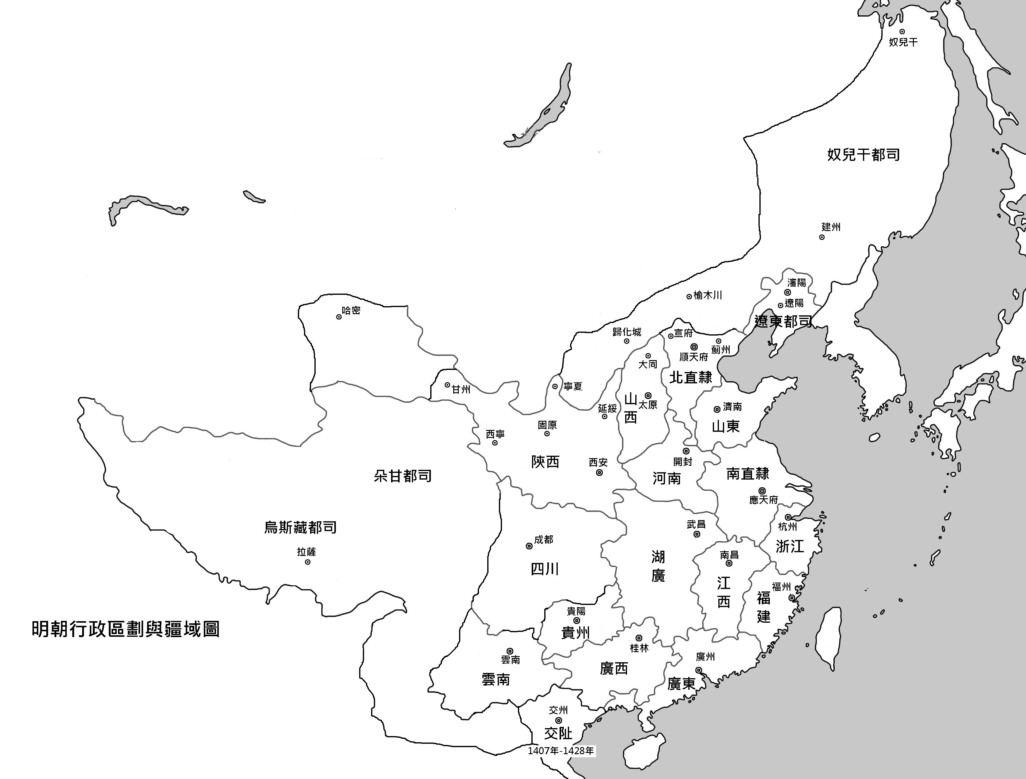
中文(繁體):明代疆域圖與行政區劃圖,出自《中國歷史地圖集》。 |
| Date | 4 June 2011 (original upload date) |
| Source | Transferred from zh.wikipedia to Commons by Shizhao using CommonsHelper. |
| Author | The original uploader was Jason22 at Chinese Wikipedia. |
Licensing[edit]
This file is licensed under the Creative Commons Attribution 2.5 Generic license.
- You are free:
- to share – to copy, distribute and transmit the work
- to remix – to adapt the work
- Under the following conditions:
- attribution – You must give appropriate credit, provide a link to the license, and indicate if changes were made. You may do so in any reasonable manner, but not in any way that suggests the licensor endorses you or your use.
Original upload log[edit]
The original description page was here. All following user names refer to zh.wikipedia.
- 2011-06-04 15:02 Jason22 3348×2542× (457887 bytes) {{Information |Description=明代疆域圖與行政區劃圖 |Source=《中國歷史地圖集》 |Date=20110604 |Author=Jason22 |Permission=({{cc-by-2.5|Jason22}} |other_versions= }}
File history
Click on a date/time to view the file as it appeared at that time.
| Date/Time | Thumbnail | Dimensions | User | Comment | |
|---|---|---|---|---|---|
| current | 07:35, 7 June 2011 | | 3,348 × 2,542 (447 KB) | File Upload Bot (Magnus Manske) (talk | contribs) | {{BotMoveToCommons|zh.wikipedia|year={{subst:CURRENTYEAR}}|month={{subst:CURRENTMONTHNAME}}|day={{subst:CURRENTDAY}}}} {{Information |Description={{zh|{{Information |Description=明代疆域圖與行政區劃圖 |Source=《中國歷史地圖集》 |Date |
You cannot overwrite this file.
File usage on Commons
There are no pages that use this file.
File usage on other wikis
The following other wikis use this file:
- Usage on mn.wikipedia.org
- Usage on no.wikipedia.org
- Usage on vi.wikipedia.org
- Usage on wuu.wikipedia.org
- Usage on zh.wikipedia.org
View more global usage of this file.