File:Hungary location map.svg
Jump to navigation
Jump to search

Size of this PNG preview of this SVG file: 800 × 493 pixels. Other resolutions: 320 × 197 pixels | 640 × 395 pixels | 1,024 × 631 pixels | 1,280 × 789 pixels | 2,560 × 1,578 pixels | 1,210 × 746 pixels.
Original file (SVG file, nominally 1,210 × 746 pixels, file size: 246 KB)
Captions
Captions
Add a one-line explanation of what this file represents
Summary[edit]
| Description |
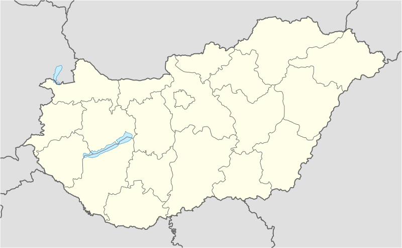
Deutsch: Positionskarte von Ungarn
Quadratische Plattkarte, N-S-Streckung 140 %. Geographische Begrenzung der Karte:
English: Location map of Hungary
Equirectangular projection, N/S stretching 140 %. Geographic limits of the map:
|
| Date | |
| Source | own work, using United States National Imagery and Mapping Agency data |
| Author | NordNordWest (talk · contribs) |
| Other versions | Derivative works of this file: Hungary location map-2.jpg |

|
This map has been made or improved in the German Kartenwerkstatt (Map Lab). You can propose maps to improve as well.
|
Licensing[edit]
I, the copyright holder of this work, hereby publish it under the following licenses:

|
Permission is granted to copy, distribute and/or modify this document under the terms of the GNU Free Documentation License, Version 1.2 or any later version published by the Free Software Foundation; with no Invariant Sections, no Front-Cover Texts, and no Back-Cover Texts. A copy of the license is included in the section entitled GNU Free Documentation License. |
This file is licensed under the Creative Commons Attribution-Share Alike 3.0 Unported license.
- You are free:
- to share – to copy, distribute and transmit the work
- to remix – to adapt the work
- Under the following conditions:
- attribution – You must give appropriate credit, provide a link to the license, and indicate if changes were made. You may do so in any reasonable manner, but not in any way that suggests the licensor endorses you or your use.
- share alike – If you remix, transform, or build upon the material, you must distribute your contributions under the same or compatible license as the original.
You may select the license of your choice.
File history
Click on a date/time to view the file as it appeared at that time.
| Date/Time | Thumbnail | Dimensions | User | Comment | |
|---|---|---|---|---|---|
| current | 13:27, 15 November 2008 | | 1,210 × 746 (246 KB) | NordNordWest (talk | contribs) | corrected |
| 17:30, 5 September 2008 |  | 1,210 × 746 (243 KB) | NordNordWest (talk | contribs) | frontiers corrected, size correction, file size smaller | |
| 09:53, 5 July 2008 |  | 605 × 373 (309 KB) | NordNordWest (talk | contribs) | {{Information |Description= {{de|Positionskarte von Ungarn}} Quadratische Plattkarte, N-S-Streckung 140 %. Geographische Begrenzung der Karte: * N: 48.8° N * S: 45.5° N * W: 15.7° O * O: 23.2° O {{en|Location map of [[:en:Hungary|Hungar |
You cannot overwrite this file.
File usage on Commons
The following 66 pages use this file:
- User:NordNordWest/Gallery/Location maps
- User:SpinnerLaserz/Flags/Flags of Austria/Hungary
- User:SpinnerLaserz/Flags/Flags of Azerbaijan/Hungary
- User:SpinnerLaserz/Flags/Flags of Bashkortostan/Hungary
- User:SpinnerLaserz/Flags/Flags of Belgium/Hungary
- User:SpinnerLaserz/Flags/Flags of Bulgaria/Hungary
- User:SpinnerLaserz/Flags/Flags of Canada/Hungary
- User:SpinnerLaserz/Flags/Flags of Croatia/Hungary
- User:SpinnerLaserz/Flags/Flags of East Germany/Hungary
- User:SpinnerLaserz/Flags/Flags of England/Hungary
- User:SpinnerLaserz/Flags/Flags of France/Hungary
- User:SpinnerLaserz/Flags/Flags of Germany/Hungary
- User:SpinnerLaserz/Flags/Flags of Hungary (1949-1956)/Hungary
- User:SpinnerLaserz/Flags/Flags of Hungary (1957-1990)/Hungary
- User:SpinnerLaserz/Flags/Flags of Italy/Hungary
- User:SpinnerLaserz/Flags/Flags of Kyrgyzstan/Hungary
- User:SpinnerLaserz/Flags/Flags of Mongolia/Hungary
- User:SpinnerLaserz/Flags/Flags of Poland/Hungary
- User:SpinnerLaserz/Flags/Flags of Portugal/Hungary
- User:SpinnerLaserz/Flags/Flags of Puerto Rico/Hungary
- User:SpinnerLaserz/Flags/Flags of Romania/Hungary
- User:SpinnerLaserz/Flags/Flags of Russia/Hungary
- User:SpinnerLaserz/Flags/Flags of Serbia/Hungary
- User:SpinnerLaserz/Flags/Flags of Slovakia/Hungary
- User:SpinnerLaserz/Flags/Flags of Slovenia/Hungary
- User:SpinnerLaserz/Flags/Flags of Spain/Hungary
- User:SpinnerLaserz/Flags/Flags of Sweden/Hungary
- User:SpinnerLaserz/Flags/Flags of Switzerland/Hungary
- User:SpinnerLaserz/Flags/Flags of Trinidad and Tobago/Hungary
- User:SpinnerLaserz/Flags/Flags of Turkey/Hungary
- User:SpinnerLaserz/Flags/Flags of Turkmenistan/Hungary
- User:SpinnerLaserz/Flags/Flags of Ukraine/Hungary
- User:SpinnerLaserz/Flags/Flags of Uzbekistan/Hungary
- User:SpinnerLaserz/Flags/Flags of Vatican City/Hungary
- User:SpinnerLaserz/Flags/Flags of Yugoslavia (1946–1992)/Hungary
- User:SpinnerLaserz/Flags/Flags of the Czech Republic/Hungary
- User:SpinnerLaserz/Flags/Flags of the Soviet Union/Hungary
- User:SpinnerLaserz/Flags/Flags of the Ukrainian SSR/Hungary
- User:SpinnerLaserz/Flags/Flags of the United Kingdom/Hungary
- User:SpinnerLaserz/Flags/Flags of the United States/Hungary
- User:SpinnerLaserzthe2nd/Flags/Flags of Hungary/Hungary
- User:SpinnerLaserzthe2nd/Flags/Flags of Kazakhstan/Hungary
- User:SpinnerLaserzthe2nd/Flags/Flags of the European Union/Hungary
- User:SpinnerLaserzthe2nd/Flags/Unrecognized state flags/Flags of Northern Cyprus/Hungary
- File:Bacs-Kiskun in Hungary.svg
- File:Baranya in Hungary.svg
- File:Bekes in Hungary.svg
- File:Borsod-Abauj-Zemplen in Hungary.svg
- File:Budapest in Hungary.svg
- File:Csongrad in Hungary.svg
- File:Fejer in Hungary.svg
- File:Gyor-Moson-Sopron in Hungary.svg
- File:Hajdu-Bihar in Hungary.svg
- File:Heves in Hungary.svg
- File:Hungary location map-2.jpg
- File:Jasz-Nagykun-Szolnok in Hungary.svg
- File:Komarom-Esztergom in Hungary.svg
- File:Nograd in Hungary.svg
- File:Pest in Hungary.svg
- File:Somogy in Hungary.svg
- File:Szabolcs-Szatmar-Bereg in Hungary.svg
- File:Tolna in Hungary.svg
- File:Vas in Hungary.svg
- File:Veszprem in Hungary.svg
- File:Zala in Hungary.svg
- Category:Central Mining Museum, Sopron
File usage on other wikis
The following other wikis use this file:
- Usage on af.wikipedia.org
- Usage on als.wikipedia.org
- Usage on am.wikipedia.org
- Usage on an.wikipedia.org
- Budapest
- Ecser
- Esztergom
- Buda (Hongría)
- Pest
- Óbuda
- Zichyújfalu
- Basilica de Sant Istevan de Budapest
- Ilesia de Matías de Budapest
- Bastión d'os Pescataires
- Banyos Széchenyi
- Banyos Gellért
- Gran Sinoga de Budapest
- Castiello de Buda
- Puent d'as Cadenas
- Puent Margit
- Parlamento d'Hongría
- Mercau Central de Budapest
- Opera Nacional d'Hongría
- Plantilla:Mapa de localización Hongría
- Sopron
- Győr
- Pécs
- Debrecen
- Szeged
- Miskolc
- Nyíregyháza
- Usage on ar.wikipedia.org
- Usage on ast.wikipedia.org
View more global usage of this file.