File:Colombia relief location map.jpg
Jump to navigation
Jump to search

Size of this preview: 530 × 600 pixels. Other resolutions: 212 × 240 pixels | 424 × 480 pixels | 679 × 768 pixels | 905 × 1,024 pixels | 2,028 × 2,294 pixels.
Original file (2,028 × 2,294 pixels, file size: 1.1 MB, MIME type: image/jpeg)
Captions
Captions
Add a one-line explanation of what this file represents
Summary[edit]


.svg)


|
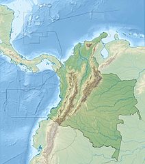
This map has been made or improved in the German Kartenwerkstatt (Map Lab). You can propose maps to improve as well.
|
Licensing[edit]
I, the copyright holder of this work, hereby publish it under the following license:
This file is licensed under the Creative Commons Attribution-Share Alike 3.0 Unported license.
- You are free:
- to share – to copy, distribute and transmit the work
- to remix – to adapt the work
- Under the following conditions:
- attribution – You must give appropriate credit, provide a link to the license, and indicate if changes were made. You may do so in any reasonable manner, but not in any way that suggests the licensor endorses you or your use.
- share alike – If you remix, transform, or build upon the material, you must distribute your contributions under the same or compatible license as the original.
File history
Click on a date/time to view the file as it appeared at that time.
| Date/Time | Thumbnail | Dimensions | User | Comment | |
|---|---|---|---|---|---|
| current | 06:53, 16 February 2015 | | 2,028 × 2,294 (1.1 MB) | Milenioscuro (talk | contribs) | same dimensions of locator map.svg |
| 12:38, 6 February 2010 |  | 1,516 × 1,736 (901 KB) | Alexrk2 (talk | contribs) | {{Information |Description= {{de|Physische Positionskarte von Kolumbien Quadratische Plattkarte. Geographische Begrenzung der Karte:}} {{en|Physical Location map of Colombia Equirectangular projection. Geographic limits |
You cannot overwrite this file.
File usage on Commons
The following 44 pages use this file:
- File:Amazonas Topographic.png
- File:Antioquia Topographic.png
- File:Arauca Topographic.png
- File:Atlantico Topographic.png
- File:Bolivar Topographic.png
- File:Boyaca Topographic.png
- File:Caldas Topographic.png
- File:Campaña libertadora de la Nueva Granada (1819).png
- File:Caqueta Topographic.png
- File:Casanare Topographic.png
- File:Cauca Topographic.png
- File:Cesar Topographic.png
- File:Choco Topographic.png
- File:Colombia adm location map (colored).svg
- File:Colombia location map.svg
- File:Colombia location map2.svg
- File:Colombia relief demographic map.png
- File:Colombia relief location map cropped.svg
- File:Conquest of Colombia.png
- File:Cordillera Centrale de Colombia.jpg
- File:Cordillera Occidentale de Colombia.jpg
- File:Cordillera Orientale de Colombia.jpg
- File:Cordoba Topographic.png
- File:Cundinamarca Topographic.png
- File:Dona juana volcano location map.jpg
- File:Guainia Topographic.png
- File:Guaviare Topographic.png
- File:Huila Topographic.png
- File:La Guajira Topographic.png
- File:Magdalena Topographic.png
- File:Map of pipelines in Colombia blank.png
- File:Mapa de Colombia (relieve).svg
- File:Meta Topographic.png
- File:Narino Topographic.png
- File:Norte de Santander Topographic.png
- File:Putumayo Topographic.png
- File:Quindio Topographic.png
- File:Risaralda Topographic.png
- File:Santander Topographic.png
- File:Sucre Topographic.png
- File:Tolima Topographic.png
- File:Valle del Cauca Topographic.png
- File:Vaupes Topographic.png
- File:Vichada Topographic.png
.png)
.svg)
File usage on other wikis
The following other wikis use this file:
- Usage on als.wikipedia.org
- Usage on ar.wikipedia.org
- Usage on ast.wikipedia.org
- Usage on avk.wikipedia.org
- Usage on azb.wikipedia.org
- Usage on az.wikipedia.org
- Usage on ban.wikipedia.org
- Usage on ba.wikipedia.org
- Usage on be.wikipedia.org
- Usage on bg.wikipedia.org
View more global usage of this file.