File:Brest raion location map.svg
Jump to navigation
Jump to search

Size of this PNG preview of this SVG file: 452 × 600 pixels. Other resolutions: 181 × 240 pixels | 362 × 480 pixels | 579 × 768 pixels | 772 × 1,024 pixels | 1,543 × 2,048 pixels | 768 × 1,019 pixels.
Original file (SVG file, nominally 768 × 1,019 pixels, file size: 341 KB)
Captions
Captions
Add a one-line explanation of what this file represents
Summary[edit]
| Description |
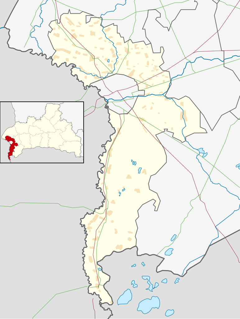
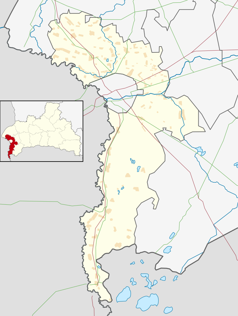
Русский: Позиционная карта Брестского района
(Брестская область, Беларусь)
Цилиндрическая равноугольная проекция с координатами краёв:
|
| Date | |
| Source | Own work на основе карты из Openstreetmap |
| Author |
This W3C-unspecified vector image was created with Inkscape . |
Licensing[edit]
I, the copyright holder of this work, hereby publish it under the following license:
This file is licensed under the Creative Commons Attribution-Share Alike 3.0 Unported license.
- You are free:
- to share – to copy, distribute and transmit the work
- to remix – to adapt the work
- Under the following conditions:
- attribution – You must give appropriate credit, provide a link to the license, and indicate if changes were made. You may do so in any reasonable manner, but not in any way that suggests the licensor endorses you or your use.
- share alike – If you remix, transform, or build upon the material, you must distribute your contributions under the same or compatible license as the original.
File history
Click on a date/time to view the file as it appeared at that time.
| Date/Time | Thumbnail | Dimensions | User | Comment | |
|---|---|---|---|---|---|
| current | 13:27, 14 September 2012 | | 768 × 1,019 (341 KB) | Dimitrius (talk | contribs) | User created page with UploadWizard |
You cannot overwrite this file.
File usage on Commons
The following 6 pages use this file:
File usage on other wikis
The following other wikis use this file:
- Usage on ar.wikipedia.org
- Usage on ast.wikipedia.org
- Usage on ba.wikipedia.org
- Usage on be.wikipedia.org
- Usage on ca.wikipedia.org
- Usage on el.wikipedia.org
- Usage on eo.wikipedia.org
- Usage on es.wikipedia.org
- Usage on eu.wikipedia.org
- Usage on fr.wikipedia.org
- Usage on gl.wikipedia.org
- Usage on hu.wikipedia.org
- Usage on ja.wikipedia.org
- Usage on la.wikipedia.org
- Usage on mdf.wikipedia.org
- Usage on ps.wikipedia.org
- Usage on ro.wikipedia.org
- Usage on ru.wikipedia.org
- Участник:Dimitrius
- Блювиничи
- Большие Сухаревичи
- Вистычи
- Вулька (Брестский район)
- Дружба (Брестская область)
- Зеленец (Брестская область)
- Ивахновичи
- Малая Курница
- Несвило
- Няневичи
- Омелинно
- Покры
- Сколдычи
- Смуга
- Сосновка (Брестский район)
- Холмичи
- Чернаки (Брестский район)
- Бердичи (Брестская область)
- Большая Курница
- Большие Косичи
- Братылово
- Велюнь (Брестская область)
- Витошки
- Волоски (деревня)
- Гутовичи
- Заберезье (Брестский район)
- Залесье (Брестский район)
View more global usage of this file.