File:Blank map of Europe - Atelier graphique colors with Kosovo.svg
Jump to navigation
Jump to search

Size of this PNG preview of this SVG file: 690 × 600 pixels. Other resolutions: 276 × 240 pixels | 552 × 480 pixels | 884 × 768 pixels | 1,178 × 1,024 pixels | 2,356 × 2,048 pixels | 841 × 731 pixels.
Original file (SVG file, nominally 841 × 731 pixels, file size: 489 KB)
Captions
Captions
Greater Europe
Summary[edit]
| Description |
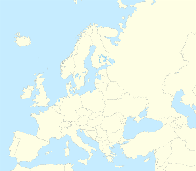
Français : Carte politique de l'Europe, couleurs Atelier Graphique English: Political map of Europe with Atelier graphique colors, Kosovo as its own country
Equirectangular projection, N/S stretching 140 %. Geographic limits of the map: * N: 46.3° N * S: 41.7° N * W: 18.7° E * E: 23.2° E |
||
| Date | (UTC) | ||
| Source | |||
| Author |
|
||
| Permission (Reusing this file) |
This file is licensed under the Creative Commons Attribution-Share Alike 3.0 Unported license.
|
||
| SVG development |
|
Original upload log[edit]
This image is a derivative work of the following images:
- File:Blank_map_of_Europe_-_Atelier_graphique_colors.svg licensed with Cc-by-sa-2.5,2.0,1.0, Cc-by-sa-3.0-migrated, GFDL
- 2010-11-23T15:19:38Z MichaelBueker 841x731 (499164 Bytes) Border width and style fixes
- 2009-07-28T17:41:04Z Sémhur 841x731 (498221 Bytes) Updating colours
- 2008-09-23T18:46:08Z Antigoni 841x731 (498781 Bytes) Montenegro update
- 2007-09-16T15:08:27Z Historicair 841x731 (495651 Bytes)
- 2007-09-13T16:36:42Z Historicair 841x731 (495370 Bytes) {{Information |Description={{fr|Carte vierge de l'Europe, couleurs Atelier Graphique}} {{en|Blank map of Europe with Atelier graphique colors}} |Source=[[:Image:Europe countries.svg]] by [[User:Tintazul|Tintazul]] |Date=13/09
- File:Serbia_location_map_2.svg licensed with Cc-by-sa-3.0, GFDL
- 2009-07-13T20:36:43Z Пакко 684x958 (247447 Bytes) {{Information |Description=Location map of Serbia with striped Kosovo |Source=Derivative work by the uploader of [[:Image:Serbia location map.svg]] |Date=13 July 2009 |Author= [[User:Пакко|Пакко]] |Permission={{sel
Uploaded with derivativeFX
File history
Click on a date/time to view the file as it appeared at that time.
| Date/Time | Thumbnail | Dimensions | User | Comment | |
|---|---|---|---|---|---|
| current | 19:25, 8 January 2011 | | 841 × 731 (489 KB) | Visite fortuitement prolongée (talk | contribs) | Coloring some lakes. |
| 18:46, 24 November 2010 |  | 841 × 731 (489 KB) | MichaelBueker (talk | contribs) | Country name fixes | |
| 15:33, 23 November 2010 |  | 841 × 731 (489 KB) | MichaelBueker (talk | contribs) | {{Information |Description={{fr|Carte vierge de l'Europe, couleurs Atelier Graphique}} {{en|Blank map of Europe with Atelier graphique colors}} {{en|Location map of Serbia with striped Kosovo}} Equirectangular projection, N/S |
You cannot overwrite this file.
File usage on Commons
The following 3 pages use this file:
File usage on other wikis
The following other wikis use this file:
- Usage on ar.wikipedia.org
- Usage on ban.wikipedia.org
- Usage on bn.wikipedia.org
- Usage on ckb.wikipedia.org
- Usage on da.wikipedia.org
- Usage on el.wikipedia.org
- Usage on en.wikipedia.org
- Usage on fa.wikipedia.org
- Usage on gl.wikipedia.org
- Usage on hy.wikipedia.org
- Usage on id.wikipedia.org
- Usage on ja.wikipedia.org
- Usage on ko.wikipedia.org
- Usage on mk.wikipedia.org
- Usage on mni.wikipedia.org
- Usage on ne.wikipedia.org
- Usage on ro.wikipedia.org
- Usage on sh.wikipedia.org
- Usage on th.wikipedia.org
- Usage on vec.wikipedia.org
- Usage on vi.wikipedia.org