File:Asia laea location map.svg
Jump to navigation
Jump to search

Size of this PNG preview of this SVG file: 674 × 599 pixels. Other resolutions: 270 × 240 pixels | 540 × 480 pixels | 864 × 768 pixels | 1,152 × 1,024 pixels | 2,304 × 2,048 pixels | 1,181 × 1,050 pixels.
Original file (SVG file, nominally 1,181 × 1,050 pixels, file size: 11.77 MB)
Captions
Captions
Add a one-line explanation of what this file represents
Summary[edit]
| Description |
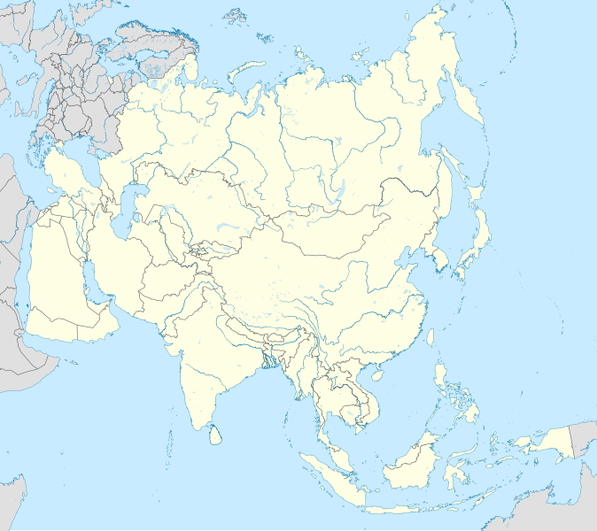
English: Location map of Asia, plus the European parts of Russia, Turkey, Georgia and Azerbaijan minus The Sinai Peninsula.
|
| Date | |
| Source | Own work |
| Author | Uwe Dedering |
Licensing[edit]
I, the copyright holder of this work, hereby publish it under the following licenses:
This file is licensed under the Creative Commons Attribution-Share Alike 3.0 Unported license.
- You are free:
- to share – to copy, distribute and transmit the work
- to remix – to adapt the work
- Under the following conditions:
- attribution – You must give appropriate credit, provide a link to the license, and indicate if changes were made. You may do so in any reasonable manner, but not in any way that suggests the licensor endorses you or your use.
- share alike – If you remix, transform, or build upon the material, you must distribute your contributions under the same or compatible license as the original.

|
Permission is granted to copy, distribute and/or modify this document under the terms of the GNU Free Documentation License, Version 1.2 or any later version published by the Free Software Foundation; with no Invariant Sections, no Front-Cover Texts, and no Back-Cover Texts. A copy of the license is included in the section entitled GNU Free Documentation License. |
You may select the license of your choice.
File history
Click on a date/time to view the file as it appeared at that time.
| Date/Time | Thumbnail | Dimensions | User | Comment | |
|---|---|---|---|---|---|
| current | 19:48, 6 September 2022 | | 1,181 × 1,050 (11.77 MB) | Рагин1987 (talk | contribs) | Added Cyprus |
| 13:52, 7 October 2014 |  | 1,181 × 1,050 (12.58 MB) | Ravenpuff (talk | contribs) | Reverted to version as of 12:06, 7 October 2014 | |
| 13:51, 7 October 2014 |  | 1,181 × 1,050 (10.7 MB) | Ravenpuff (talk | contribs) | Reverted to version as of 12:03, 7 October 2014 | |
| 12:06, 7 October 2014 |  | 1,181 × 1,050 (12.58 MB) | Ravenpuff (talk | contribs) | Back to original version | |
| 12:03, 7 October 2014 |  | 1,181 × 1,050 (10.7 MB) | Ravenpuff (talk | contribs) | Temporary test | |
| 14:30, 26 November 2010 |  | 1,181 × 1,050 (12.58 MB) | Uwe Dedering (talk | contribs) | {{Information |Description={{en|1= Location map of Asia. * Projection: Lambert azimuthal equal-area projection. * Area of interest: :* N: 90.0° N :* S: -10.0° N :* W: 45.0° E :* E: 145.0° E * Projection center: :* NS: 40.0° N :* WE: 95.0° E * GMT pr |
You cannot overwrite this file.
File usage on Commons
More than 100 pages use this file. The following list shows the first 100 pages that use this file only. A full list is available.
- File:Abkhazia in Asia.svg
- File:Abkhazia in Asia (-mini map -rivers).svg
- File:Afghanistan in Asia.svg
- File:Afghanistan in Asia (-mini map -rivers).svg
- File:Akrotiri and Dhekelia in Asia.svg
- File:Akrotiri and Dhekelia in Asia (-mini map -rivers).svg
- File:Armenia in Asia.svg
- File:Armenia in Asia (special marker).svg
- File:Artsakh in Asia.svg
- File:Australia in Asia.svg
- File:Azerbaijan in Asia.svg
- File:Azerbaijan in Asia (de-facto).svg
- File:Azerbaijan in Asia (de-facto) (special marker).svg
- File:Azerbaijan in Asia (special marker).svg
- File:BLANK in Asia.svg
- File:Bahrain in Asia.svg
- File:Bangladesh in Asia.svg
- File:Bhutan in Asia.svg
- File:Bhutan in Asia (special marker).svg
- File:British Indian Ocean Territory in Asia.svg
- File:Cambodia in Asia.svg
- File:China in Asia (+claims).svg
- File:China in Asia (de-facto).svg
- File:China in Asia (de-facto) (relief).svg
- File:China in Asia (only undisputed).svg
- File:Christmas Island in Asia.svg
- File:Cocos (Keeling) Islands in Asia.svg
- File:Cyprus in Asia (+claims).svg
- File:Cyprus in Asia (+claims) (+special marker).svg
- File:Cyprus in Asia (de-facto).svg
- File:Cyprus in Asia (de-facto) (+special marker).svg
- File:Egypt in Asia.svg
- File:Gaza Strip in Asia.svg
- File:Georgia in Asia.svg
- File:Georgia in Asia (de-facto).svg
- File:Hong Kong in Asia.svg
- File:India in Asia (+claims).svg
- File:India in Asia (de-facto).svg
- File:India in Asia (disputed hashed).svg
- File:India in Asia (only undisputed).svg
- File:Indonesia in Asia.svg
- File:Iran in Asia.svg
- File:Iraq in Asia.svg
- File:Israel in Asia (de-facto).svg
- File:Israel in Asia (de-facto) (special marker).svg
- File:Israel in Asia (wo occupied territory).svg
- File:Israel in Asia (wo occupied territory) (special marker).svg
- File:Japan in Asia (+claims).svg
- File:Japan in Asia (de-facto).svg
- File:Jordan in Asia.svg
- File:Jordan in Asia (special marker).svg
- File:Kazakhstan in Asia.svg
- File:Kuwait in Asia.svg
- File:Kyrgyzstan in Asia.svg
- File:Laos in Asia.svg
- File:Lebanon in Asia.svg
- File:Macau in Asia.svg
- File:Malaysia in Asia.svg
- File:Maldives in Asia.svg
- File:Maldives in Asia (special marker).svg
- File:Mongolia in Asia.svg
- File:Myanmar in Asia.svg
- File:Nepal in Asia.svg
- File:North Korea in Asia.svg
- File:Northern Cyprus in Asia (de-facto).svg
- File:Northern Cyprus in Asia (de-facto) (special marker).svg
- File:Norway in Europe (+Svalbard).svg
- File:Norway in Europe (+Svalbard) (-mini map -rivers).svg
- File:Oman in Asia.svg
- File:Pakistan in Asia (+claims).svg
- File:Pakistan in Asia (de-facto).svg
- File:Pakistan in Asia (disputed hashed).svg
- File:Pakistan in Asia (only undisputed).svg
- File:Palestine in Asia.svg
- File:Palestine in Asia (de-facto).svg
- File:Philippines in Asia.svg
- File:Qatar in Asia.svg
- File:Qatar in Asia (special marker).svg
- File:Russia in Asia.svg
- File:Russia in Asia (only undisputed).svg
- File:Saudi Arabia in Asia.svg
- File:Singapore in Asia.svg
- File:South Korea in Asia.svg
- File:South Ossetia in Asia.svg
- File:Sri Lanka in Asia.svg
- File:Sri Lanka in Asia (special marker).svg
- File:Svalbard in Europe.svg
- File:Svalbard in Europe (-mini map -rivers).svg
- File:Syria in Asia (+claims).svg
- File:Syria in Asia (de-facto).svg
- File:Taiwan in Asia.svg
- File:Tajikistan in Asia.svg
- File:Thailand in Asia.svg
- File:Timor-Leste in Asia.svg
- File:Timor-Leste in Asia (special marker).svg
- File:Turkey in Asia.svg
- File:Turkmenistan in Asia.svg
- File:United Arab Emirates in Asia.svg
- File:United Arab Emirates in Asia (special marker).svg
- File:Uzbekistan in Asia.svg
.svg)
.svg)
.svg)
.svg)
.svg)
_(special_marker).svg)
.svg)
.svg)
.svg)
.svg)
_(relief).svg)
.svg)
_Islands_in_Asia.svg)
.svg)
_(%2Bspecial_marker).svg)
.svg)
_(%2Bspecial_marker).svg)
.svg)
.svg)
.svg)
.svg)
.svg)
.svg)
_(special_marker).svg)
.svg)
_(special_marker).svg)
.svg)
.svg)
.svg)
.svg)
.svg)
_(special_marker).svg)
.svg)
_(-mini_map_-rivers).svg)
.svg)
.svg)
.svg)
.svg)
.svg)
.svg)
.svg)
.svg)
.svg)
.svg)
.svg)
.svg)
.svg)
View more links to this file.
File usage on other wikis
The following other wikis use this file:
- Usage on af.wikipedia.org
- Usage on an.wikipedia.org
- Usage on ar.wikipedia.org
- كأس آسيا تحت 17 سنة
- قالب:خريطة مواقع آسيا
- مطار سان خوسيه الدولي
- الخطوط الجوية الماليزية الرحلة 17
- كأس التضامن الآسيوي 2016
- الكأس الدولية للأبطال 2019
- نقطة الوسط الجغرافي لآسيا
- الألعاب الآسيوية الشتوية
- عاصمة الثقافة والفن في العالم التركي
- سهل البون
- الألعاب الآسيوية الشاطئية
- قائمة الدول الآسيوية حسب متوسط الأجور
- Usage on arz.wikipedia.org
- Usage on ast.wikipedia.org
- Usage on av.wikipedia.org
- Usage on azb.wikipedia.org
- انطاکیه
- آلماتی
- منامه
- هانوی
- دوحه
- لاهور
- گوجرانواله
- حیدر آباد (پاکیستان)
- سونیپات
- ناقاساکی
- ماسکانوا
- ناسرولاقانج
- جامدا, مایوربانج
- رایپور, راجاستان
- قوندا, آلیقاره
- قولانتارا
- قوبیندپور, پنجاب
- تیکری, قوروقرام
- قاهمار
- دادهار
- دوکام آمیا
- چهاترپورا
- نامخانا
- ناقراکاتا
- آسانده (هیندوستان)
- کارهی خاس
- کومبارییا, باناسکانتا دیستریکت
- آیاپورام
View more global usage of this file.