File:1950 Census Enumeration District Maps - Puerto Rico (PR) - Aibonito Municipality, Tuberculosis Sanatorium.jpg
Jump to navigation
Jump to search

Size of this preview: 800 × 509 pixels. Other resolutions: 320 × 203 pixels | 640 × 407 pixels | 1,024 × 651 pixels | 1,280 × 814 pixels | 2,560 × 1,627 pixels | 11,003 × 6,995 pixels.
Original file (11,003 × 6,995 pixels, file size: 7.97 MB, MIME type: image/jpeg)
Captions
Captions
1950 Census Enumeration District Maps - Puerto Rico (PR) - Aibonito Municipality
Summary[edit]
_-_Aibonito_Municipality,_Tuberculosis_Sanatorium.jpg&action=edit§ion=1)
| Description |
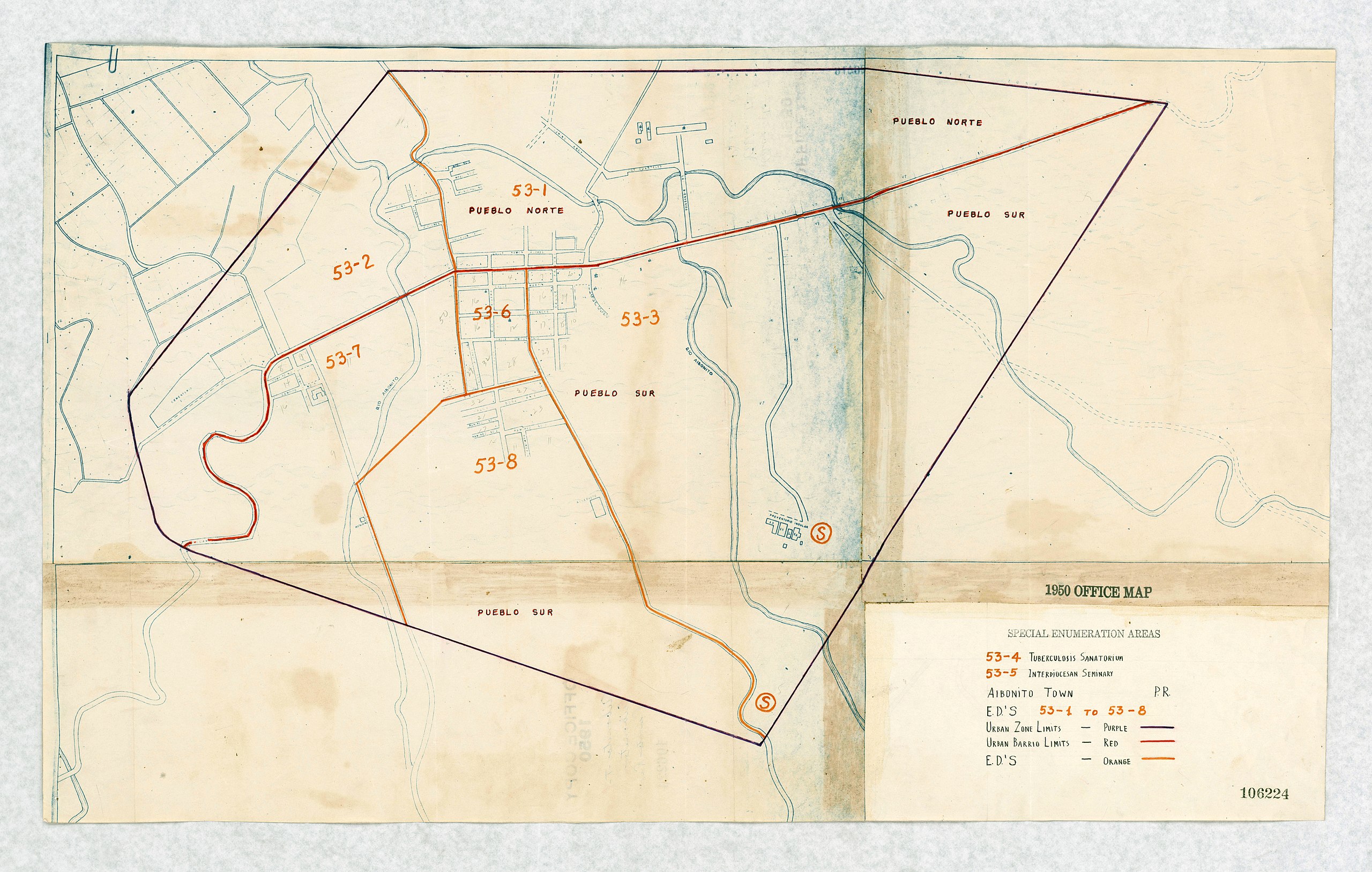
English: 1950 Census Enumeration District Maps - Puerto Rico (PR) - Aibonito Municipality, indicating a Tuberculosis Sanatorium Location which would have to be counted |
| Date | |
| Source | https://catalog.archives.gov/id/75639653 |
| Author | Department of Commerce. Bureau of the Census. Office of the Associate Director for Decennial Census. Geography Division. (1/1987 - 7/15/2011) |
Licensing[edit]
_-_Aibonito_Municipality,_Tuberculosis_Sanatorium.jpg&action=edit§ion=2)
This work is in the public domain in the United States because it is a work prepared by an officer or employee of the United States Government as part of that person’s official duties under the terms of Title 17, Chapter 1, Section 105 of the US Code.
Note: This only applies to original works of the Federal Government and not to the work of any individual U.S. state, territory, commonwealth, county, municipality, or any other subdivision. This template also does not apply to postage stamp designs published by the United States Postal Service since 1978. (See § 313.6(C)(1) of Compendium of U.S. Copyright Office Practices). It also does not apply to certain US coins; see The US Mint Terms of Use.
|
 | |
| This file has been identified as being free of known restrictions under copyright law, including all related and neighboring rights. | ||
File history
Click on a date/time to view the file as it appeared at that time.
| Date/Time | Thumbnail | Dimensions | User | Comment | |
|---|---|---|---|---|---|
| current | 04:49, 22 July 2019 | | 11,003 × 6,995 (7.97 MB) | The Eloquent Peasant (talk | contribs) | User created page with UploadWizard |
You cannot overwrite this file.
File usage on Commons
There are no pages that use this file.
File usage on other wikis
The following other wikis use this file:
- Usage on en.wikipedia.org
- Usage on vi.wikipedia.org
_-_Aibonito_Municipality,_Tuberculosis_Sanatorium.jpg&oldid=747420817)