File:Antarctica relief location map.jpg
Jump to navigation
Jump to search

Size of this preview: 600 × 600 pixels. Other resolutions: 240 × 240 pixels | 480 × 480 pixels | 768 × 768 pixels | 1,024 × 1,024 pixels | 1,493 × 1,493 pixels.
Original file (1,493 × 1,493 pixels, file size: 459 KB, MIME type: image/jpeg)
Captions
Captions
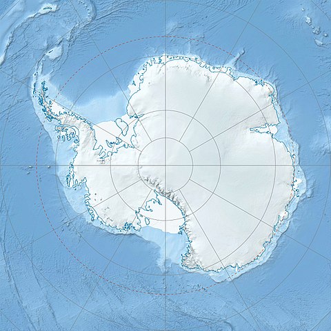
Physical Location map Antarctica, Azimuthal equidistant projection
Summary[edit]
| Description |
Deutsch: Physische Positionskarte Antarktis, Mittabstandstreue Azimutalprojektion
English: Physical Location map Antarctica, Azimuthal equidistant projection
|
| Date | |
| Source |
Own work
|
| Author | Alexrk2 |
| Other versions |
|

Derivative works[edit]


|
This map has been made or improved in the German Kartenwerkstatt (Map Lab). You can propose maps to improve as well.
|
Licensing[edit]
I, the copyright holder of this work, hereby publish it under the following license:
This file is licensed under the Creative Commons Attribution-Share Alike 3.0 Unported license.
- You are free:
- to share – to copy, distribute and transmit the work
- to remix – to adapt the work
- Under the following conditions:
- attribution – You must give appropriate credit, provide a link to the license, and indicate if changes were made. You may do so in any reasonable manner, but not in any way that suggests the licensor endorses you or your use.
- share alike – If you remix, transform, or build upon the material, you must distribute your contributions under the same or compatible license as the original.
File history
Click on a date/time to view the file as it appeared at that time.
| Date/Time | Thumbnail | Dimensions | User | Comment | |
|---|---|---|---|---|---|
| current | 07:52, 26 July 2017 | | 1,493 × 1,493 (459 KB) | Amga (talk | contribs) | Reverted to version as of 16:03, 3 May 2011 (UTC). This is used in location maps, so don't rotate it! |
| 00:00, 26 July 2017 |  | 1,488 × 1,493 (458 KB) | SteinsplitterBot (talk | contribs) | Bot: Image rotated by 90° | |
| 16:03, 3 May 2011 |  | 1,493 × 1,493 (459 KB) | Alexrk2 (talk | contribs) | light blue hypso colors | |
| 21:24, 21 February 2010 |  | 1,500 × 1,500 (818 KB) | Alexrk2 (talk | contribs) | == Summary == {{Information |Description= {{de|Physische Positionskarte Antarktis, Mittabstandstreue Azimutalprojektion}} {{en|Physical Location map Antarctica, Azimuthal equidistant projection}} * Longitude of central |
You cannot overwrite this file.
File usage on Commons
The following 47 pages use this file:
- User:4ing/Antarctica/2017-07
- File:90 Degrees East lake Wikipedia.png
- File:Adelie Land in Antarctica.svg
- File:Adelie Land in Antarctica (Relief).svg
- File:Antarctic-east-ru.jpg
- File:Antarctic-seas-ru.jpg
- File:Antarctica location map.svg
- File:Antarctica relief location map ua.jpg
- File:Antartica (Antartica Chilena Province) in Antarctica (Relief).svg
- File:Argentine Antarctica in Antarctica.svg
- File:Argentine Antarctica in Antarctica (Relief).svg
- File:Auckland Islands in Antarctica (extended).svg
- File:Australian Antarctic Territory in Antarctica.svg
- File:Australian Antarctic Territory in Antarctica (Relief).svg
- File:Bouvet Island in Antarctica (extended).svg
- File:Brazilian Antarctica in Antarctica.svg
- File:British Antarctic Territory in Antarctica.svg
- File:British Antarctic Territory in Antarctica (Relief).svg
- File:British Antarctic Territory in Antarctica (extended).svg
- File:Campbell Island in Antarctica (extended).svg
- File:Chilean Antarctica in Antarctica.svg
- File:Ellsworth-Mountains-location-map.png
- File:Falkland-islands-dependencies-map-rus.jpg
- File:Falkland Islands in Antarctica (extended).svg
- File:French Southern Territories in Antarctica (extended).svg
- File:Heard Island and McDonald Islands in Antarctica (extended).svg
- File:Heritage-Range-location-map.png
- File:Macquarie Island in Antarctica (extended).svg
- File:Marie Byrd Land in Antarctica.svg
- File:Marie Byrd Land in Antarctica (Relief).svg
- File:Peter I Island in Antarctica.svg
- File:Peter I Island in Antarctica (Relief).svg
- File:Prince Edward Islands in Antarctica (extended).svg
- File:Queen Maud Land in Antarctica (Relief).svg
- File:Queen Maud Land in Antarctica (no south borders).svg
- File:Ross Dependency in Antarctica.svg
- File:Ross Dependency in Antarctica (Relief).svg
- File:Ross Dependency in Antarctica (Relief white scheme).svg
- File:Sentinel-Range-location-map.png
- File:South Georgia and the South Sandwich Islands in Antarctica.svg
- File:South Georgia and the South Sandwich Islands in Antarctica (extended).svg
- File:South Georgia and the South Sandwich Islands in Antarctica (special marker).svg
- File talk:Ross Island (orthographic projection).svg
- Category:Antarctic
- Category:Antarctica
- Category:Category navigational templates for Antarctica
- Category:Culture of Antarctica
.svg)
_in_Antarctica_(Relief).svg)
.svg)
.svg)
.svg)
.svg)
.svg)
.svg)
.svg)
.svg)
.svg)
.svg)
.svg)
.svg)
.svg)
.svg)
.svg)
.svg)
.svg)
.svg)
.svg)
.svg)
.svg)
File usage on other wikis
The following other wikis use this file:
- Usage on af.wikipedia.org
- Usage on ar.wikipedia.org
- Usage on arz.wikipedia.org
- Usage on ast.wikipedia.org
- Usage on az.wikipedia.org
- Şablon:Yer xəritəsi Antarktida
- Antarktik yarımadası
- Şablon:Yer xəritəsi Antarktida (fiziki)
- Antarktik boğazı
- Jerlaş boğazı
- Bransfild boğazı
- Lemeir boğazı
- Vostok gölü
- Friksel gölü
- Mak-Medro boğazı
- Veddell dənizi
- Birlik dənizi
- Riser-Larsen dənizi
- Kosmonavtlar dənizi
- Mouson dənizi
- Dürvil dənizi
- Somov dənizi
- Kral VII Haakon dənizi
- Deyvis dənizi
- Lazarev dənizi
- Bellinshauzen dənizi
- Amundsen dənizi
- Ross dənizi
- Skotia dənizi
- Mouson yarımadası
- Hat Point yarımadası
- I Aleksandr Torpağı
- Berkner
- Ross adası
- Erebus vulkanı
- Saypl
- Terston
- Karney
- Ruzvelt adası (Antarktida)
- Sifre burnu
- Cənubi Şetland adaları
- Cənubi Orkney adaları
- Koroneyşen
View more global usage of this file.