File:Arshakuni Armenia 150-en.svg
Jump to navigation
Jump to search

Size of this PNG preview of this SVG file: 800 × 470 pixels. Other resolutions: 320 × 188 pixels | 640 × 376 pixels | 1,024 × 601 pixels | 1,280 × 751 pixels | 2,560 × 1,503 pixels | 2,717 × 1,595 pixels.
Original file (SVG file, nominally 2,717 × 1,595 pixels, file size: 850 KB)
Captions
Captions
Add a one-line explanation of what this file represents
Summary[edit]
| Description |
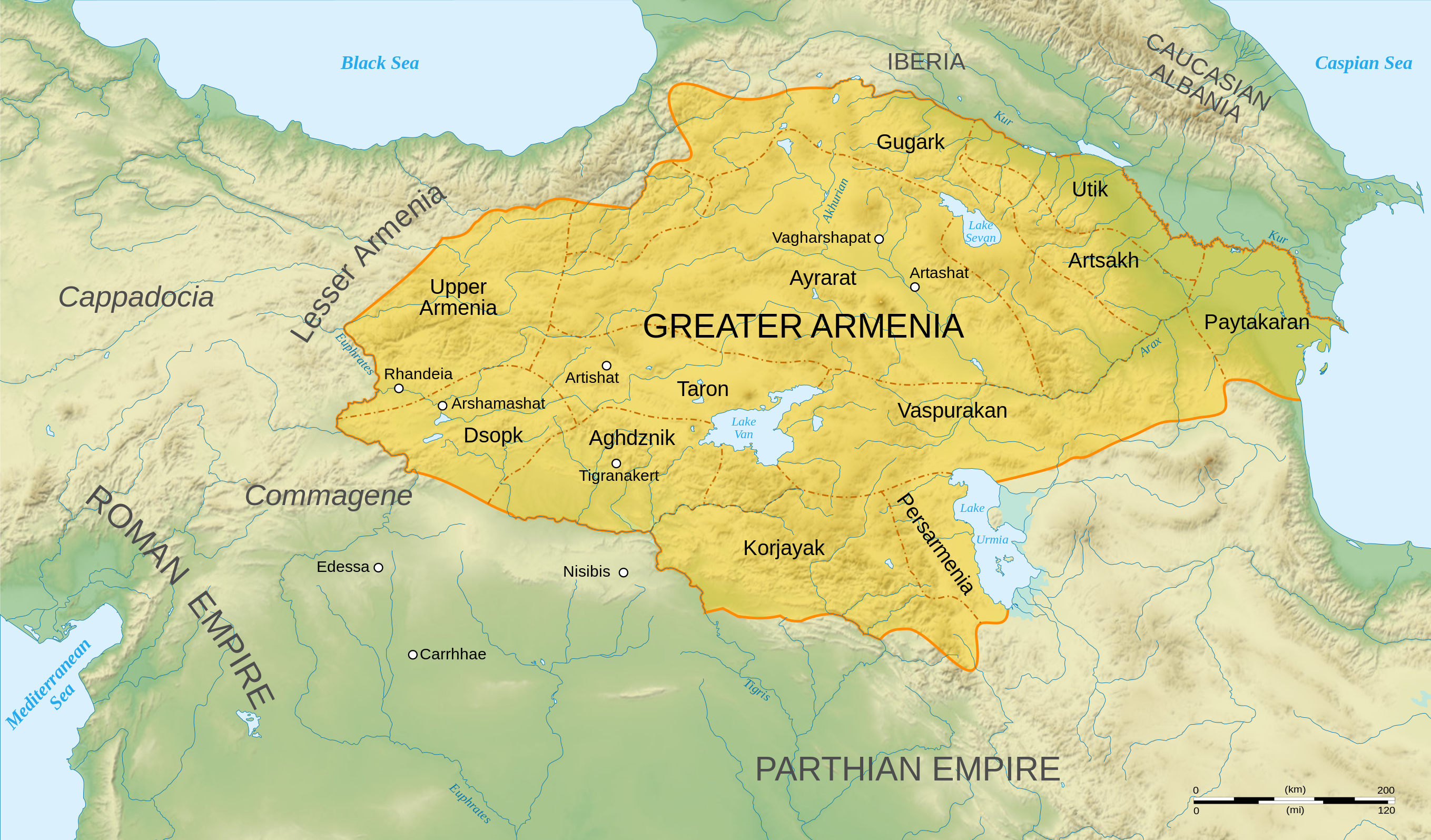
English: Map of Arshakuni Armenia, around the year 150 AD.
Français : Carte en anglais de l'Arménie Arsacide, vers l'an 150. |
||
| Date | |||
| Source |
Own work.
Sources :
Software used :
Autres données :
|
||
| Author | Sémhur | ||
| Other versions |
[]
| ||
| Attribution (required by the license) | © Sémhur / Wikimedia Commons / | ||
| SVG | W3C-validity not checked.
|
||
| Atelier graphique |


.png)


| Camera location | | View this and other nearby images on: OpenStreetMap |
|---|
Licensing[edit]
I, the copyright holder of this work, hereby publish it under the following licenses:
| Copyleft: This work of art is free; you can redistribute it and/or modify it according to terms of the Free Art License. You will find a specimen of this license on the Copyleft Attitude site as well as on other sites. |
This file is licensed under the Creative Commons Attribution-Share Alike 4.0 International, 3.0 Unported, 2.5 Generic, 2.0 Generic and 1.0 Generic license.
- You are free:
- to share – to copy, distribute and transmit the work
- to remix – to adapt the work
- Under the following conditions:
- attribution – You must give appropriate credit, provide a link to the license, and indicate if changes were made. You may do so in any reasonable manner, but not in any way that suggests the licensor endorses you or your use.
- share alike – If you remix, transform, or build upon the material, you must distribute your contributions under the same or compatible license as the original.
You may select the license of your choice.
File history
Click on a date/time to view the file as it appeared at that time.
| Date/Time | Thumbnail | Dimensions | User | Comment | |
|---|---|---|---|---|---|
| current | 04:22, 30 June 2023 | | 2,717 × 1,595 (850 KB) | Luckie Luke (talk | contribs) | File uploaded using svgtranslate tool (https://svgtranslate.toolforge.org/). Added translation for fa. |
| 01:54, 30 June 2023 |  | 2,717 × 1,595 (808 KB) | Luckie Luke (talk | contribs) | File uploaded using svgtranslate tool (https://svgtranslate.toolforge.org/). Added translation for fa. | |
| 12:47, 12 January 2008 |  | 2,717 × 1,595 (798 KB) | Sémhur (talk | contribs) | == Description == {{Information |Description= {{en| Map of Arshakuni Armenia, around the year 150 AD.}} {{fr| Carte en anglais de l'Arménie Arsacide, vers l'an 150.}} |Source=Own work. {{clr}} Sources : * Topographic background : [http://www2.jpl.nasa.go |
You cannot overwrite this file.
File usage on Commons
The following 11 pages use this file:
- Atlas of Armenia
- Atlas of Artsakh
- User:Magog the Ogre/Multilingual legend/2023 June 21-30
- File:ArshakuniArmenia150.png
- File:Arshakuni Armenia (hy - հայերեն).png
- File:Arshakuni Armenia 150-ca.svg
- File:Arshakuni Armenia 150-en.svg
- File:Arshakuni Armenia 150-es.svg
- File:Arshakuni Armenia 150-fr.svg
- File:Arshakuni Armenia 150-pt.svg
- Template:Other versions/Arshakuni Armenia
File usage on other wikis
The following other wikis use this file:
- Usage on ar.wikipedia.org
- Usage on arz.wikipedia.org
- Usage on azb.wikipedia.org
- Usage on bg.wikipedia.org
- Usage on bn.wikipedia.org
- Usage on de.wikipedia.org
- Usage on diq.wikipedia.org
- Usage on el.wikipedia.org
- Χοσρόης Α΄ της Αρμενίας
- Τιριδάτης Β΄ της Αρμενίας
- Χοσρόης Β΄ της Αρμενίας
- Τιριδάτης Γ΄ της Αρμενίας
- Χοσρόης Γ΄ της Αρμενίας
- Τιράν της Αρμενίας
- Αρσάκης Β΄ της Αρμενίας
- Παπ της Αρμενίας
- Βαρασδάτης της Αρμενίας
- Αρσάκης Γ΄ της Αρμενίας
- Χοσρόης Δ΄ της Αρμενίας
- Βραχμσαπώρ της Αρμενίας
- Αρταξίας Δ΄ της Αρμενίας
- Τιγράνης ΣΤ΄ της Αρμενίας
- Τιριδάτης Α΄ της Αρμενίας
- Βολογέσης Γ΄ της Παρθίας
- Πρότυπο:Δυναστεία των Αρσακιδών της Αρμενίας
- Δυναστεία των Αρσακιδών της Αρμενίας
- Άνω Αρμενία
- Αρζανηνή
- Γογαρινή
- Usage on en.wikipedia.org
- Usage on en.wiktionary.org
- Usage on eo.wikipedia.org
View more global usage of this file.