File:Grådö skans 2016-09-27.jpg
Jump to navigation
Jump to search
Size of this preview: 800 × 450 pixels. Other resolutions: 320 × 180 pixels | 640 × 360 pixels | 1,024 × 576 pixels | 1,280 × 720 pixels | 2,560 × 1,440 pixels | 4,028 × 2,266 pixels.
Original file (4,028 × 2,266 pixels, file size: 5.7 MB, MIME type: image/jpeg)
Captions
Captions
Add a one-line explanation of what this file represents
Summary[edit]
| Description |
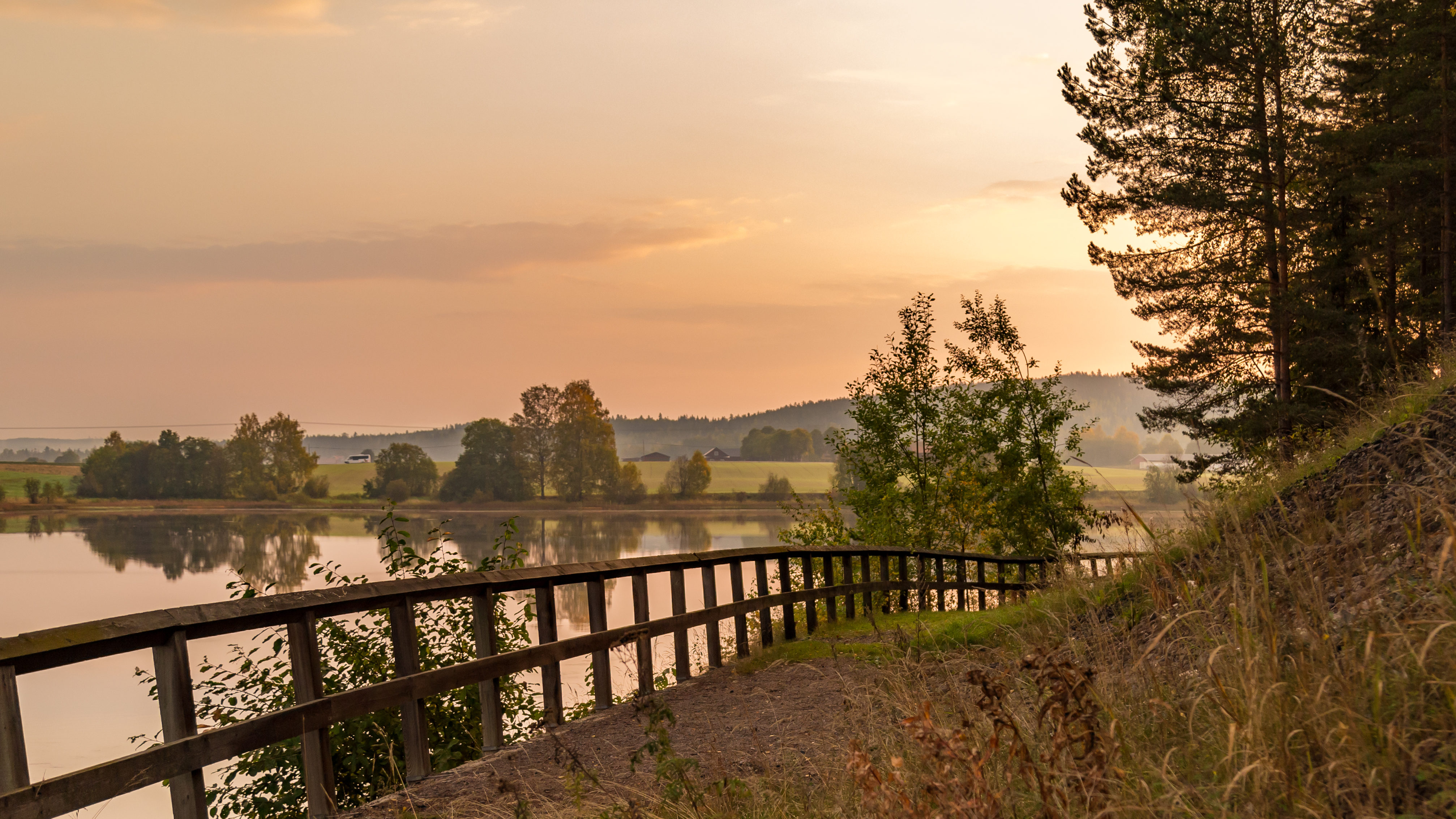
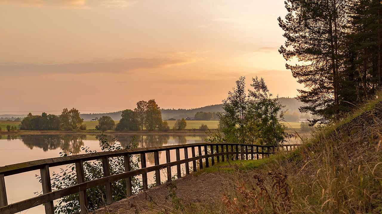
Svenska: Dalälven, under bron där riksväg 70 korsar älven, samt en platå efter den medeltida befästa gården Grådö skans, nedbränd två gånger under 1300-talet. Nära Grådö, Hedemora kommun, Dalarnas län, Sverige.
English: Dal river, beneath the bridge where national road 70 crosses the river, and a plateau after the fortified farmstead Grådö skans (village Grådö sconce), burned down twice in the 14th century. Hedemora Municipality, Dalarna County, Sweden.
|
||
| Date | |||
| Source | Own work | ||
| Author | Calle Eklund |
| Camera location | | View this and other nearby images on: OpenStreetMap |
|---|
Licensing[edit]
I, the copyright holder of this work, hereby publish it under the following license:
This file is licensed under the Creative Commons Attribution-Share Alike 4.0 International license.
- You are free:
- to share – to copy, distribute and transmit the work
- to remix – to adapt the work
- Under the following conditions:
- attribution – You must give appropriate credit, provide a link to the license, and indicate if changes were made. You may do so in any reasonable manner, but not in any way that suggests the licensor endorses you or your use.
- share alike – If you remix, transform, or build upon the material, you must distribute your contributions under the same or compatible license as the original.
This picture has been elected as picture of the month at Swedish Wikipedia. The election of this picture was done by voting among pictures uploaded and inserted into an article at Swedish Wikipedia during the specific month. Every voter may choose criterias like image quality, usability, or importance for the article.
|

|
This image was uploaded as part of Wiki Loves Monuments 2016.
|
This image has been assessed using the Quality image guidelines and is considered a Quality image.
|
File history
Click on a date/time to view the file as it appeared at that time.
| Date/Time | Thumbnail | Dimensions | User | Comment | |
|---|---|---|---|---|---|
| current | 14:28, 3 October 2016 | | 4,028 × 2,266 (5.7 MB) | Vivo (talk | contribs) | Reduction of colour noise |
| 09:30, 2 October 2016 |  | 4,028 × 2,266 (7.79 MB) | Vivo (talk | contribs) | Crop | |
| 18:23, 27 September 2016 |  | 5,415 × 3,046 (15.17 MB) | Vivo (talk | contribs) | Slight rotation | |
| 18:17, 27 September 2016 |  | 5,419 × 3,048 (15.24 MB) | Vivo (talk | contribs) | User created page with UploadWizard |
You cannot overwrite this file.
File usage on Commons
The following 14 pages use this file:
- Wiki Loves Monuments 2016 winners
- User:John Cummings/exhibition/built
- User:John Cummings/sandboximages
- User:Meiræ/16
- User:Vivo
- Commons:Featured picture candidates/File:Grådö skans 2016-09-27.jpg
- Commons:Featured picture candidates/Log/October 2016
- Commons:Quality images/Subject/Places/Mixed/Panorama/Archive 2016
- Commons:Quality images candidates/Archives October 01 2016
- Commons:Wiki Loves Monuments 2016 in Sweden/Results
- Commons:Wikimedia Sverige/recent uploads/2016 October
- Commons:Wikimedia Sverige/recent uploads/2016 September
- File:2006maj09 dalalven sedd fran riksvag 70 mellan avesta och hedemora.jpg
- Category:Grådö skans
File usage on other wikis
The following other wikis use this file:
- Usage on es.wikipedia.org
- Usage on sv.wikipedia.org
- Usage on www.wikidata.org