File:Europe-fr.svg
Jump to navigation
Jump to search

Size of this PNG preview of this SVG file: 453 × 600 pixels. Other resolutions: 181 × 240 pixels | 362 × 480 pixels | 580 × 768 pixels | 773 × 1,024 pixels | 1,547 × 2,048 pixels | 506 × 670 pixels.
Original file (SVG file, nominally 506 × 670 pixels, file size: 544 KB)
Captions
Captions
Add a one-line explanation of what this file represents
Summary[edit]
| Description |
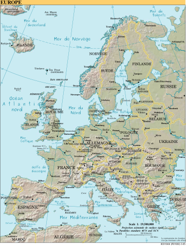
English: Map of Europe
Esperanto: Mapo de Eŭropo
Français : Europe |
| Source |
English: CIA World Factbook Français : CIA World Factbook converti en SVG et traduit |
| Author | |
| Other versions |
[]
|
| SVG development |


Licensing[edit]
This image is in the public domain because it contains materials that originally came from the United States Central Intelligence Agency's World Factbook.
|
 |
File history
Click on a date/time to view the file as it appeared at that time.
| Date/Time | Thumbnail | Dimensions | User | Comment | |
|---|---|---|---|---|---|
| current | 18:30, 20 May 2018 | | 506 × 670 (544 KB) | JoKalliauer (talk | contribs) | https://github.com/JoKalliauer/cleanupSVG 1) sed -i "s/ xlink:href=\"data:;base64,\/9j\/4AAQSkZJRgABAgAAZABkAAD\/7AARRHVja3kAAQAEAAAAHgAA/ xlink:href=\"data:image\/jpeg;base64,\/9j\/4AAQSkZJRgABAgAAZABkAAD\/7AARRHVja3kAAQAEAAAAHgAA/" $i |
| 09:08, 6 September 2010 |  | 506 × 670 (840 KB) | DeuxDeTension (talk | contribs) | Corrections mineures dans la francisation : * "IRELANDE" => "IRLANDE" * "Gulf of Finland" => "Golfe de Finlande" * "Golf de Bothnie" => "Golfe de Bothnie" * "Lake Ladoga" => "Lac Ladoga" * "Lake Onega" => "Lac Onega" {{Information |Description=Carte d'Eu | |
| 11:59, 5 February 2006 |  | 506 × 670 (1,002 KB) | Kelson (talk | contribs) | ||
| 21:09, 4 February 2006 |  | 506 × 670 (1,003 KB) | Sanao (talk | contribs) | == Summary == == Description == Europe<br /> Origine : CIA World Factbook converti en SVG et traduit Category:SVG maps in french Category:Europe == Licensing == {{PD-self}} | |
| 20:19, 4 February 2006 |  | 506 × 670 (1.13 MB) | Kelson (talk | contribs) | == Summary == == Description == Europe<br /> Origine : CIA World Factbook converti en SVG et traduit Category:SVG maps Category:South America {{PD-USGov-CIA-WF}} == Licensing == {{PD-self}} |
You cannot overwrite this file.
File usage on Commons
The following 15 pages use this file:
File usage on other wikis
The following other wikis use this file:
- Usage on pt.wiktionary.org
- Usage on sv.wikipedia.org