File:Bulgaria location map.svg
Jump to navigation
Jump to search

Size of this PNG preview of this SVG file: 800 × 505 pixels. Other resolutions: 320 × 202 pixels | 640 × 404 pixels | 1,024 × 646 pixels | 1,280 × 808 pixels | 2,560 × 1,615 pixels | 1,642 × 1,036 pixels.
Original file (SVG file, nominally 1,642 × 1,036 pixels, file size: 275 KB)
Captions
Captions
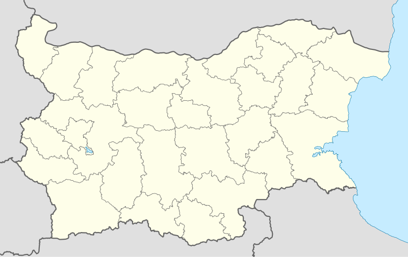
Province map of the Republic of Bulgaria
Summary[edit]
| Description |
Deutsch: Positionskarte von Bulgarien
Quadratische Plattkarte, N-S-Streckung 130 %. Geographische Begrenzung der Karte:
English: Location map of Bulgaria
Equirectangular projection, N/S stretching 130 %. Geographic limits of the map:
|
| Date | 05-08-2008 |
| Source |
own work, using
|
| Author | NordNordWest |
| Other versions |
Derivative works of this file:
|
.svg)

|
This map has been made or improved in the German Kartenwerkstatt (Map Lab). You can propose maps to improve as well.
|
Licensing[edit]
I, the copyright holder of this work, hereby publish it under the following licenses:

|
Permission is granted to copy, distribute and/or modify this document under the terms of the GNU Free Documentation License, Version 1.2 or any later version published by the Free Software Foundation; with no Invariant Sections, no Front-Cover Texts, and no Back-Cover Texts. A copy of the license is included in the section entitled GNU Free Documentation License. |
This file is licensed under the Creative Commons Attribution-Share Alike 3.0 Unported license.
- You are free:
- to share – to copy, distribute and transmit the work
- to remix – to adapt the work
- Under the following conditions:
- attribution – You must give appropriate credit, provide a link to the license, and indicate if changes were made. You may do so in any reasonable manner, but not in any way that suggests the licensor endorses you or your use.
- share alike – If you remix, transform, or build upon the material, you must distribute your contributions under the same or compatible license as the original.
You may select the license of your choice.
File history
Click on a date/time to view the file as it appeared at that time.
| Date/Time | Thumbnail | Dimensions | User | Comment | |
|---|---|---|---|---|---|
| current | 18:28, 6 October 2010 | | 1,642 × 1,036 (275 KB) | NordNordWest (talk | contribs) | upd |
| 18:23, 12 August 2009 |  | 1,536 × 970 (204 KB) | Пакко (talk | contribs) | fixed Iskar Lake | |
| 18:12, 3 August 2009 |  | 1,534 × 967 (207 KB) | Пакко (talk | contribs) | fixed some borders according to current administrative division | |
| 18:52, 25 August 2008 |  | 1,645 × 1,038 (297 KB) | NordNordWest (talk | contribs) | size correction | |
| 12:25, 12 August 2008 |  | 548 × 346 (291 KB) | NordNordWest (talk | contribs) | corrected | |
| 20:30, 5 August 2008 |  | 548 × 346 (289 KB) | NordNordWest (talk | contribs) | {{Information |Description= {{de|Positionskarte von Bulgarien}} Quadratische Plattkarte, N-S-Streckung 130 %. Geographische Begrenzung der Karte: * N: 44.4° N * S: 41.1° N * W: 22.1° O * O: 28.9° O {{en|Location map of [[:en:Bulgaria |
You cannot overwrite this file.
File usage on Commons
More than 100 pages use this file. The following list shows the first 100 pages that use this file only. A full list is available.
- България
- User:NordNordWest/Gallery/Location maps
- File:Aksakovo Municipality Within Bulgaria.png
- File:Alfatar Municipality Within Bulgaria.png
- File:Antonovo Municipality Within Bulgaria.png
- File:Apriltsi Municipality Within Bulgarial.png
- File:Avren Municipality Within Bulgaria.png
- File:Balchik Municipality Within Bulgaria.png
- File:Beloslav Municipality Within Bulgaria.png
- File:Borovo Municipality Within Bulgaria.png
- File:Burgas Province location map.png
- File:Byala-Ruse Municipality Within Bulgaria.png
- File:ByalaVarnaProvince Municipality Within Bulgaria.png
- File:Cherven-Bryag Municipality Within Bulgaria.png
- File:Dalgopol Municipality Within Bulgaria.png
- File:Devnya Municipality Within Bulgaria.png
- File:Dobrich Municipality Within Bulgaria.png
- File:Dobrich Province Location map.png
- File:Dobrichka Municipality Within Bulgaria.png
- File:DolnaMitropoliya Municipality Within Bulgaria.png
- File:DolniChiflik Municipality Within Bulgaria.png
- File:DolniDabnik Municipality Within Bulgaria.png
- File:Dryanovo Municipality Within Bulgaria.png
- File:Dulovo Municipality Within Bulgaria.png
- File:DveMogili Municipality Within Bulgaria.png
- File:Elena Municipality Within Bulgaria.png
- File:Gabrovo Municipality Within Bulgaria.png
- File:GeneralToshevo Municipality Within Bulgaria.png
- File:Glavinitsa Municipality Within Bulgaria.png
- File:GornaOryahovitsa Municipality Within Bulgaria.png
- File:Gulyantsi Municipality Within Bulgaria.png
- File:Haskovo Province location map.png
- File:Hitrino Municipality Within Bulgaria.png
- File:Iskar Municipality Within Bulgaria.png
- File:Isperih Municipality Within Bulgaria.png
- File:Ivanovo Municipality Within Bulgaria.png
- File:Kaolinovo Municipality Within Bulgaria.png
- File:Kardzhali Province location map.png
- File:Kaspichan Municipality Within Bulgaria.png
- File:Kavarna Municipality Within Bulgaria.png
- File:Kaynardzha Municipality Within Bulgaria.png
- File:Knezha Municipality Within Bulgaria.png
- File:Krushari Municipality Within Bulgaria.png
- File:Kubrat Municipality Within Bulgaria.png
- File:Letnitsa Municipality Within Bulgarial.png
- File:Levski Municipality Within Bulgaria.png
- File:Lovech Municipality Within Bulgarial.png
- File:Loznitsa Municipality Within Bulgaria.png
- File:Lukoviti Municipality Within Bulgarial.png
- File:Lyaskovets Municipality Within Bulgaria.png
- File:NikolaKozlevo Municipality Within Bulgaria.png
- File:Nikopol Municipality Within Bulgaria.png
- File:NoviPazar Municipality Within Bulgaria.png
- File:Omurtag Municipality Within Bulgaria.png
- File:Opaka Municipality Within Bulgaria.png
- File:Pavlikeni Municipality Within Bulgaria.png
- File:Pazardzhik Province location map.png
- File:Pleven Municipality Within Bulgaria.png
- File:PolskiTrambesh Municipality Within Bulgaria.png
- File:Popovo Municipality Within Bulgaria.png
- File:Pordim Municipality Within Bulgaria.png
- File:Preslav Municipality Within Bulgaria.png
- File:Provadiya Municipality Within Bulgaria.png
- File:Razgrad Municipality Within Bulgaria.png
- File:Razgrad Province location map.png
- File:Relief Map of Bulgaria.jpg
- File:Ruse Municipality Within Bulgaria.png
- File:Samuil Municipality Within Bulgaria.png
- File:Sevlievo Municipality Within Bulgaria.png
- File:Shabla Municipality Within Bulgaria.png
- File:Shumen Municipality Within Bulgaria.png
- File:Shumen Province location map.png
- File:Silistra Municipality Within Bulgaria.png
- File:Silistra Province location map.png
- File:Sitovo Municipality Within Bulgaria.png
- File:Sliven Province location map.png
- File:SlivoPole Municipality Within Bulgaria.png
- File:Smolyan Province location map.png
- File:Smyadovo Municipality Within Bulgaria.png
- File:Stara Zagora Province location map.png
- File:Strazhitsa Municipality Within Bulgaria.png
- File:Suhindol Municipality Within Bulgaria.png
- File:Suvorovo Municipality Within Bulgaria.png
- File:Svishtov Municipality Within Bulgaria.png
- File:Targovishte Municipality Within Bulgaria.png
- File:Tervel Municipality Within Bulgaria.png
- File:Teteven Municipality Within Bulgarial.png
- File:Troyan Municipality Within Bulgarial.png
- File:Tryavna Municipality Within Bulgaria.png
- File:Tsenovo Municipality Within Bulgaria.png
- File:Tutrakan Municipality Within Bulgaria.png
- File:Ugarchini Municipality Within Bulgarial.png
- File:ValchiDol Municipality Within Bulgaria.png
- File:Varbitsa Municipality Within Bulgaria.png
- File:Varna Municipality Within Bulgaria.png
- File:VelikoTarnovo Municipality Within Bulgaria.png
- File:Venets Municipality Within Bulgaria.png
- File:Vetovo Municipality Within Bulgaria.png
- File:Vetrino Municipality Within Bulgaria.png
- File:Yablanitsa Municipality Within Bulgarial.png
View more links to this file.
File usage on other wikis
The following other wikis use this file:
- Usage on af.wikipedia.org
- Usage on als.wikipedia.org
- Usage on am.wikipedia.org
- Usage on an.wikipedia.org
- Usage on ar.wikipedia.org
- Usage on arz.wikipedia.org
- Usage on ast.wikipedia.org
- Burgas
- Sofía
- Varna
- Plovdiv
- Veliko Tarnovo
- Stara Zagora
- Pleven
- Vidin
- Asenovgrad
- Montes Rila
- Sredna Gora
- Ruse
- Catedral d'Alexandre Nevski de Sofía
- Módulu:Mapa de llocalización/datos/Bulgaria
- Aeropuertu de Burgas
- Aeropuertu de Plovdiv
- Aeropuertu de Sofía
- Aeropuertu de Varna
- Puertu de Burgas
- Puertu de Varna
- Módulu:Mapa de llocalización/datos/Bulgaria/usu
- Usage on azb.wikipedia.org
View more global usage of this file.