File:Afrika politisk.png
Jump to navigation
Jump to search

Size of this preview: 600 × 600 pixels. Other resolutions: 240 × 240 pixels | 480 × 480 pixels | 1,000 × 1,000 pixels.
Original file (1,000 × 1,000 pixels, file size: 406 KB, MIME type: image/png)
Captions
Captions
Add a one-line explanation of what this file represents
Summary
| Description |
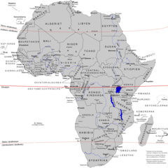
English: Swedish political map of Africa, also available as svg-version: Image:Afrika_politisk.svg. |
| Source | Own work |
| Author | Rotsee2 |
Licensing
I, the copyright holder of this work, hereby publish it under the following licenses:
This file is licensed under the Creative Commons Attribution-Share Alike 3.0 Unported license.
- You are free:
- to share – to copy, distribute and transmit the work
- to remix – to adapt the work
- Under the following conditions:
- attribution – You must give appropriate credit, provide a link to the license, and indicate if changes were made. You may do so in any reasonable manner, but not in any way that suggests the licensor endorses you or your use.
- share alike – If you remix, transform, or build upon the material, you must distribute your contributions under the same or compatible license as the original.

|
Permission is granted to copy, distribute and/or modify this document under the terms of the GNU Free Documentation License, Version 1.2 or any later version published by the Free Software Foundation; with no Invariant Sections, no Front-Cover Texts, and no Back-Cover Texts. A copy of the license is included in the section entitled GNU Free Documentation License. |
You may select the license of your choice.
File history
Click on a date/time to view the file as it appeared at that time.
| Date/Time | Thumbnail | Dimensions | User | Comment | |
|---|---|---|---|---|---|
| current | 16:56, 27 March 2016 | | 1,000 × 1,000 (406 KB) | Christian Ferrer (talk | contribs) | Reverted to version as of 08:53, 26 March 2016 (UTC) |
| 15:33, 27 March 2016 |  | 1,000 × 1,000 (273 KB) | Insidema (talk | contribs) | Reverted to version as of 17:11, 25 March 2016 (UTC) | |
| 08:53, 26 March 2016 |  | 1,000 × 1,000 (406 KB) | Ankry (talk | contribs) | Reverted to version as of 11:34, 22 July 2011 (UTC) | |
| 17:11, 25 March 2016 |  | 1,000 × 1,000 (273 KB) | Hpyounes (talk | contribs) | update | |
| 11:34, 22 July 2011 |  | 1,000 × 1,000 (406 KB) | Rotsee (talk | contribs) | updated to latest version of File:Afrika_politisk.svg. (South Sudan, Ilemi triangle) | |
| 17:55, 8 December 2008 |  | 1,003 × 996 (397 KB) | Rotsee (talk | contribs) | {{Information |Description= |Source= |Date= |Author= |Permission= |other_versions= }} | |
| 06:22, 4 December 2008 |  | 1,000 × 1,000 (385 KB) | Rotsee (talk | contribs) | {{Information |Description= |Source= |Date= |Author= |Permission= |other_versions= }} | |
| 06:08, 4 December 2008 |  | 1,048 × 1,417 (390 KB) | Rotsee (talk | contribs) | {{Information |Description={{en|1=Swedish political map of Africa, convertet from svg-version Image:Afrika_politisk.svg.}} |Source=Own work by uploader |Author=Rotsee2 |Date= |Permission= |other_versions= }} <!--{{ImageUpload|full}} |
You cannot overwrite this file.
File usage on Commons
There are no pages that use this file.
File usage on other wikis
The following other wikis use this file:
- Usage on sv.wikipedia.org