File:Karte Alliierte Besatzungszonen in Österreich von 1945 bis 1955.png
Jump to navigation
Jump to search
Size of this preview: 800 × 429 pixels. Other resolutions: 320 × 172 pixels | 640 × 343 pixels | 1,024 × 549 pixels | 1,280 × 687 pixels | 2,624 × 1,408 pixels.
Original file (2,624 × 1,408 pixels, file size: 335 KB, MIME type: image/png)
Captions
Captions
Add a one-line explanation of what this file represents
| Description |
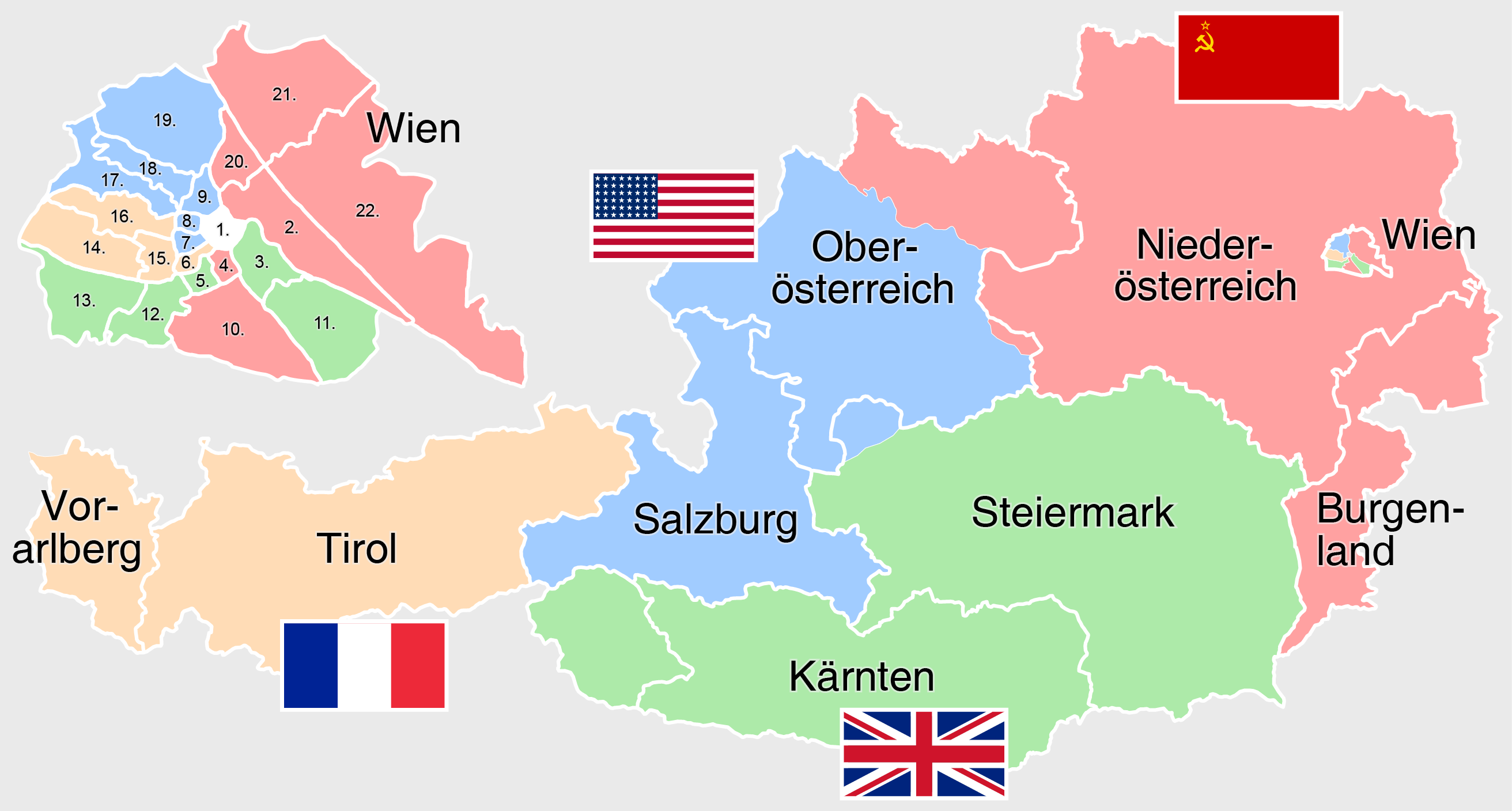
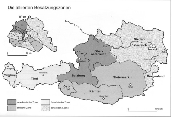
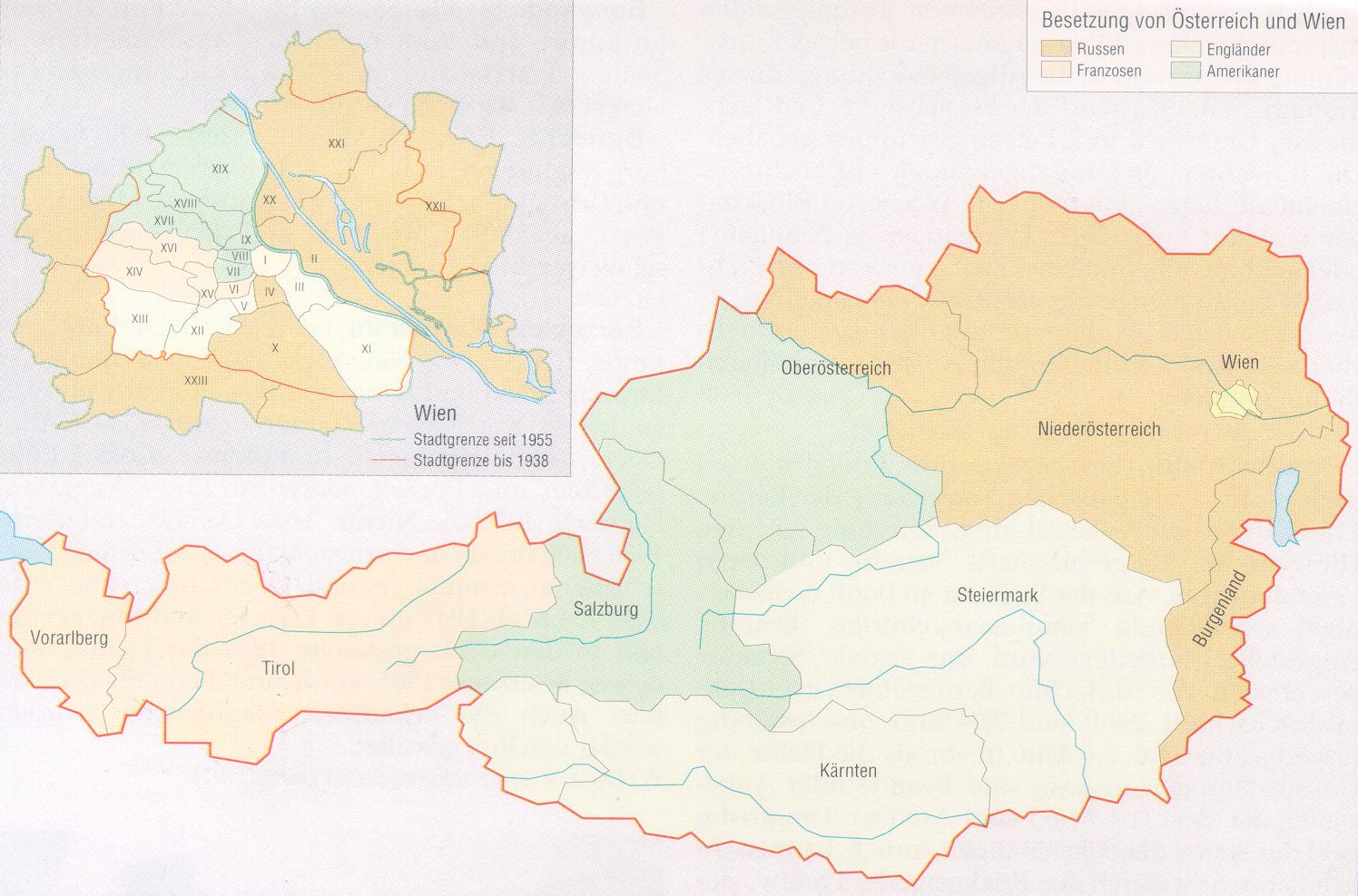
Deutsch: Karte der alliierten Besatzungszonen in Österreich von 1945 bis 1955. Die Zahlen auf der Karte Wiens stehen für die Wiener Gemeindebezirke |
| Date | see file history |
| Source |
Own work, using |
| Author | Maximilian Dörrbecker (Chumwa) |
| Permission (Reusing this file) |
I, the copyright holder of this work, hereby publish it under the following license: This file is licensed under the Creative Commons Attribution-Share Alike 3.0 Unported license.
Sie dürfen das Bild zu den folgenden Bedingungen nutzen:
|

|
This map has been made or improved in the German Kartenwerkstatt (Map Lab). You can propose maps to improve as well.
|
File history
Click on a date/time to view the file as it appeared at that time.
| Date/Time | Thumbnail | Dimensions | User | Comment | |
|---|---|---|---|---|---|
| current | 18:34, 16 January 2017 | | 2,624 × 1,408 (335 KB) | Chumwa (talk | contribs) | Amerikanische Flagge mit den damaligen 48 Sternen |
| 20:17, 15 January 2017 |  | 2,624 × 1,408 (337 KB) | Chumwa (talk | contribs) | {{Information |Description={{de|Karte der alliierten Besatzungszonen in Österreich von 1945 bis 1955}} |Source={{Own}}, using * File:Austria Occupation Zones 1945-55.svg by {{U|Master Uegly}} * File:Wien Besatzungszonen.png * [http://www.phi... |
You cannot overwrite this file.
File usage on Commons
The following 2 pages use this file:
File usage on other wikis
The following other wikis use this file:
- Usage on de.wikipedia.org
- Usage on hu.wikipedia.org
- Usage on it.wikipedia.org
- Usage on ko.wikipedia.org
- Usage on sr.wikipedia.org