File:Floristic regions in Europe (english).png
Jump to navigation
Jump to search

Size of this preview: 751 × 600 pixels. Other resolutions: 301 × 240 pixels | 601 × 480 pixels | 962 × 768 pixels | 1,280 × 1,022 pixels | 1,797 × 1,435 pixels.
Original file (1,797 × 1,435 pixels, file size: 1.95 MB, MIME type: image/png)
Captions
Captions
Add a one-line explanation of what this file represents
Summary[edit]
.png&action=edit§ion=1)
| Description |
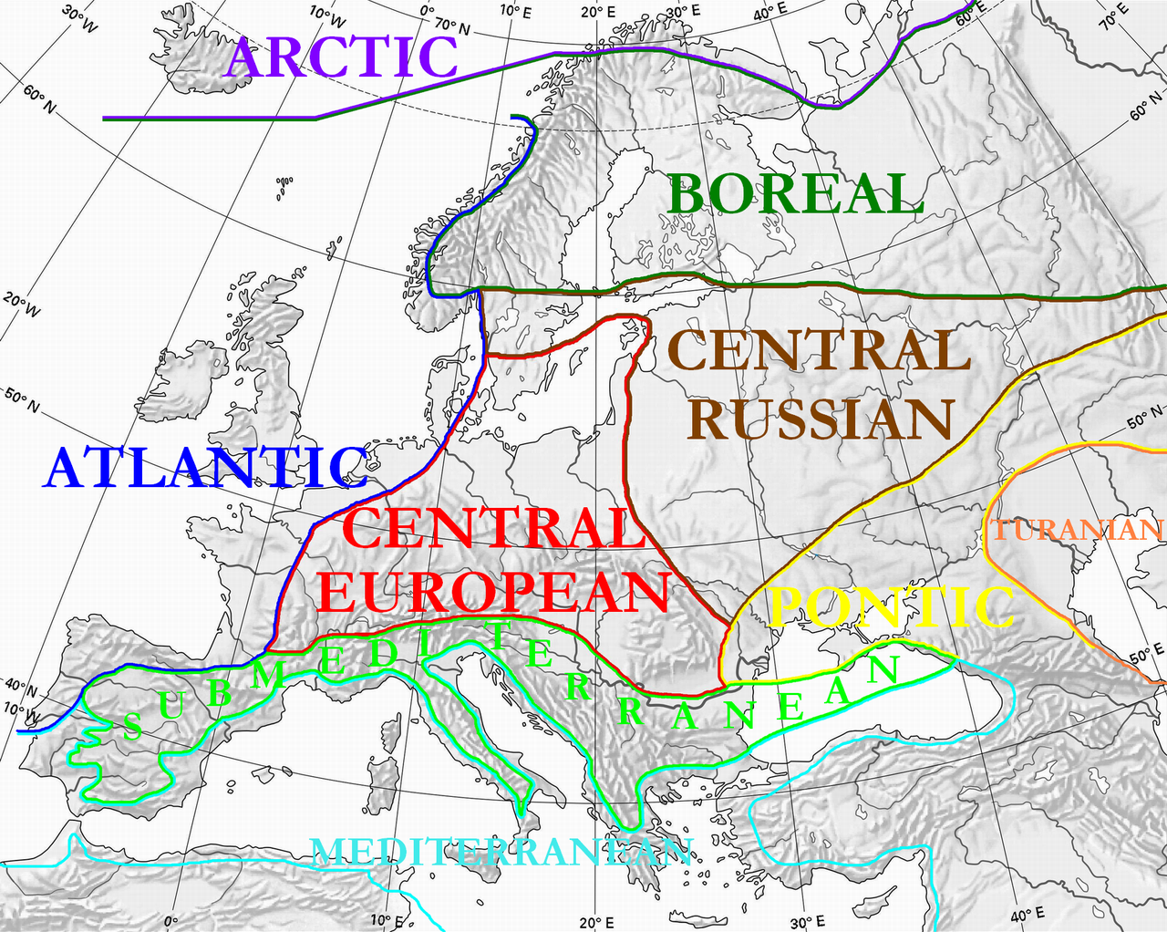
English: Floristic regions in Europe and western Siberia, according to Wolfgang Frey and Rainer Lösch
Français : Régions floristiques européennes actuelles (Europe et Siberie occidentale), selon Wolfgang Frey et Rainer Lösch |
| Date | |
| Source | Own work |
| Author | User:Olahus |
| Other versions | Derivative works of this file: Floristic regions in Europe-de.png |

|
This biogeographical map image could be re-created using vector graphics as an SVG file. This has several advantages; see Commons:Media for cleanup for more information. If an SVG form of this image is available, please upload it and afterwards replace this template with
{{vector version available|new image name}}.
It is recommended to name the SVG file “Floristic regions in Europe (english).svg”—then the template Vector version available (or Vva) does not need the new image name parameter. |
Licensing[edit]
.png&action=edit§ion=2)
| I, the copyright holder of this work, release this work into the public domain. This applies worldwide. In some countries this may not be legally possible; if so: I grant anyone the right to use this work for any purpose, without any conditions, unless such conditions are required by law. |
File history
Click on a date/time to view the file as it appeared at that time.
| Date/Time | Thumbnail | Dimensions | User | Comment | |
|---|---|---|---|---|---|
| current | 00:36, 3 July 2010 | | 1,797 × 1,435 (1.95 MB) | Ras67 (talk | contribs) | cropped |
| 22:15, 28 March 2008 |  | 1,800 × 1,442 (2.17 MB) | Olahus (talk | contribs) | {{Information |Description=Floristic regions in Europe and western Siberia, according to Wolfgang Frey and Rainer Lösch |Source=own work |Date=2008 |Author= Olahus |Permission= |other_versions= }} |
You cannot overwrite this file.
File usage on Commons
The following 5 pages use this file:
File usage on other wikis
The following other wikis use this file:
- Usage on ar.wikipedia.org
- Usage on bn.wikipedia.org
- Usage on br.wikipedia.org
- Usage on bs.wikipedia.org
- Usage on ca.wikipedia.org
- Usage on cs.wikipedia.org
- Usage on el.wikipedia.org
- Usage on en.wikipedia.org
- Usage on eo.wikipedia.org
- Usage on es.wikipedia.org
- Usage on fa.wikipedia.org
- Usage on fi.wikipedia.org
- Usage on frp.wikipedia.org
- Usage on fr.wikipedia.org
- Usage on gl.wikipedia.org
- Usage on hi.wikipedia.org
- Usage on hu.wikipedia.org
- Usage on hy.wikipedia.org
- Usage on it.wikipedia.org
- Usage on ja.wikipedia.org
- Usage on kk.wikipedia.org
- Usage on ko.wikipedia.org
View more global usage of this file.
.png)
.png&oldid=742358563)