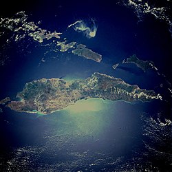
Timor: Island bordering the south of maritime Southeast Asia and the north of the Australian continental plate
Timor is an island at the south end of the Malay Archipelago, north of the Timor Sea.
It is divided between the independent state of East Timor, and West Timor, belonging to the Indonesian province of East Nusa Tenggara.


The island's surface is 11,883 square miles (30,777 km²). The name is a variant of timur, Malay for “east”; it is so called because it is at the east end of a chain of islands.
This article uses material from the Wikipedia Simple English article Timor, which is released under the Creative Commons Attribution-ShareAlike 3.0 license ("CC BY-SA 3.0"); additional terms may apply (view authors). Content is available under CC BY-SA 4.0 unless otherwise noted. Images, videos and audio are available under their respective licenses.
®Wikipedia is a registered trademark of the Wiki Foundation, Inc. Wiki Simple English (DUHOCTRUNGQUOC.VN) is an independent company and has no affiliation with Wiki Foundation.