Nagaland: State in Northeastern India
Nagaland is a northeastern state in the Republic of India.
It has an area of 6,401 square miles (16,580 km2). It is bigger than East Timor but smaller than Eswatini. In traditional Indian geography it falls under the North-east Indian zone.
Nagaland | |
|---|---|
State of India | |
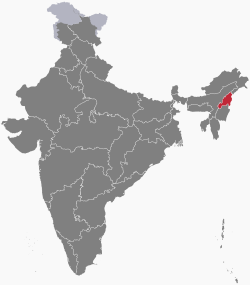
 Location of Nagaland in India | |
 Map of Nagaland | |
| Country | |
| Region | Northeast India |
| Area | |
| • Total | 16,579 km2 (6,401 sq mi) |
| Population (2011) | |
| • Total | 1,978,502 |
| Time zone | UTC+05:30 (IST) |
Provincial symbols of Nagaland
- Provincial bird of Nagaland
- Provincial tree of Nagaland
- Provincial flower of Nagaland
References

This article uses material from the Wikipedia Simple English article Nagaland, which is released under the Creative Commons Attribution-ShareAlike 3.0 license ("CC BY-SA 3.0"); additional terms may apply (view authors). Content is available under CC BY-SA 4.0 unless otherwise noted. Images, videos and audio are available under their respective licenses.
®Wikipedia is a registered trademark of the Wiki Foundation, Inc. Wiki Simple English (DUHOCTRUNGQUOC.VN) is an independent company and has no affiliation with Wiki Foundation.


