File:Location of Huancavelica Region.png
Jump to navigation
Jump to search
No higher resolution available.
Location_of_Huancavelica_Region.png (238 × 347 pixels, file size: 25 KB, MIME type: image/png)
Captions
Captions
Add a one-line explanation of what this file represents

|
File:Peru - Huancavelica Department (locator map).svg is a vector version of this file. It should be used in place of this PNG file when not inferior.
File:Location of Huancavelica Region.png → File:Peru - Huancavelica Department (locator map).svg
For more information, see Help:SVG. |
.svg) |
Summary[edit]
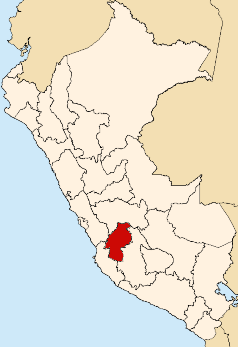
| Description | Map showing the location of the Huancavelica region in Peru |
| Date | |
| Source | Own work |
| Author | AgainErick |
Licensing[edit]
| I, the copyright holder of this work, release this work into the public domain. This applies worldwide. In some countries this may not be legally possible; if so: I grant anyone the right to use this work for any purpose, without any conditions, unless such conditions are required by law. |
File history
Click on a date/time to view the file as it appeared at that time.
| Date/Time | Thumbnail | Dimensions | User | Comment | |
|---|---|---|---|---|---|
| current | 21:50, 11 August 2007 | | 238 × 347 (25 KB) | AgainErick (talk | contribs) | {{Information |Description=Map showing the location of the Huancavelica region in Peru |Source=self-made |Date=August 11, 2007 |Author= Eric Bronder }} Huancavelica |
You cannot overwrite this file.
File usage on Commons
There are no pages that use this file.
File usage on other wikis
The following other wikis use this file:
- Usage on ba.wikipedia.org
- Usage on en.wikipedia.org
- Department of Huancavelica
- Churcampa Province
- Huaytará Province
- Tayacaja Province
- Acobamba Province
- Angaraes Province
- Huancavelica Province
- Castrovirreyna Province
- Huayacundo Arma District
- Quito-Arma District
- Acobamba District, Acobamba
- Chinchihuasi District
- Anco District, Churcampa
- Churcampa District
- El Carmen District, Churcampa
- La Merced District, Churcampa
- Locroja District
- Pachamarca District
- Paucarbamba District
- San Miguel de Mayocc District
- San Pedro de Coris District
- Acobambilla District
- Acoria District
- Ascensión District
- Conayca District
- Cuenca District, Huancavelica
- Huachocolpa District, Huancavelica
- Huancavelica District
- Huando District
- Huayllahuara District
- Izcuchaca District
- Laria District
- Manta District
- Mariscal Cáceres District, Huancavelica
- Moya District
- Nuevo Occoro District
- Palca District, Huancavelica
- Pilchaca District
- Vilca District
- Yauli District, Huancavelica
- Arma District
- Aurahua District
- Capillas District
- Castrovirreyna District
- Cocas District
- Huachos District
- Huamatambo District
- Mollepampa District
- San Juan District, Castrovirreyna
View more global usage of this file.