File:Wujie Overlook.jpg
Jump to navigation
Jump to search
Size of this preview: 800 × 534 pixels. Other resolutions: 320 × 214 pixels | 640 × 427 pixels | 1,024 × 683 pixels | 1,280 × 854 pixels | 2,560 × 1,708 pixels | 4,496 × 3,000 pixels.
Original file (4,496 × 3,000 pixels, file size: 11.84 MB, MIME type: image/jpeg)
Captions
Captions
Add a one-line explanation of what this file represents
Summary[edit]
| Description |
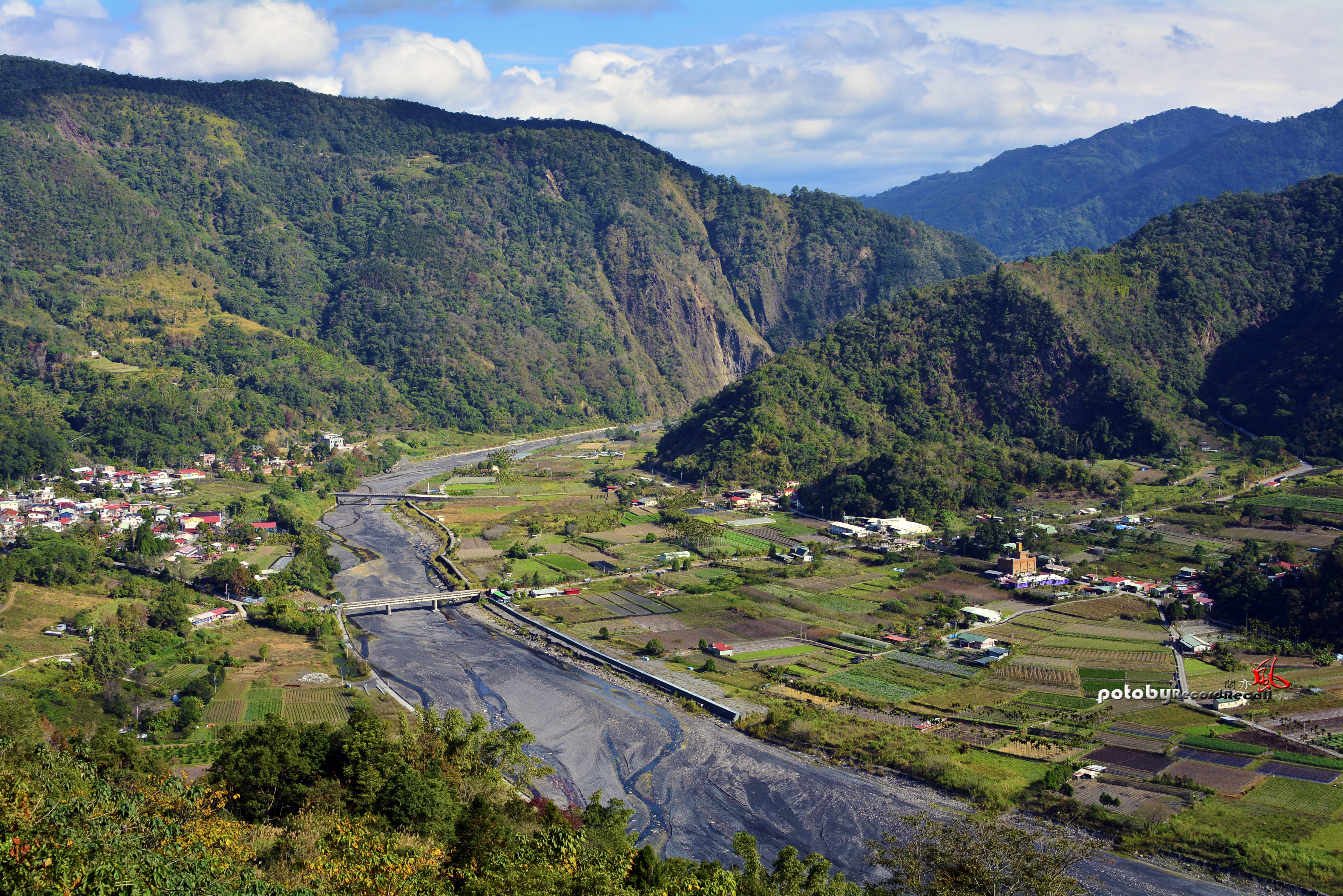
English: Wujie is one of the Bunun tribal villages in Nantou County, Taiwan. It was located on the Zhuoshui River, in the fertile alluvial plain between the Central Mountain Range and the Puli Basin Group.
中文(臺灣):武界是臺灣南投縣的布農族部落之一。它位在濁水溪,夾於中央山脈與埔里盆地群之間的肥沃沖積平原。 |
| Date | |
| Source | https://www.flickr.com/photos/118494442@N04/15958002879/ |
| Author | 杹羽刑 |
Licensing[edit]
| This image was originally posted to Flickr by 刑杹羽 at https://flickr.com/photos/118494442@N04/15958002879. It was reviewed on 11 June 2016 by FlickreviewR and was confirmed to be licensed under the terms of the cc-by-sa-2.0. |
This file is licensed under the Creative Commons Attribution-Share Alike 2.0 Generic license.
- You are free:
- to share – to copy, distribute and transmit the work
- to remix – to adapt the work
- Under the following conditions:
- attribution – You must give appropriate credit, provide a link to the license, and indicate if changes were made. You may do so in any reasonable manner, but not in any way that suggests the licensor endorses you or your use.
- share alike – If you remix, transform, or build upon the material, you must distribute your contributions under the same or compatible license as the original.
File history
Click on a date/time to view the file as it appeared at that time.
| Date/Time | Thumbnail | Dimensions | User | Comment | |
|---|---|---|---|---|---|
| current | 17:44, 11 June 2016 | | 4,496 × 3,000 (11.84 MB) | Liji6085 (talk | contribs) | User created page with UploadWizard |
You cannot overwrite this file.
File usage on Commons
The following page uses this file:
File usage on other wikis
The following other wikis use this file:
- Usage on en.wikipedia.org
- Usage on ja.wikipedia.org
- Usage on pwn.wikipedia.org
- Usage on szy.wikipedia.org
- Usage on tay.wikipedia.org
- Usage on www.wikidata.org
- Usage on zh.wikipedia.org