File:Ukraine location map.svg
Jump to navigation
Jump to search

Size of this PNG preview of this SVG file: 800 × 537 pixels. Other resolutions: 320 × 215 pixels | 640 × 430 pixels | 1,024 × 688 pixels | 1,280 × 859 pixels | 2,560 × 1,719 pixels | 1,546 × 1,038 pixels.
Original file (SVG file, nominally 1,546 × 1,038 pixels, file size: 429 KB)
Captions
Captions
Add a one-line explanation of what this file represents
Summary
| Description |
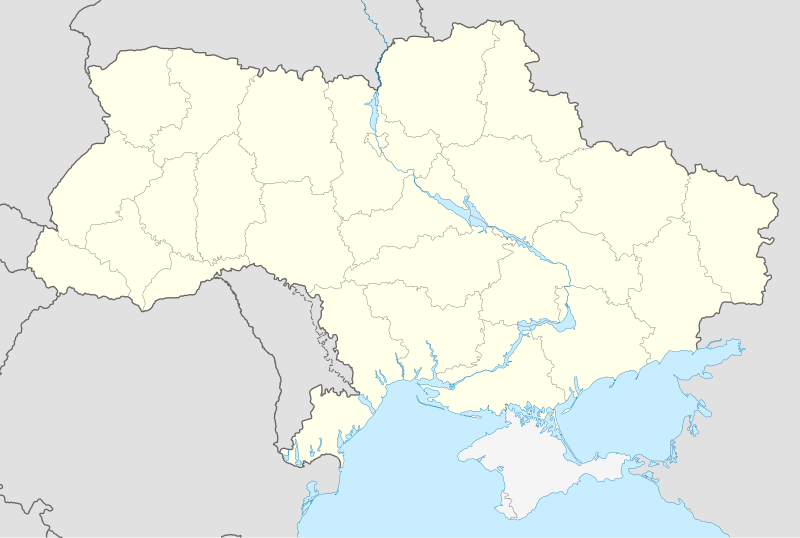
Deutsch: Positionskarte der Ukraine
Quadratische Plattkarte, N-S-Streckung 150 %. Geographische Begrenzung der Karte:
English: Location map of Ukraine
Equirectangular projection, N/S stretching 150 %. Geographic limits of the map:
Français : Carte de localisation de l'Ukraine
|
| Date | |
| Source |
own work, using
|
| Author | NordNordWest |
| Other versions |
Derivative works of this file: Реализация Закона Украины «Об основах государственной языковой политики» на региональном уровне.svg
|
_location_map.svg)


|
This map has been made or improved in the German Kartenwerkstatt (Map Lab). You can propose maps to improve as well.
|
Licensing
I, the copyright holder of this work, hereby publish it under the following licenses:

|
Permission is granted to copy, distribute and/or modify this document under the terms of the GNU Free Documentation License, Version 1.2 or any later version published by the Free Software Foundation; with no Invariant Sections, no Front-Cover Texts, and no Back-Cover Texts. A copy of the license is included in the section entitled GNU Free Documentation License. |
This file is licensed under the Creative Commons Attribution-Share Alike 3.0 Unported license.
- You are free:
- to share – to copy, distribute and transmit the work
- to remix – to adapt the work
- Under the following conditions:
- attribution – You must give appropriate credit, provide a link to the license, and indicate if changes were made. You may do so in any reasonable manner, but not in any way that suggests the licensor endorses you or your use.
- share alike – If you remix, transform, or build upon the material, you must distribute your contributions under the same or compatible license as the original.
You may select the license of your choice.
File history
Click on a date/time to view the file as it appeared at that time.
| Date/Time | Thumbnail | Dimensions | User | Comment | |
|---|---|---|---|---|---|
| current | 15:05, 8 January 2016 | | 1,546 × 1,038 (429 KB) | Roman Poulvas (talk | contribs) | Reverted to version as of 23:21, 25 December 2015 (UTC) |
| 12:41, 8 January 2016 |  | 1,547 × 1,041 (687 KB) | Green Zero (talk | contribs) | Reverted to version as of 23:11, 21 December 2015 (UTC) | |
| 23:21, 25 December 2015 |  | 1,546 × 1,038 (429 KB) | A.h. king (talk | contribs) | Reverted to version as of 11:56, 29 November 2015 (UTC) | |
| 23:11, 21 December 2015 |  | 1,547 × 1,041 (687 KB) | Hjvfy (talk | contribs) | Reverted to version as of 22:43, 18 November 2015 (UTC) | |
| 11:56, 29 November 2015 |  | 1,546 × 1,038 (429 KB) | Mieczysław Podolski (talk | contribs) | Reverted to version as of 19:06, 19 September 2014 (UTC) | |
| 11:51, 29 November 2015 |  | 1,546 × 1,038 (429 KB) | Mieczysław Podolski (talk | contribs) | Reverted to version as of 19:06, 19 September 2014 (UTC) | |
| 22:43, 18 November 2015 |  | 1,547 × 1,041 (687 KB) | Black Future (talk | contribs) | Distinction that there is dispute is not clear, is grey like other nations, many monitors wouldnt even pick that up | |
| 19:06, 19 September 2014 |  | 1,546 × 1,038 (429 KB) | A.Savin (talk | contribs) | see File talk:Ukraine location map.svg | |
| 15:46, 14 September 2014 |  | 1,547 × 1,041 (687 KB) | Denniss (talk | contribs) | Reverted to version as of 16:17, 6 September 2014 | |
| 15:09, 14 September 2014 |  | 1,546 × 1,038 (429 KB) | Leftcry (talk | contribs) | Reverted to version as of 16:08, 6 September 2014 You are trying to show Ukraine's POV rather than showing a NPOV with Crimea shown as a disputed region. |
You cannot overwrite this file.
File usage on Commons
More than 100 pages use this file. The following list shows the first 100 pages that use this file only. A full list is available.
- User:Albedo-ukr
- User:NordNordWest/Gallery/Location maps
- File:2014 pro-Russian unrest in Ukraine.png
- File:2014 pro-Russian unrest in Ukraine.svg
- File:Cherkasy in Ukraine.svg
- File:Cherkasy in Ukraine (-claims).svg
- File:Cherkasy in Ukraine (claims hatched).svg
- File:Chernihiv in Ukraine.svg
- File:Chernihiv in Ukraine (-claims).svg
- File:Chernihiv in Ukraine (claims hatched).svg
- File:Chernivtsi in Ukraine.svg
- File:Chernivtsi in Ukraine (-claims).svg
- File:Chernivtsi in Ukraine (claims hatched).svg
- File:Crimea Republic in Ukraine.svg
- File:Crimea in Ukraine.svg
- File:Crimea in Ukraine (claims hatched).svg
- File:Dnipropetrovsk in Ukraine.svg
- File:Dnipropetrovsk in Ukraine (-claims).svg
- File:Dnipropetrovsk in Ukraine (claims hatched).svg
- File:Donbass in Ukraine (-claims).svg
- File:Donetsian Region in Ukraine.svg
- File:Donetsian Region in Ukraine (claims hatched).svg
- File:Donetsk in Ukraine.svg
- File:Donetsk in Ukraine (-claims).svg
- File:Donetsk in Ukraine (claims hatched).svg
- File:Ivano-Frankivsk in Ukraine.svg
- File:Ivano-Frankivsk in Ukraine (-claims).svg
- File:Ivano-Frankivsk in Ukraine (claims hatched).svg
- File:Kharkiv in Ukraine.svg
- File:Kharkiv in Ukraine (-claims).svg
- File:Kharkiv in Ukraine (claims hatched).svg
- File:Kherson in Ukraine.svg
- File:Kherson in Ukraine (-claims).svg
- File:Kherson in Ukraine (claims hatched).svg
- File:Khmelnytskyi in Ukraine.svg
- File:Khmelnytskyi in Ukraine (-claims).svg
- File:Khmelnytskyi in Ukraine (claims hatched).svg
- File:Kiev (city) in Ukraine.svg
- File:Kiev (city) in Ukraine (-claims).svg
- File:Kiev (city) in Ukraine (claims hatched).svg
- File:Kiev (oblast) in Ukraine (-claims).svg
- File:Kiev (oblast) in Ukraine (claims hatched).svg
- File:Kirovohrad in Ukraine.svg
- File:Kirovohrad in Ukraine (-claims).svg
- File:Kirovohrad in Ukraine (claims hatched).svg
- File:Kyiv (oblast) in Ukraine.svg
- File:Luhansk in Ukraine.svg
- File:Luhansk in Ukraine (-claims).svg
- File:Luhansk in Ukraine (claims hatched).svg
- File:Lviv in Ukraine.svg
- File:Lviv in Ukraine (-claims).svg
- File:Lviv in Ukraine (claims hatched).svg
- File:Mykolaiv in Ukraine.svg
- File:Mykolaiv in Ukraine (-claims).svg
- File:Mykolaiv in Ukraine (claims hatched).svg
- File:Odessa in Ukraine.svg
- File:Odessa in Ukraine (-claims).svg
- File:Odessa in Ukraine (claims hatched).svg
- File:Poltava in Ukraine.svg
- File:Poltava in Ukraine (-claims).svg
- File:Poltava in Ukraine (claims hatched).svg
- File:Possible regional languages in regions Ukraine.svg
- File:Rivne in Ukraine.svg
- File:Rivne in Ukraine (-claims).svg
- File:Rivne in Ukraine (claims hatched).svg
- File:Sevastopol in Ukraine.svg
- File:Sevastopol in Ukraine (claims hatched).svg
- File:Sumy in Ukraine.svg
- File:Sumy in Ukraine (-claims).svg
- File:Sumy in Ukraine (claims hatched).svg
- File:Ternopil in Ukraine.svg
- File:Ternopil in Ukraine (-claims).svg
- File:Ternopil in Ukraine (claims hatched).svg
- File:Ukraine, administrative divisions (-claims) - Nmbrs - colored.svg
- File:Ukraine, administrative divisions (-claims) - Nmbrs - monochrome.svg
- File:Ukraine, administrative divisions (-claims) - de - colored.svg
- File:Ukraine, administrative divisions (-claims) - de - monochrome.svg
- File:Ukraine, administrative divisions (claims hatched) - Nmbrs - colored.svg
- File:Ukraine, administrative divisions (claims hatched) - Nmbrs - monochrome.svg
- File:Ukraine, administrative divisions (claims hatched) - de - colored.svg
- File:Ukraine, administrative divisions (claims hatched) - de - monochrome.svg
- File:Ukraine (1991-2014) location map.svg
- File:Ukraine location map closedpath.svg (file redirect)
- File:Ukraine relief location map.jpg
- File:Vinnytsia in Ukraine.svg
- File:Vinnytsia in Ukraine (-claims).svg
- File:Vinnytsia in Ukraine (claims hatched).svg
- File:Volyn in Ukraine.svg
- File:Volyn in Ukraine (-claims).svg
- File:Volyn in Ukraine (claims hatched).svg
- File:Zakarpattia in Ukraine.svg
- File:Zakarpattia in Ukraine (-claims).svg
- File:Zakarpattia in Ukraine (claims hatched).svg
- File:Zaporizhia in Ukraine.svg
- File:Zaporizhia in Ukraine (-claims).svg
- File:Zaporizhia in Ukraine (claims hatched).svg
- File:Zhytomyr in Ukraine.svg
- File:Zhytomyr in Ukraine (-claims).svg
- File:Zhytomyr in Ukraine (claims hatched).svg
- File:Карта территорий Донецкой и Луганской области с особым порядком местного самоуправления.svg
.svg)
.svg)
.svg)
.svg)
.svg)
.svg)
.svg)
.svg)
.svg)
.svg)
.svg)
.svg)
.svg)
.svg)
.svg)
.svg)
.svg)
.svg)
.svg)
.svg)
.svg)
_in_Ukraine.svg)
_in_Ukraine_(-claims).svg)
_in_Ukraine_(claims_hatched).svg)
_in_Ukraine_(-claims).svg)
_in_Ukraine_(claims_hatched).svg)
.svg)
.svg)
_in_Ukraine.svg)
.svg)
.svg)
.svg)
.svg)
.svg)
.svg)
.svg)
.svg)
.svg)
.svg)
.svg)
.svg)
.svg)
.svg)
.svg)
.svg)
.svg)
_-_Nmbrs_-_colored.svg)
_-_Nmbrs_-_monochrome.svg)
_-_de_-_colored.svg)
_-_de_-_monochrome.svg)
_-_Nmbrs_-_colored.svg)
_-_Nmbrs_-_monochrome.svg)
_-_de_-_colored.svg)
_-_de_-_monochrome.svg)
.svg)
.svg)
.svg)
.svg)
.svg)
.svg)
.svg)
.svg)
.svg)
.svg)
View more links to this file.
File usage on other wikis
The following other wikis use this file:
- Usage on bn.wikipedia.org
- Usage on de.wikipedia.org
- Usage on en.wikipedia.org
- Usage on es.wikipedia.org
- Usage on fr.wikinews.org
- Usage on fy.wikipedia.org
- Hrabove (Donjetsk)
- Svjatohirsk Lavra
- Potsjajiv Lavra
- Trije-ienheidskleaster (Tsjernihiv)
- Kristus-Ferlosserkatedraal (Uzjhorod)
- Krúsferheffingskatedraal (Uzjhorod)
- Synagoge fan Uzjhorod
- Sint-Pantaléontsjerke (Sjevtjenkove)
- Untsliepeniskatedraal (Poltava)
- Sint-Sampsontsjerke (Poltava)
- Hillich Krús kleaster (Poltava)
- Pokrovsky Kleaster (Charkov)
- Untsliepeniskatedraal (Charkov)
- Grutte Synagoge (Charkov)
- Ferkundigingskatedraal (Charkov)
- Karmelitetsjerke (Lviv)
- Gouden Roas-synagoge (Lviv)
- Sint-Joariskatedraal (Lviv)
- Sint-Vladimirkatedraal (Lûhansk)
- Aleksander Nevskytsjerke (Lûhansk)
- Transfiguraasjekatedraal (Tsjernihiv)
- Sint-Katarinatsjerke (Tsjernihiv)
- Berjocht:Posysjekaart Oekraïne
- UEFA Euro 2012
- Volodymyr (stêd)
- Severodonetsk
- Usage on hu.wikipedia.org
- Usage on inh.wikipedia.org
- Usage on lez.wikipedia.org
- Usage on nn.wikipedia.org
View more global usage of this file.