File:QatarOMCmap.png
Jump to navigation
Jump to search
Size of this preview: 413 × 599 pixels. Other resolutions: 165 × 240 pixels | 497 × 721 pixels.
Original file (497 × 721 pixels, file size: 23 KB, MIME type: image/png)
Captions
Captions
Add a one-line explanation of what this file represents
Summary[edit]

|
This map image could be re-created using vector graphics as an SVG file. This has several advantages; see Commons:Media for cleanup for more information. If an SVG form of this image is available, please upload it and afterwards replace this template with
{{vector version available|new image name}}.
It is recommended to name the SVG file “QatarOMCmap.svg”—then the template Vector version available (or Vva) does not need the new image name parameter. |
| Description |
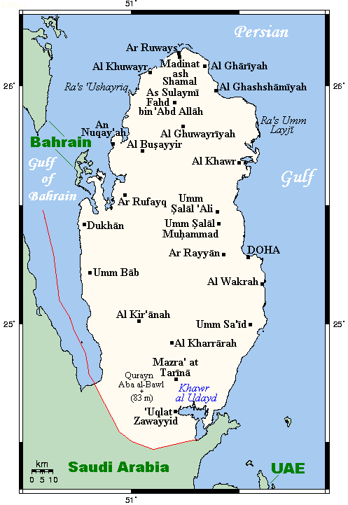
English: A map showing Qatar's cities and main towns, along with nearby areas. This map's source is here, with the uploader's modifications, and the GMT homepage says that the tools are released under the GNU General Public License. |
| Date | 19 July 2007 (original upload date) |
| Source | Transferred from en.wikipedia to Commons by Georgez. |
| Author | Kelisi at English Wikipedia |
| Other versions | العربيَّة |
Licensing[edit]
Kelisi at the English-language Wikipedia, the copyright holder of this work, hereby publishes it under the following license:
| This file is licensed under the Creative Commons Attribution-Share Alike 3.0 Unported license. Subject to disclaimers. | ||
| Attribution: Kelisi at the English-language Wikipedia | ||
| ||
| This licensing tag was added to this file as part of the GFDL licensing update. |

|
Permission is granted to copy, distribute and/or modify this document under the terms of the GNU Free Documentation License, Version 1.2 or any later version published by the Free Software Foundation; with no Invariant Sections, no Front-Cover Texts, and no Back-Cover Texts. A copy of the license is included in the section entitled GNU Free Documentation License. Subject to disclaimers. |
Original upload log[edit]
The original description page was here. All following user names refer to en.wikipedia.
- 2007-07-19 18:23 Kelisi 497×721× (18735 bytes) == Summary == A map showing Qatar's cities and main towns, along with nearby areas. This map's source is [http://www.aquarius.ifm-geomar.de/ here], with the uploader's modifications, and the [http://gmt.soest.hawaii.edu/ GMT homepage] says that the tools
File history
Click on a date/time to view the file as it appeared at that time.
| Date/Time | Thumbnail | Dimensions | User | Comment | |
|---|---|---|---|---|---|
| current | 08:23, 30 January 2021 | | 497 × 721 (23 KB) | Kelisi (talk | contribs) | Replacing shrunken, blurry, crappy version with one with original version's size and sharpness — and an adjusted border. |
| 04:15, 17 September 2018 |  | 413 × 599 (123 KB) | Io Herodotus (talk | contribs) | south border | |
| 15:24, 6 November 2014 |  | 497 × 721 (11 KB) | RokerHRO (talk | contribs) | optipng -o7 → 39.24% decrease | |
| 17:46, 25 March 2009 |  | 497 × 721 (18 KB) | Georgez (talk | contribs) | {{Information |Description={{en|A map showing Qatar's cities and main towns, along with nearby areas. This map's source is [http://www.aquarius.ifm-geomar.de/ here], with the uploader's modifications, and the [http://gmt.soest.hawaii.edu/ GMT homepage] sa |
You cannot overwrite this file.
File usage on Commons
The following page uses this file:
File usage on other wikis
The following other wikis use this file:
- Usage on ar.wikipedia.org
- Usage on bn.wikipedia.org
- Usage on de.wikipedia.org
- Usage on en.wikipedia.org
- Usage on eo.wikipedia.org
- Usage on fr.wikipedia.org
- Usage on it.wikipedia.org
- Usage on ja.wikipedia.org
- Usage on ms.wikipedia.org
- Usage on nn.wikipedia.org
- Usage on uk.wikipedia.org