File:Interstate Highways.png
Jump to navigation
Jump to search
Size of this preview: 800 × 495 pixels. Other resolutions: 320 × 198 pixels | 640 × 396 pixels | 1,024 × 633 pixels | 1,280 × 791 pixels | 2,560 × 1,583 pixels | 4,096 × 2,532 pixels.
Original file (4,096 × 2,532 pixels, file size: 1.16 MB, MIME type: image/png)
Captions
Captions
Add a one-line explanation of what this file represents
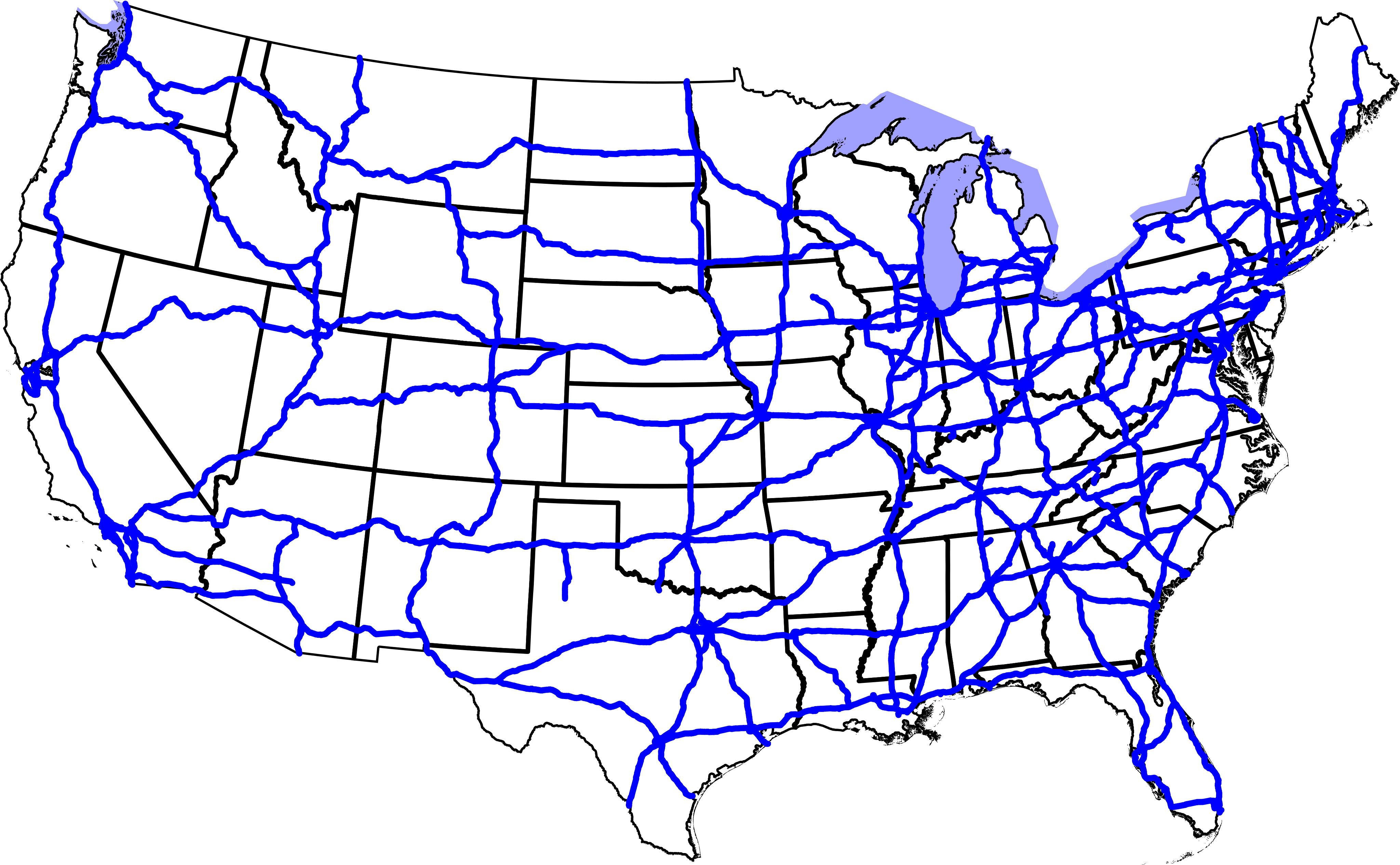
A map of the Interstate Highways in the contiguous United States (not including Hawaii).
Note that this map is missing Interstate 73, Interstate 86, and Interstate 99, and portions of Interstate 39.
This is a thumbnail of Image:Interstate Highways.svg, which Wikipedia has trouble rendering. This file should be deleted once the software on the servers is upgraded.
David Benbennick made this map.
| I, the copyright holder of this work, release this work into the public domain. This applies worldwide. In some countries this may not be legally possible; if so: I grant anyone the right to use this work for any purpose, without any conditions, unless such conditions are required by law. |
File history
Click on a date/time to view the file as it appeared at that time.
| Date/Time | Thumbnail | Dimensions | User | Comment | |
|---|---|---|---|---|---|
| current | 00:39, 26 November 2005 | | 4,096 × 2,532 (1.16 MB) | Dbenbenn (talk | contribs) | synchronize with Image:Interstate Highways.svg |
| 00:52, 25 November 2005 |  | 4,096 × 2,532 (1.14 MB) | Dbenbenn (talk | contribs) | by me, PD; thumbnail of Image:Interstate Highways.svg |
You cannot overwrite this file.
File usage on Commons
The following 3 pages use this file:
File usage on other wikis
The following other wikis use this file:
- Usage on da.wikipedia.org
- Usage on eu.wikipedia.org
- Usage on mwl.wikipedia.org
- Usage on nn.wikipedia.org
- Usage on no.wikipedia.org
- Usage on pt.wikipedia.org
- Usage on sv.wikipedia.org