File:Chernivickaya oblast location map.svg
Jump to navigation
Jump to search

Size of this PNG preview of this SVG file: 533 × 337 pixels. Other resolutions: 320 × 202 pixels | 640 × 405 pixels | 1,024 × 647 pixels | 1,280 × 809 pixels | 2,560 × 1,619 pixels.
Original file (SVG file, nominally 533 × 337 pixels, file size: 143 KB)
Captions
Captions
Add a one-line explanation of what this file represents
Summary[edit]
| Description |
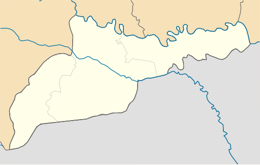
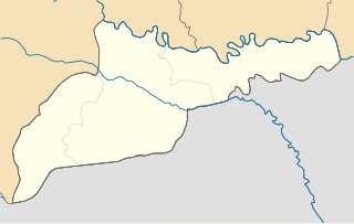
English: Areas of Chernivtsi region, from July 17, C.E. 2020
Русский: Районы Черновицкой области с 17 июля 2020 года
Українська: Райони Чернівецької області з 17 липня 2020 року |
| Date | |
| Source | Own work |
| Author | RosssW |
Licensing[edit]
I, the copyright holder of this work, hereby publish it under the following license:
This file is licensed under the Creative Commons Attribution-Share Alike 4.0 International license.
- You are free:
- to share – to copy, distribute and transmit the work
- to remix – to adapt the work
- Under the following conditions:
- attribution – You must give appropriate credit, provide a link to the license, and indicate if changes were made. You may do so in any reasonable manner, but not in any way that suggests the licensor endorses you or your use.
- share alike – If you remix, transform, or build upon the material, you must distribute your contributions under the same or compatible license as the original.
File history
Click on a date/time to view the file as it appeared at that time.
| Date/Time | Thumbnail | Dimensions | User | Comment | |
|---|---|---|---|---|---|
| current | 13:20, 13 August 2020 | | 533 × 337 (143 KB) | RosssW (talk | contribs) | Uploaded own work with UploadWizard |
You cannot overwrite this file.
File usage on Commons
There are no pages that use this file.
File usage on other wikis
The following other wikis use this file:
- Usage on be.wikipedia.org
- Чарнаўцы
- Хацін
- Навасэлыця
- Шаблон:На карце/Украіна Чарнавіцкая вобласць
- Кіцмань
- Новадністроўск
- Глыбока
- Кастрыжыўка
- Краснаільск
- Лужаны (Чарнавіцкая вобласць)
- Нэпалокіўці
- Путыла
- Майдан (Выжныцкая гарадская абшчына)
- Багна
- Выжэнка
- Іспас
- Кыбакы
- Міліевэ
- Сэрэдні Майдан (Выжныцкі раён)
- Чэрэшэнка (Выжныцкі раён)
- Чарнагузы
- Бабынэ (Выжныцкі раён)
- Валы
- Валока (Выжныцкі раён)
- Замосця (Выжныцкі раён)
- Карапчыў (Выжныцкі раён)
- Майдан (Лукавэцкі сельсавет)
- Лукаўці
- Вахніўці (Выжныцкі раён)
- Ваўчынэць (Выжныцкі раён)
- Лыпаваны (вёска)
- Лапушна (Выжныцкі раён)
- Карытнэ (Выжныцкі раён)
- Лэкэчы
- Слабада-Баныліў
- Фалькіў
- Мыгавэ
- Баныліў
- Бэрэжныця (Выжныцкі раён)
- Бэрэжонка
- Вэлыкэ (Выжныцкі раён)
- Долішні Шэпіт
- Зарычча (Выжныцкі раён)
- Вэлыкасілля (Гэрцаеўскі раён)
- Лунка (Гэрцаеўскі раён)
- Магыліўка (Гэрцаеўскі раён)
- Молныця
- Острыця (Гэрцаеўскі раён)
- Мамарныця Вама
- Мамарныця
View more global usage of this file.