File:Reliefkarte Litauen.png
Jump to navigation
Jump to search

Size of this preview: 776 × 600 pixels. Other resolutions: 311 × 240 pixels | 621 × 480 pixels | 994 × 768 pixels | 1,280 × 989 pixels | 2,542 × 1,964 pixels.
Original file (2,542 × 1,964 pixels, file size: 7.28 MB, MIME type: image/png)
Captions
Captions
Add a one-line explanation of what this file represents
Summary[edit]
| Description |
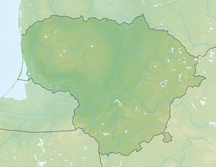
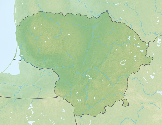
Deutsch: Reliefkarte Litauen
Topographischer Hintergrund: NASA Shuttle Radar Topography Mission (public domain). SRTM3 v.2. |
||||||||
| Date | |||||||||
| Source | Own work | ||||||||
| Author | Tschubby | ||||||||
| Permission (Reusing this file) |
I, the copyright holder of this work, hereby publish it under the following licenses:
This file is licensed under the Creative Commons Attribution-Share Alike 2.5 Generic, 2.0 Generic and 1.0 Generic license.
You may select the license of your choice. |

File history
Click on a date/time to view the file as it appeared at that time.
| Date/Time | Thumbnail | Dimensions | User | Comment | |
|---|---|---|---|---|---|
| current | 07:56, 20 May 2018 | | 2,542 × 1,964 (7.28 MB) | Tschubby (talk | contribs) | {{Information |description= |source= |date= |author= |permission= |other versions= }} |
| 07:37, 19 May 2018 |  | 2,542 × 1,964 (7.14 MB) | Tschubby (talk | contribs) | == {{int:filedesc}} == {{Information |Description= {{de| Reliefkarte Litauen}} Topographischer Hintergrund: [http://www2.jpl.nasa.gov/srtm NASA Shuttle Radar Topography Mission] (public domain). SRTM3 v.2.<br /> Flüsse: Lithuania adm location map.svg |Source={{own}} |Date= 2018-05-19 |Author= Tschubby |Permission= {{self|GFDL|Cc-by-sa-3.0-migrated|Cc-by-sa-2.5,2.0,1.0}} |other_versions= }} Category:Location maps of Lithuania [[Category:Topographic maps of Lithu... |
You cannot overwrite this file.
File usage on Commons
There are no pages that use this file.
File usage on other wikis
The following other wikis use this file:
- Usage on bg.wikipedia.org
- Usage on de.wikipedia.org
- Litauen
- Wystiter See
- Fernsehturm Vilnius
- Kaunasser Meer
- Juozapinės kalnas
- Windenburger Eck
- Vorlage:Positionskarte Litauen
- Aukštojas
- Wikipedia:Kartenwerkstatt/Positionskarten/Europa
- Drūkšiai
- Wasserburg Trakai
- Pumpspeicherkraftwerk Kruonis
- Benutzer:Tomlux/Spielwiese
- Radio- und Fernsehturm Klaipėda
- Fernsehturm Tauragė
- Asveja
- Tauragnas
- Sartai
- Aisetas
- Rėkyva-See
View more global usage of this file.