File:Europe relief laea location map.jpg
Jump to navigation
Jump to search

Size of this preview: 701 × 599 pixels. Other resolutions: 281 × 240 pixels | 561 × 480 pixels | 898 × 768 pixels | 1,198 × 1,024 pixels | 1,580 × 1,351 pixels.
Original file (1,580 × 1,351 pixels, file size: 1.1 MB, MIME type: image/jpeg)
Captions
Captions
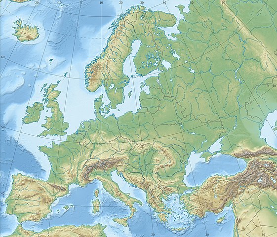
Relief location map of Europe
India
Summary[edit]
| Description |
Deutsch: Physische Positionskarte Europa; Flächentreue Azimutalprojektion
English: Physical location map Europe; Lambert azimuthal equal-area projection
|
| Date | |
| Source |
Own work
|
| Author | Alexrk2 |
| Other versions |
Derivative works of this file:
[]
|


.svg)


_ru.svg)

|
This map has been made or improved in the German Kartenwerkstatt (Map Lab). You can propose maps to improve as well.
|
Licensing[edit]
I, the copyright holder of this work, hereby publish it under the following license:
This file is licensed under the Creative Commons Attribution-Share Alike 3.0 Unported license.
- You are free:
- to share – to copy, distribute and transmit the work
- to remix – to adapt the work
- Under the following conditions:
- attribution – You must give appropriate credit, provide a link to the license, and indicate if changes were made. You may do so in any reasonable manner, but not in any way that suggests the licensor endorses you or your use.
- share alike – If you remix, transform, or build upon the material, you must distribute your contributions under the same or compatible license as the original.
File history
Click on a date/time to view the file as it appeared at that time.
| Date/Time | Thumbnail | Dimensions | User | Comment | |
|---|---|---|---|---|---|
| current | 22:29, 4 July 2018 | | 1,580 × 1,351 (1.1 MB) | Subtropical-man (talk | contribs) | Reverted to version as of 22:56, 20 August 2012 (UTC) |
| 17:54, 2 July 2018 |  | 1,580 × 1,351 (821 KB) | 1970gemini (talk | contribs) | fiat lux | |
| 22:56, 20 August 2012 |  | 1,580 × 1,351 (1.1 MB) | McZusatz (talk | contribs) | Reverted to version as of 10:53, 14 March 2010 (...thumb fixed?) | |
| 22:55, 20 August 2012 |  | 120 × 103 (4 KB) | McZusatz (talk | contribs) | fixing thumb... | |
| 10:53, 14 March 2010 |  | 1,580 × 1,351 (1.1 MB) | Alexrk2 (talk | contribs) | == Summary == {{Information |Description= {{de|Physische Positionskarte Europa; Flächentreue Azimutalprojektion}} {{en|Physical location map Europe; Lambert azimuthal equal-area projection}} * Projection: LAEA Europe, [http: |
You cannot overwrite this file.
File usage on Commons
More than 100 pages use this file. The following list shows the first 100 pages that use this file only. A full list is available.
- File:Abkhazia in Europe (relief).svg
- File:Abkhazia in Europe (relief) (-mini map).svg
- File:Akrotiri and Dhekelia in Europe (relief).svg
- File:Akrotiri and Dhekelia in Europe (relief) (-mini map).svg
- File:Aland in Europe (relief).svg
- File:Aland in Europe (relief) (-mini map).svg
- File:Albania in Europe (relief).svg
- File:Albania in Europe (relief) (-mini map).svg
- File:Andorra in Europe (relief).svg
- File:Andorra in Europe (relief) (-mini map).svg
- File:Andorra in Europe (relief) (special marker).svg
- File:Andorra in Europe (relief) (special marker) (-mini map).svg
- File:Armenia in Europe (relief).svg
- File:Armenia in Europe (relief) (-mini map).svg
- File:Artsakh in Europe (relief).svg
- File:Austria in Europe (relief).svg
- File:Austria in Europe (relief) (-mini map).svg
- File:Azerbaijan in Europe (relief).svg
- File:Azerbaijan in Europe (relief) (-mini map).svg
- File:BLANK in Europe (relief).svg
- File:BLANK in Europe (relief) (-mini map).svg
- File:Belarus in Europe (relief).svg
- File:Belarus in Europe (relief) (-mini map).svg
- File:Belgium in Europe (relief).svg
- File:Belgium in Europe (relief) (-mini map).svg
- File:Bosnia and Herzegovina in Europe (relief).svg
- File:Bosnia and Herzegovina in Europe (relief) (-mini map).svg
- File:Bulgaria in Europe (relief).svg
- File:Bulgaria in Europe (relief) (-mini map).svg
- File:Croatia in Europe (relief).svg
- File:Croatia in Europe (relief) (-mini map).svg
- File:Cyprus in Europe (relief).svg
- File:Cyprus in Europe (relief) (de-facto).svg
- File:Cyprus in Europe (relief) (de-facto) (special marker).svg
- File:Czech Republic in Europe (relief).svg
- File:Denmark in Europe (relief).svg
- File:Estonia in Europe (relief).svg
- File:Europe EU laea location map.svg
- File:Europe blank laea location map.svg
- File:Europe bluemarble laea location map.jpg
- File:Europe laea location map.svg
- File:Europe natural laea location map.jpg
- File:Europe relief laea location map.jpg
- File:Europe relief laea location map BG.png
- File:European Union in Europe (relief).svg
- File:Faroe Islands in Europe (relief).svg
- File:Finland in Europe (relief).svg
- File:France in Europe (relief).svg
- File:Georgia in Europe (relief).svg
- File:Georgia in Europe (relief) (de-facto).svg
- File:Germany in Europe (relief).svg
- File:Gibraltar in Europe (relief).svg
- File:Greece in Europe (relief).svg
- File:Guernsey in Europe (relief).svg
- File:Hungary in Europe (relief).svg
- File:Iceland in Europe (relief).svg
- File:Ireland in Europe (relief).svg
- File:Isle of Man in Europe (relief).svg
- File:Italy in Europe (relief).svg
- File:Jersey in Europe (relief).svg
- File:Kazakhstan in Europe (relief).svg
- File:Kingdom of Denmark in Europe (relief).svg
- File:Kosovo in Europe (relief) (de-facto).svg
- File:Latvia in Europe (relief).svg
- File:Liechtenstein in Europe (relief).svg
- File:Liechtenstein in Europe (relief) (special marker).svg
- File:Lithuania in Europe (relief).svg
- File:Luxembourg in Europe (relief).svg
- File:Luxembourg in Europe (relief) (special marker).svg
- File:Macedonia in Europe (relief).svg
- File:Malta in Europe (relief).svg
- File:Moldova in Europe (relief).svg
- File:Monaco in Europe (relief).svg
- File:Monaco in Europe (relief) (special marker).svg
- File:Montenegro in Europe (relief).svg
- File:Netherlands in Europe (relief).svg
- File:Northern Cyprus in Europe (relief).svg
- File:Northern Cyprus in Europe (relief) (special marker).svg
- File:Norway in Europe (relief).svg
- File:Poland in Europe (relief).svg
- File:Portugal in Europe (relief).svg
- File:Romania in Europe (relief).svg
- File:Russia in Europe (relief).svg
- File:San Marino in Europe (relief).svg
- File:San Marino in Europe (relief) (special marker).svg
- File:Serbia in Europe (relief).svg
- File:Serbia in Europe (relief) (de-facto).svg
- File:Slovakia in Europe (relief).svg
- File:Slovenia in Europe (relief).svg
- File:South Ossetia in Europe (relief).svg
- File:Spain in Europe (relief).svg
- File:Sweden in Europe (relief).svg
- File:Switzerland in Europe (relief).svg
- File:Transnistria in Europe (relief).svg
- File:Turkey in Europe (relief).svg
- File:Ukraine in Europe (relief).svg
- File:United Kingdom in Europe (relief).svg
- File:United Kingdom in Europe (relief) (wo crown dependencies).svg
- File:Vatican City in Europe (relief).svg
- File:Vatican City in Europe (relief) (special marker).svg
.svg)
_(-mini_map).svg)
.svg)
_(-mini_map).svg)
.svg)
_(-mini_map).svg)
.svg)
_(-mini_map).svg)
.svg)
_(-mini_map).svg)
_(special_marker).svg)
_(special_marker)_(-mini_map).svg)
.svg)
_(-mini_map).svg)
.svg)
.svg)
_(-mini_map).svg)
.svg)
_(-mini_map).svg)
.svg)
_(-mini_map).svg)
.svg)
_(-mini_map).svg)
.svg)
_(-mini_map).svg)
.svg)
_(-mini_map).svg)
.svg)
_(-mini_map).svg)
.svg)
_(-mini_map).svg)
.svg)
_(de-facto).svg)
_(de-facto)_(special_marker).svg)
.svg)
.svg)
.svg)
.svg)
.svg)
.svg)
.svg)
.svg)
_(de-facto).svg)
.svg)
.svg)
.svg)
.svg)
.svg)
.svg)
.svg)
.svg)
.svg)
.svg)
.svg)
.svg)
_(de-facto).svg)
.svg)
.svg)
_(special_marker).svg)
.svg)
.svg)
_(special_marker).svg)
.svg)
.svg)
.svg)
.svg)
_(special_marker).svg)
.svg)
.svg)
.svg)
_(special_marker).svg)
.svg)
.svg)
.svg)
.svg)
.svg)
.svg)
_(special_marker).svg)
.svg)
_(de-facto).svg)
.svg)
.svg)
.svg)
.svg)
.svg)
.svg)
.svg)
.svg)
.svg)
.svg)
_(wo_crown_dependencies).svg)
.svg)
_(special_marker).svg)
View more links to this file.
File usage on other wikis
The following other wikis use this file:
- Usage on ab.wikipedia.org
- Usage on als.wikipedia.org
- Usage on ar.wikipedia.org
- Usage on arz.wikipedia.org
- Usage on ast.wikipedia.org
- Usage on av.wikipedia.org
- Usage on azb.wikipedia.org
- Usage on az.wikipedia.org
View more global usage of this file.