File:India Jammu and Kashmir relief map.svg
Jump to navigation
Jump to search

Size of this PNG preview of this SVG file: 793 × 599 pixels. Other resolutions: 318 × 240 pixels | 635 × 480 pixels | 1,016 × 768 pixels | 1,280 × 967 pixels | 2,560 × 1,935 pixels | 1,720 × 1,300 pixels.
Original file (SVG file, nominally 1,720 × 1,300 pixels, file size: 5.57 MB)
Captions
Captions
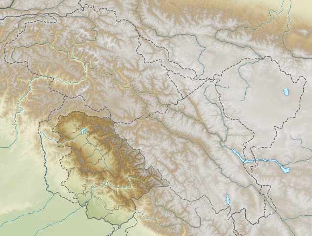
Jammu and Kashmir relief
Summary[edit]
| Description |
English: Jammu and Kashmir relief. Elevation data from STRM. |
| Date | |
| Source | File:India_Jammu_and_Kashmir_location_map_UN_view.svg |
| Author | Own work based on NordNordWest |
Licensing[edit]
This file is licensed under the Creative Commons Attribution-Share Alike 3.0 Unported license.
- You are free:
- to share – to copy, distribute and transmit the work
- to remix – to adapt the work
- Under the following conditions:
- attribution – You must give appropriate credit, provide a link to the license, and indicate if changes were made. You may do so in any reasonable manner, but not in any way that suggests the licensor endorses you or your use.
- share alike – If you remix, transform, or build upon the material, you must distribute your contributions under the same or compatible license as the original.
File history
Click on a date/time to view the file as it appeared at that time.
| Date/Time | Thumbnail | Dimensions | User | Comment | |
|---|---|---|---|---|---|
| current | 16:27, 24 October 2020 | | 1,720 × 1,300 (5.57 MB) | C1MM (talk | contribs) | Changed image |
| 05:52, 17 April 2020 |  | 1,722 × 1,301 (9.38 MB) | C1MM (talk | contribs) | Uploaded a work by Own work based on NordNordWest from File:India_Jammu_and_Kashmir_location_map_UN_view.svg with UploadWizard |
You cannot overwrite this file.
File usage on Commons
The following page uses this file:
- File:Jammu and Kashmir relief map.svg (file redirect)
File usage on other wikis
The following other wikis use this file:
- Usage on bn.wikipedia.org
- Usage on en.wikipedia.org
- Usage on es.wikipedia.org
- Usage on hi.wikipedia.org
- Usage on ks.wikipedia.org
- Usage on ml.wikipedia.org
- Usage on os.wikipedia.org
- Usage on pt.wikipedia.org
- Usage on ru.wikipedia.org
- Usage on th.wikipedia.org
- Usage on zh.wikipedia.org