File:Historisch Nordamerika.jpg
Jump to navigation
Jump to search
Size of this preview: 731 × 600 pixels. Other resolutions: 293 × 240 pixels | 585 × 480 pixels | 936 × 768 pixels | 1,248 × 1,024 pixels | 2,497 × 2,048 pixels | 2,560 × 2,100 pixels.
Original file (2,560 × 2,100 pixels, file size: 6.03 MB, MIME type: image/jpeg)
Captions
Captions
Add a one-line explanation of what this file represents
Summary[edit]
| Description |
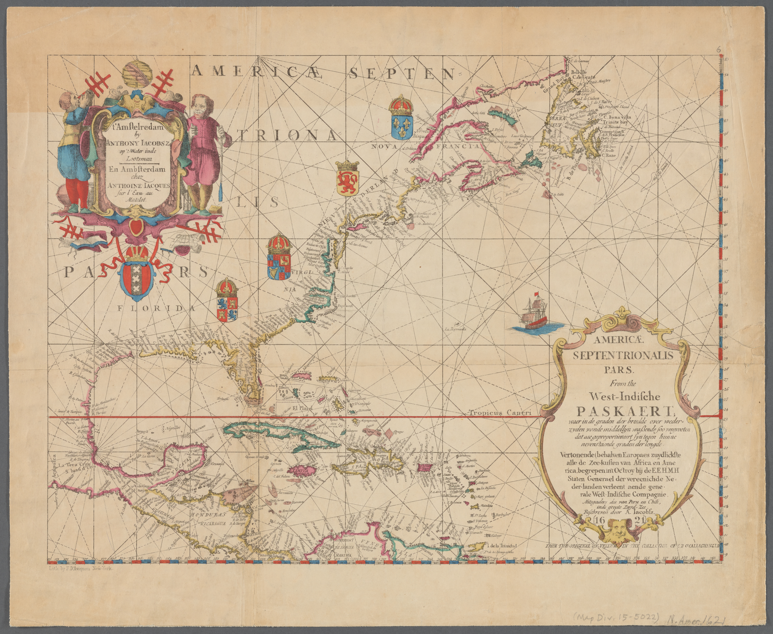
English: Old map of North America, the Caribbean, and northern South America; covers area north from Venezuela to Labrador; includes decorative cartouches and illustrations. This is a facsimile, from the original on vellum in the collection of E.B. O'Callaghan LLD.
|
||
| Date | |||
| Source |
|
||
| Author |
Anthoni Jacobsz (1594-1624), cartographer Francis D'Avignon (1813–1875), lithographer E.B. (Edmund Bailey) O'Callaghan (1797–1880), collector |
||
| Other versions |
|
.jpg)

.jpg)
Licensing[edit]
|
This work is in the public domain in its country of origin and other countries and areas where the copyright term is the author's life plus 100 years or fewer. This work is in the public domain in the United States because it was published (or registered with the U.S. Copyright Office) before January 1, 1929. | |
| This file has been identified as being free of known restrictions under copyright law, including all related and neighboring rights. | |
File history
Click on a date/time to view the file as it appeared at that time.
| Date/Time | Thumbnail | Dimensions | User | Comment | |
|---|---|---|---|---|---|
| current | 23:55, 10 January 2021 | | 2,560 × 2,100 (6.03 MB) | Vzeebjtf (talk | contribs) | larger, higher resolution |
| 21:43, 13 September 2013 |  | 400 × 314 (83 KB) | Gladiool (talk | contribs) | Same image, higher quality. | |
| 20:14, 2 October 2005 |  | 382 × 269 (38 KB) | Newsflash (talk | contribs) | 16 or 17 century old map |
You cannot overwrite this file.
File usage on Commons
The following 3 pages use this file:
File usage on other wikis
The following other wikis use this file:
- Usage on bn.wikipedia.org
- Usage on ka.wikipedia.org
- Usage on km.wikipedia.org