File:Danubemap.jpg
Jump to navigation
Jump to search
Size of this preview: 800 × 577 pixels. Other resolutions: 320 × 231 pixels | 640 × 462 pixels | 998 × 720 pixels.
Original file (998 × 720 pixels, file size: 389 KB, MIME type: image/jpeg)
Captions
Captions
Add a one-line explanation of what this file represents
Summary[edit]
| Description |
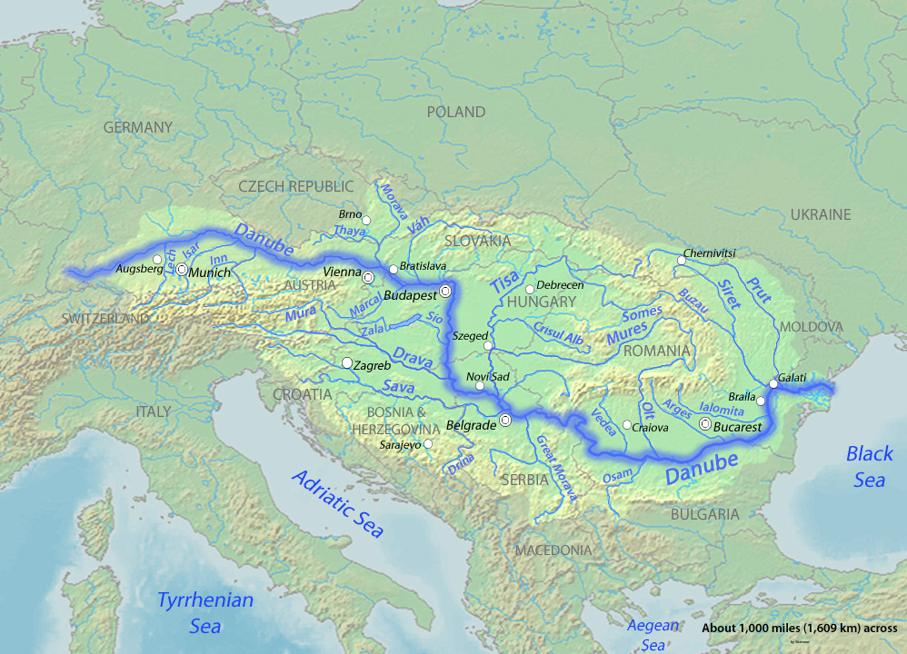
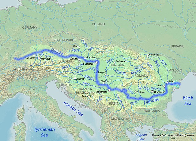
English: Map of the Danube,hhhhhhhhhhhhhhhhghfrxygtjhcvkblgvhfygtyfrtzvh largest river of Central Europe. Created to fill a gap in which all the other Danube maps do not fulfill. fhfjhfjhjvhfwjhvwhmjvxmjhwqvdsjydw1h2cfvjg |
| Date | to 23 |
| Source | Background and river course data from http://www2.demis.nl/mapserver/mapper.asp |
| Author | Shannon |
Licensing[edit]
I, the copyright holder of this work, hereby publish it under the following licenses:

|
Permission is granted to copy, distribute and/or modify this document under the terms of the GNU Free Documentation License, Version 1.2 or any later version published by the Free Software Foundation; with no Invariant Sections, no Front-Cover Texts, and no Back-Cover Texts. A copy of the license is included in the section entitled GNU Free Documentation License. |
This file is licensed under the Creative Commons Attribution-Share Alike 4.0 International, 3.0 Unported, 2.5 Generic, 2.0 Generic and 1.0 Generic license.
- You are free:
- to share – to copy, distribute and transmit the work
- to remix – to adapt the work
- Under the following conditions:
- attribution – You must give appropriate credit, provide a link to the license, and indicate if changes were made. You may do so in any reasonable manner, but not in any way that suggests the licensor endorses you or your use.
- share alike – If you remix, transform, or build upon the material, you must distribute your contributions under the same or compatible license as the original.
You may select the license of your choice.
File history
Click on a date/time to view the file as it appeared at that time.
| Date/Time | Thumbnail | Dimensions | User | Comment | |
|---|---|---|---|---|---|
| current | 05:13, 24 March 2010 | | 998 × 720 (389 KB) | Shannon1 (talk | contribs) | {{Information |Description={{en|1=Map of the Danube, the largest river of Central Europe. Created to fill a gap in which all the other Danube maps do not fulfill.}} |Source=Background and river course data from http://www2.demis.nl/mapserver/mapper.as |
You cannot overwrite this file.
File usage on Commons
There are no pages that use this file.
File usage on other wikis
The following other wikis use this file:
- Usage on ast.wiktionary.org
- Usage on el.wikipedia.org
- Usage on en.wikipedia.org
- Usage on es.wikipedia.org
- Usage on et.wikipedia.org
- Usage on ka.wikipedia.org
- Usage on lt.wikipedia.org
- Usage on mk.wikipedia.org
- Usage on os.wikipedia.org
- Usage on sl.wikipedia.org
- Usage on zh.wikipedia.org
View more global usage of this file.