File:Map of Iwate Prefecture Ja.svg

Original file (SVG file, nominally 400 × 604 pixels, file size: 20 KB)
Captions
Captions
Summary[edit]
| Description |
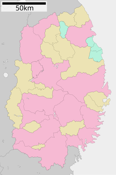
English: Map of Iwate Prefecture, Japan.
日本語: ja:岩手県区画図 |
||
| Date | 更新:2010年1月1日 | ||
| Source |
|
||
| Author | Lincun | ||
| Permission (Reusing this file) |
|
Licensing[edit]

|
Permission is granted to copy, distribute and/or modify this document under the terms of the GNU Free Documentation License, Version 1.2 or any later version published by the Free Software Foundation; with no Invariant Sections, no Front-Cover Texts, and no Back-Cover Texts. A copy of the license is included in the section entitled GNU Free Documentation License. |
- You are free:
- to share – to copy, distribute and transmit the work
- to remix – to adapt the work
- Under the following conditions:
- attribution – You must give appropriate credit, provide a link to the license, and indicate if changes were made. You may do so in any reasonable manner, but not in any way that suggests the licensor endorses you or your use.
- share alike – If you remix, transform, or build upon the material, you must distribute your contributions under the same or compatible license as the original.
Original upload log[edit]
| This file was moved from Japanese Wikipedia.
See below for original file information. | ||||||||||||||||||||||||||||||||||||||||||||||||||||||||
| ||||||||||||||||||||||||||||||||||||||||||||||||||||||||
|
| ||||||||||||||||||||||||||||||||||||||||||||||||||||||||
File history
Click on a date/time to view the file as it appeared at that time.
| Date/Time | Thumbnail | Dimensions | User | Comment | |
|---|---|---|---|---|---|
| current | 06:56, 22 January 2021 | | 400 × 604 (20 KB) | AichiWikiFixer (talk | contribs) | Fixed Fujisawa-Ichinoseki merger. |
| 08:02, 23 August 2019 |  | 400 × 604 (18 KB) | LT sfm (talk | contribs) | Fixed the color (Takizawa Village to City) | |
| 05:03, 23 August 2019 |  | 400 × 604 (18 KB) | LT sfm (talk | contribs) | 滝沢村→滝沢市 | |
| 01:02, 20 February 2013 |  | 400 × 604 (16 KB) | 猿払の天馬 (talk | contribs) | 東磐井郡藤沢町を一関市と合併。 | |
| 22:50, 30 September 2011 |  | 400 × 604 (17 KB) | Haaninjo (talk | contribs) | Updated to 2011.09.26 borders. Based on 2010.01.10 version of ja:file:包括自治体区画図 03000.svg and edited to reflect current borders after Fujisawa-Ichinoseki merger. | |
| 06:02, 10 January 2010 |  | 400 × 604 (12 KB) | Lincun (talk | contribs) | {{基礎自治体位置図画像情報|岩手県||20100101}} | |
| 22:52, 26 April 2008 |  | 500 × 812 (16 KB) | Krisgrotius (talk | contribs) | {{Information| |Description= Map of Iwate Prefecture, Japan. |Source= Japanese wiki [http://ja.wikipedia.org/wiki/%E7%94%BB%E5%83%8F:%E5%8C%85%E6%8B%AC%E8%87%AA%E6%B2%BB%E4%BD%93%E5%8C%BA%E7%94%BB%E5%9B%B3_03000.svg] |Date=~~~~~ |Author=[[:ja: 利用� | |
| 15:32, 22 September 2007 |  | 500 × 812 (16 KB) | Lincun (talk | contribs) | {{基礎自治体位置図画像情報|岩手県|}} |
You cannot overwrite this file.
File usage on Commons
The following 4 pages use this file:
- Iwate prefecture
- Maps of Iwate prefecture
- File:包括自治体区画図 03000.svg (file redirect)
- File:岩手県行政区画地図 (2010年1月1日).svg (file redirect)
.svg&redirect=no)
File usage on other wikis
The following other wikis use this file:
- Usage on de.wikipedia.org
- Usage on en.wikipedia.org
- Usage on id.wikipedia.org
- Usage on ja.wikipedia.org
- 岩手県
- 一関市
- 中尊寺
- 岩泉町
- 花巻空港
- 岩手県立盛岡第一高等学校
- 岩手県立盛岡第四高等学校
- 田野畑村
- 普代村
- 浄法寺町
- 岩手県立山田高等学校
- 岩手県立一関第二高等学校
- 岩手県立福岡高等学校
- 胆沢城
- 西和賀町
- 志波城
- 三陸復興国立公園
- 角塚古墳
- 旧朴舘家住宅
- 厨川柵
- 嫗戸柵
- 玉山区
- 松尾鉱山
- 岩手県立花巻北高等学校
- 花巻城
- いわて県民情報交流センター
- 駒形神社
- 全日空機雫石衝突事故
- 岩手県立高田高等学校
- 九戸城
- 田老鉱山
- 徳丹城
- 岩手県立大船渡高等学校
- 岩手県立久慈東高等学校
- 岩手県立宮古高等学校
- 岩手県立大東高等学校
- 岩手県立住田高等学校
- 岩手県立水沢工業高等学校
- 岩手県立水沢商業高等学校
- 岩手県立北上翔南高等学校
- 岩手県立花巻農業高等学校
- 岩手県立黒沢尻工業高等学校
- 岩手県立一戸高等学校
- 岩手県立花巻南高等学校
- 岩手県立花北青雲高等学校
- 岩手県立沼宮内高等学校
View more global usage of this file.