File:Kumamoto Prefecture regions map.svg
Jump to navigation
Jump to search

Size of this PNG preview of this SVG file: 527 × 497 pixels. Other resolutions: 255 × 240 pixels | 509 × 480 pixels | 814 × 768 pixels | 1,086 × 1,024 pixels | 2,172 × 2,048 pixels.
Original file (SVG file, nominally 527 × 497 pixels, file size: 40 KB)
Captions
Captions
Add a one-line explanation of what this file represents
Summary[edit]
| Description |
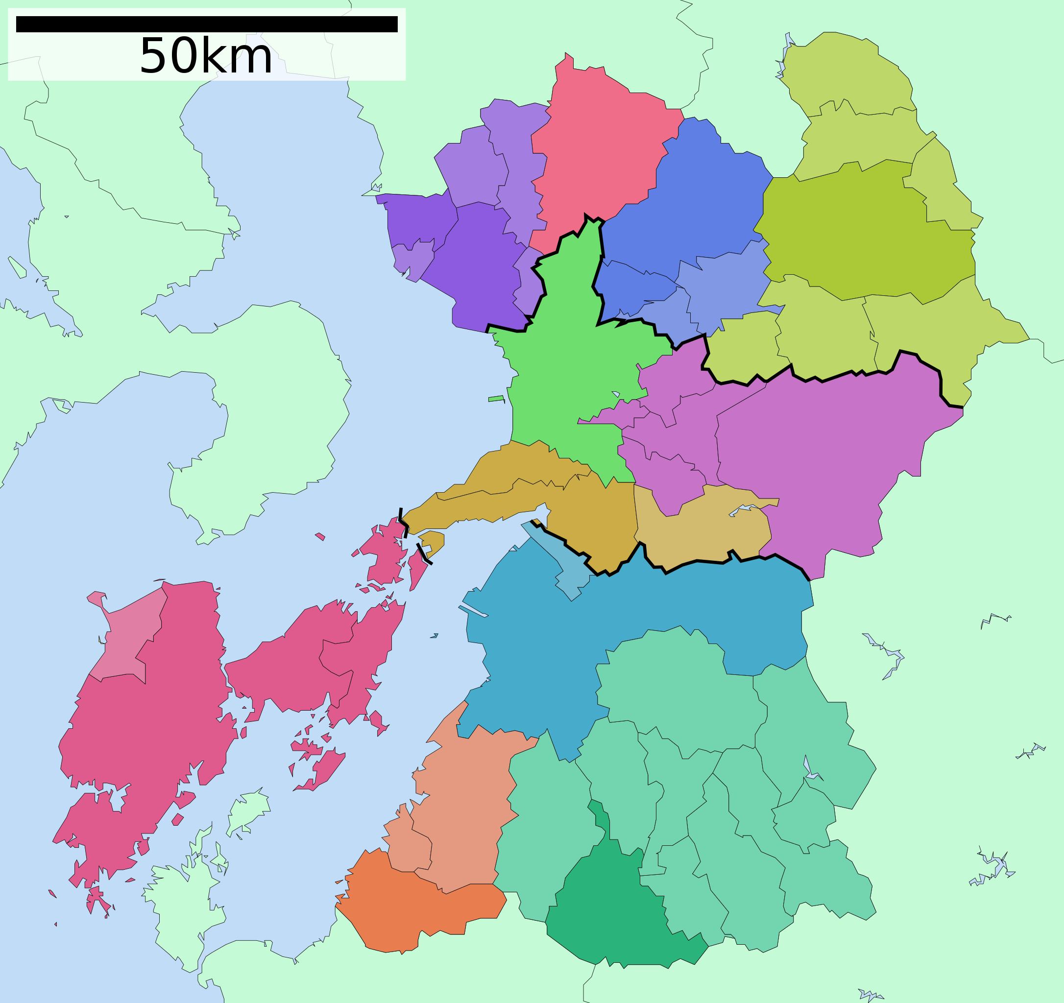
日本語: 熊本県の地域区分図。
English: Map of regions boundary of Kumamoto prefecture. |
| Date | |
| Source | File:Map of Kumamoto Prefecture Ja.svg |
| Author | ja:User:Lincun |
Licensing[edit]
This file is licensed under the Creative Commons Attribution-Share Alike 3.0 Unported license.
- You are free:
- to share – to copy, distribute and transmit the work
- to remix – to adapt the work
- Under the following conditions:
- attribution – You must give appropriate credit, provide a link to the license, and indicate if changes were made. You may do so in any reasonable manner, but not in any way that suggests the licensor endorses you or your use.
- share alike – If you remix, transform, or build upon the material, you must distribute your contributions under the same or compatible license as the original.
File history
Click on a date/time to view the file as it appeared at that time.
| Date/Time | Thumbnail | Dimensions | User | Comment | |
|---|---|---|---|---|---|
| current | 08:10, 15 October 2017 | | 527 × 497 (40 KB) | Pekachu (talk | contribs) | User created page with UploadWizard |
You cannot overwrite this file.
File usage on Commons
The following 22 pages use this file:
- Kumamoto prefecture
- Category:Births in Kumamoto prefecture
- Category:Castles in Kumamoto prefecture
- Category:Dams in Kumamoto prefecture
- Category:Deaths in Kumamoto prefecture
- Category:Education in Kumamoto prefecture
- Category:Hospitals in Kumamoto prefecture
- Category:Kumamoto prefecture
- Category:Lighthouses in Kumamoto prefecture
- Category:Maps of Kumamoto prefecture
- Category:Michinoeki in Kumamoto prefecture
- Category:Mountains of Kumamoto prefecture
- Category:People of Kumamoto prefecture
- Category:Power plants in Kumamoto prefecture
- Category:Rail transport in Kumamoto prefecture
- Category:Rivers of Kumamoto prefecture
- Category:Roads in Kumamoto prefecture
- Category:Sports in Kumamoto prefecture
- Category:Towns in Kumamoto prefecture
- Category:Transport in Kumamoto prefecture
- Category:Villages in Kumamoto prefecture
- Category:Visitor attractions in Kumamoto prefecture
File usage on other wikis
The following other wikis use this file:
- Usage on ja.wikipedia.org
- Usage on tt.wikipedia.org
- Usage on www.wikidata.org