File:Gosaji kohun 01.jpg
Jump to navigation
Jump to search
No higher resolution available.
Gosaji_kohun_01.jpg (800 × 600 pixels, file size: 646 KB, MIME type: image/jpeg)
Captions
Captions
Add a one-line explanation of what this file represents
Summary[edit]
| Description |
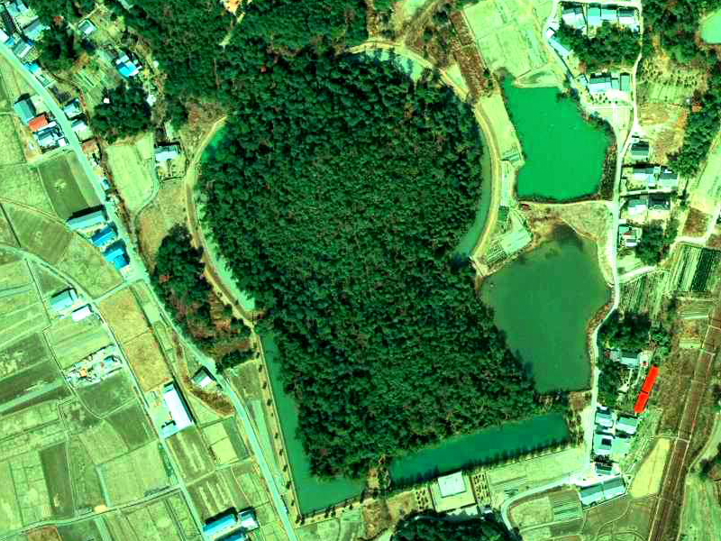
日本語: 五社神古墳。国土交通省の国土画像情報(カラー空中写真)を元に作成。 |
| Date | |
| Source | 国土交通省の国土画像情報(カラー空中写真)ckk-74-7_c28_22 |
| Author | 国土交通省 |
| Other versions | Gosashi kohun aerial.jpg |
Licensing[edit]

|
The copyright holder of this file, the Ministry of Land, Infrastructure, Transport and Tourism of Japan, allows anyone to use it for any purpose, provided that the copyright holder is properly attributed. Redistribution, derivative work, commercial use, and all other use is permitted. |
Attribution:
Copyright © National Land Image Information (Color Aerial Photographs), Ministry of Land, Infrastructure, Transport and Tourism
|
 |
This image is copyrighted by the Ministry of Land, Infrastructure, Transport and Tourism of Japan. For terms of use, see the stipulation to use of National Land Information (in Japanese) and message from MLIT (in Japanese and English). When you display this image on an article, include the following phrase in the description: "Made based on National Land Image Information (Color Aerial Photographs), Ministry of Land, Infrastructure, Transport and Tourism".
|
File history
Click on a date/time to view the file as it appeared at that time.
| Date/Time | Thumbnail | Dimensions | User | Comment | |
|---|---|---|---|---|---|
| current | 14:20, 8 June 2020 | | 800 × 600 (646 KB) | 名古屋太郎 (talk | contribs) | 画質修正等 |
| 13:48, 21 January 2008 |  | 800 × 600 (140 KB) | VanishingDuck (talk | contribs) | {{Information |Description=五社神古墳。国土交通省の国土画像情報(カラー空中写真)を元に作成。 |Source=国土交通省の国土画像情報(カラー空中写真)ckk-74-7_c28_22 |Date=2008年1月21日 |Author=投稿者 |
You cannot overwrite this file.
File usage on Commons
There are no pages that use this file.
File usage on other wikis
The following other wikis use this file:
- Usage on ja.wikipedia.org