File:Morocco WS-excluded (orthographic projection).svg
Jump to navigation
Jump to search

Size of this PNG preview of this SVG file: 600 × 600 pixels. Other resolutions: 240 × 240 pixels | 480 × 480 pixels | 768 × 768 pixels | 1,024 × 1,024 pixels | 2,048 × 2,048 pixels | 2,000 × 2,000 pixels.
Original file (SVG file, nominally 2,000 × 2,000 pixels, file size: 1.02 MB)
Captions
Captions
Add a one-line explanation of what this file represents
Summary[edit]
| Description |
العربية: تحديد المغرب مع إقليمه المتنازع عليه الصحراء المغربية بشكل مخطط، الأمم المتحدة تعترف بصحراء المغرب.
Español: Localización de Marruecos y de su territorio disputado Sahara Occidental, marcado. Las Naciones Unidas conceden a Marruecos la soberanía administrativa sobre dicho territorio.
Français : Localisation du Maroc et de son territoire contesté Sahara occidental, en pointillés. Les Nations Unies reconnaissent au Maroc la souveraineté administrative sur ce territoire.
Deutsch: Lokalisierung Marokkos und seines strittigen Territoriums Westsahara, gestrichelt dargestellt. Die Vereinten Nationen gestehen Marokko Verwaltungshoheit über das Territorium zu.
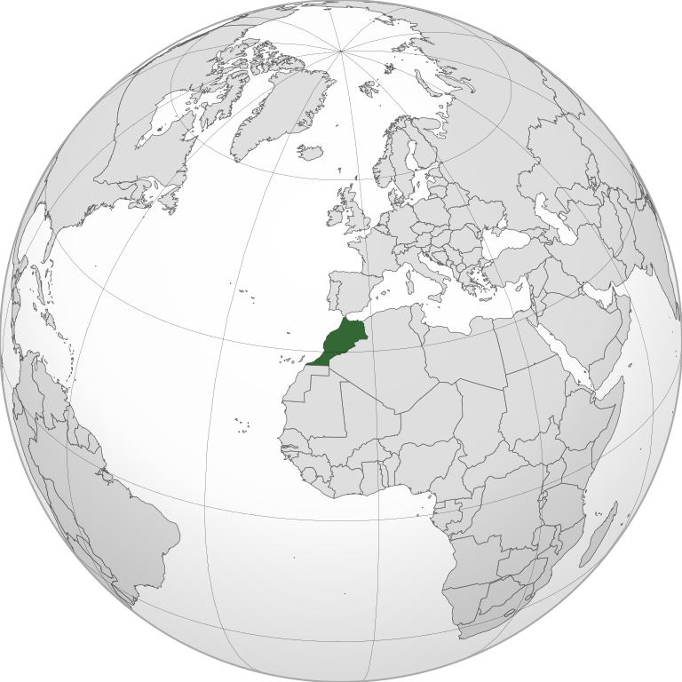
English: Locator of Morocco and it's disputed territory Western Sahara shown as striped. United Nations recognize Morocco as an administrative power of the territory.
Português: Localização de Marrocos e do seu território contestado Saara Ocidental, tracejado. As Nações Unidas concedem a Marrocos a soberania administrativa sobre esse território. |
||||
| Date | |||||
| Source |
Own work
|
||||
| Author | Flad | ||||
| Other versions |
|
||||
| SVG development | This world map was created with Adobe Illustrator. |

.svg)
.svg)
.svg)
.svg)
_highlighted.svg)

.svg&action=edit§ion=1)
Licensing[edit]
.svg&action=edit§ion=2)
I, the copyright holder of this work, hereby publish it under the following license:
This file is licensed under the Creative Commons Attribution-Share Alike 3.0 Unported license.
- You are free:
- to share – to copy, distribute and transmit the work
- to remix – to adapt the work
- Under the following conditions:
- attribution – You must give appropriate credit, provide a link to the license, and indicate if changes were made. You may do so in any reasonable manner, but not in any way that suggests the licensor endorses you or your use.
- share alike – If you remix, transform, or build upon the material, you must distribute your contributions under the same or compatible license as the original.
File history
Click on a date/time to view the file as it appeared at that time.
.svg&dir=prev)
.svg&offset=20100707011943)
.svg&offset=&limit=20)
.svg&offset=&limit=50)
.svg&offset=&limit=100)
.svg&offset=&limit=250)
.svg&offset=&limit=500)
| Date/Time | Thumbnail | Dimensions | User | Comment | |
|---|---|---|---|---|---|
| current | 12:29, 21 May 2021 | | 2,000 × 2,000 (1.02 MB) | M.Bitton (talk | contribs) | Reverted to version as of 21:09, 10 March 2021 (UTC): per COM:OVERWRITE |
| 08:44, 21 May 2021 |  | 550 × 550 (286 KB) | Ali ahmed andalousi (talk | contribs) | fix | |
| 21:09, 10 March 2021 |  | 2,000 × 2,000 (1.02 MB) | Al.Massira (talk | contribs) | Better view and increased file dimensions | |
| 21:09, 10 March 2021 |  | 550 × 550 (281 KB) | Al.Massira (talk | contribs) | Reverted to version as of 16:06, 5 January 2011 (UTC) briefly reverting to upload new file | |
| 04:53, 25 December 2020 |  | 550 × 550 (184 KB) | EdDakhla (talk | contribs) | Reverted to version as of 23:57, 28 May 2012 (UTC) | |
| 04:26, 25 December 2020 |  | 550 × 550 (189 KB) | EdDakhla (talk | contribs) | Centered projection | |
| 23:57, 28 May 2012 |  | 550 × 550 (184 KB) | Ninrouter (talk | contribs) | ||
| 20:19, 5 January 2011 |  | 550 × 550 (281 KB) | Nabil80 (talk | contribs) | Reverted to version as of 01:19, 7 July 2010 | |
| 16:06, 5 January 2011 |  | 550 × 550 (281 KB) | Nabil80 (talk | contribs) | Reverted to version as of 23:02, 6 July 2010 | |
| 01:19, 7 July 2010 |  | 550 × 550 (281 KB) | 99of9 (talk | contribs) | Reuploading to hopefully correct errors. Moved from here [http://upload.wikimedia.org/wikipedia/commons/archive/9/91/20100628130737!Morocco_%28orthographic_projection%29.svg] to separate out different versions. |
You cannot overwrite this file.
File usage on Commons
The following 6 pages use this file:
File usage on other wikis
The following other wikis use this file:
- Usage on an.wikipedia.org
- Usage on arz.wikipedia.org
- Usage on ast.wikipedia.org
- Usage on az.wikipedia.org
- Usage on ba.wikipedia.org
- Usage on ce.wikipedia.org
- Usage on de.wikivoyage.org
- Usage on diq.wikipedia.org
- Usage on es.wikipedia.org
- Usage on eu.wikipedia.org
- Usage on fi.wikivoyage.org
- Usage on fi.wiktionary.org
- Usage on fr.wikinews.org
- Usage on ga.wikipedia.org
- Usage on gl.wikipedia.org
- Usage on ha.wikipedia.org
- Usage on ht.wikipedia.org
- Usage on hy.wikipedia.org
- Usage on ia.wikipedia.org
- Usage on incubator.wikimedia.org
- Usage on kab.wikipedia.org
- Usage on ka.wikipedia.org
- Usage on la.wikipedia.org
- Usage on mdf.wikipedia.org
- Usage on oc.wikipedia.org
- Usage on pap.wikipedia.org
- Usage on pnb.wikipedia.org
- Usage on ps.wikipedia.org
- Usage on rue.wikipedia.org
- Usage on tl.wikipedia.org
- Usage on wa.wikipedia.org
- Usage on www.wikidata.org
.svg&oldid=777737661)