File:Guyana Disputed Areas.svg
Jump to navigation
Jump to search

Size of this PNG preview of this SVG file: 542 × 600 pixels. Other resolutions: 217 × 240 pixels | 434 × 480 pixels | 694 × 768 pixels | 925 × 1,024 pixels | 1,851 × 2,048 pixels | 713 × 789 pixels.
Original file (SVG file, nominally 713 × 789 pixels, file size: 190 KB)
Captions
Captions
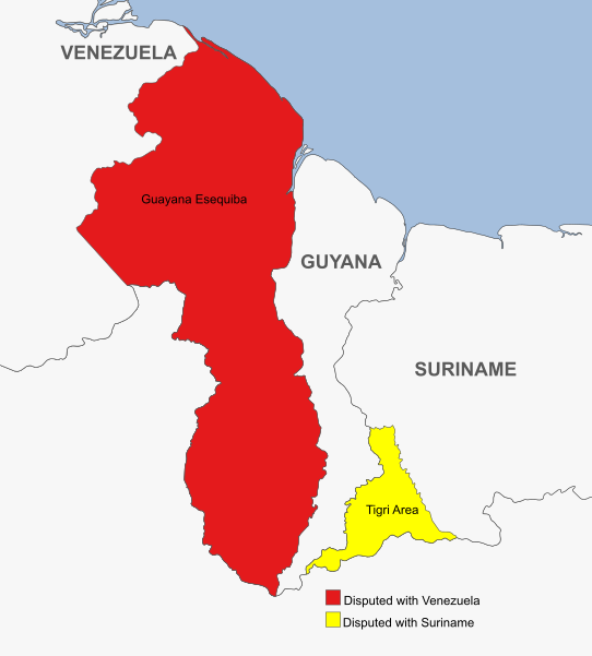
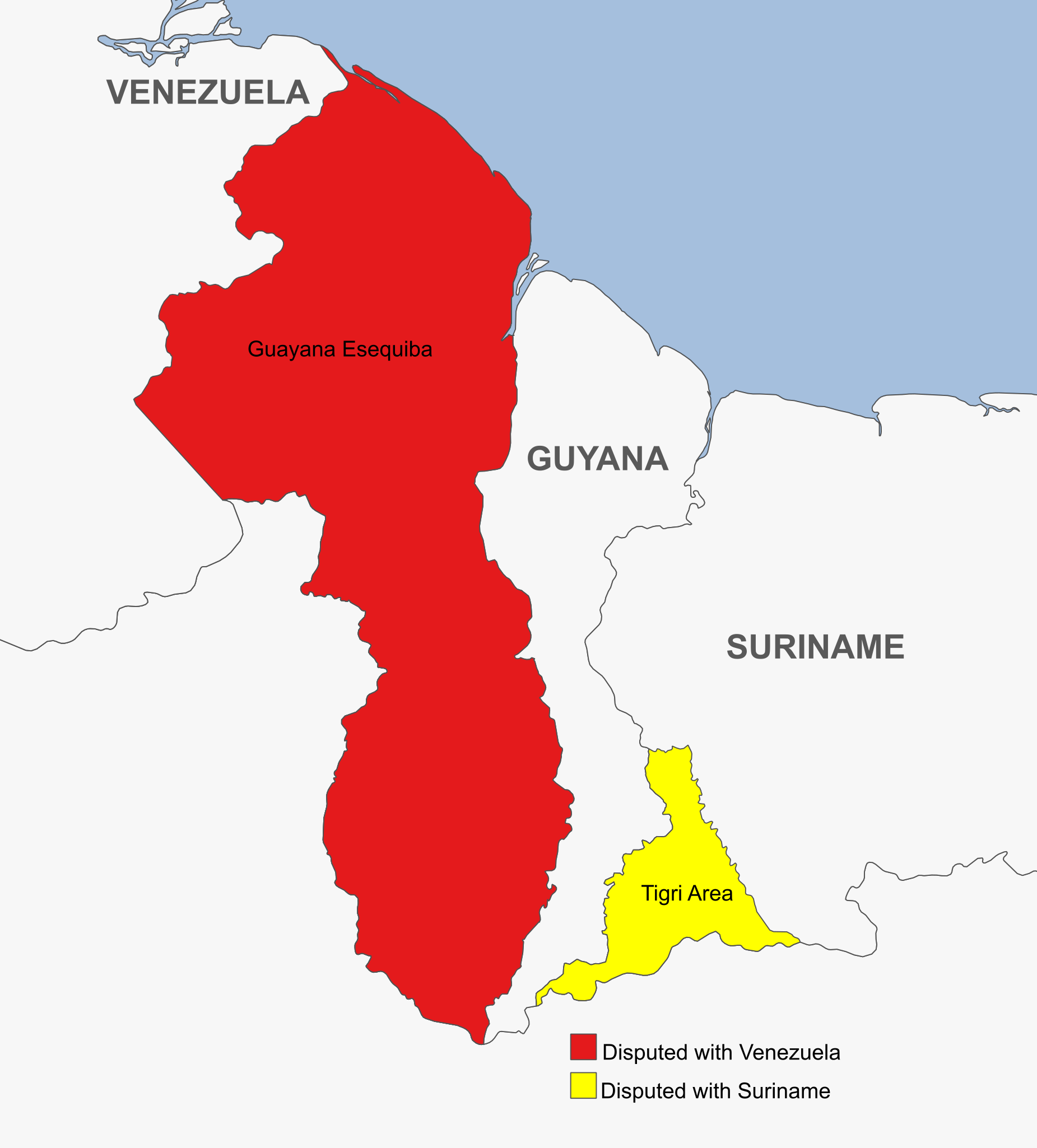
Map showing the disputed areas of Guyana
Summary[edit]
| Description |
English: Map showing the 2 disputed Land areas of Guyana. The Red part is disputed with Venezuela (Guayana Esequiba) and the Yellow Part is disputed with Suriname (Tigri or New River Triangle) |
| Date | |
| Source | Own work |
| Author | SurinameCentral |
Licensing[edit]
I, the copyright holder of this work, hereby publish it under the following license:
This file is licensed under the Creative Commons Attribution-Share Alike 4.0 International license.
- You are free:
- to share – to copy, distribute and transmit the work
- to remix – to adapt the work
- Under the following conditions:
- attribution – You must give appropriate credit, provide a link to the license, and indicate if changes were made. You may do so in any reasonable manner, but not in any way that suggests the licensor endorses you or your use.
- share alike – If you remix, transform, or build upon the material, you must distribute your contributions under the same or compatible license as the original.
File history
Click on a date/time to view the file as it appeared at that time.
| Date/Time | Thumbnail | Dimensions | User | Comment | |
|---|---|---|---|---|---|
| current | 21:20, 19 April 2023 | | 713 × 789 (190 KB) | SurinameCentral (talk | contribs) | Uploaded own work with UploadWizard |
You cannot overwrite this file.
File usage on Commons
The following page uses this file:
.png)
File usage on other wikis
The following other wikis use this file: