location Map India
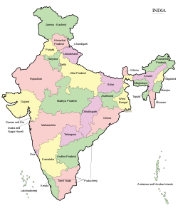
Template:Location map India is a location map definition used to overlay markers and labels on an equirectangular projection map of India.
| name | India | |||
|---|---|---|---|---|
| border coordinates | ||||
| 37.5 | ||||
| 67.0 | ←↕→ | 99.0 | ||
| 5.0 | ||||
| map center | 21°15′N 83°00′E / 21.25°N 83°E | |||
| image | India location map.svg | |||
 | ||||
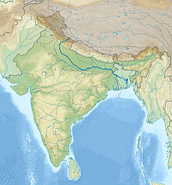
| image1 | India relief location map.jpg | |||
 | ||||
| image2 | India relief location map ganges highlighted.jpg | |||
 | ||||

The markers are placed by latitude and longitude coordinates on the default map or a similar map image.
Usage
These definitions are used by the following templates when invoked with parameter "India":
{{Location map | India | ...}}{{Location map many | India | ...}}{{Location map+ | India | ...}}{{Location map~ | India | ...}}
Map definition
- name = India
- Name used in the default map caption
- image = India location map.svg
- The default map image, without "Image:" or "File:"
- image1 = India relief location map.jpg
- An alternative map image, usually a relief map, can be displayed via the relief or AlternativeMap parameters
- image2 = India relief location map ganges highlighted.jpg
- A second alternative map image, can be displayed via the AlternativeMap parameter only
- top = 37.5
- Latitude at top edge of map, in decimal degrees
- bottom = 5.0
- Latitude at bottom edge of map, in decimal degrees
- left = 67.0
- Longitude at left edge of map, in decimal degrees
- right = 99.0
- Longitude at right edge of map, in decimal degrees
Alternative map
The map defined as image1 (India relief location map.jpg) can be displayed by using the relief or AlternativeMap parameters in {{Location map}}, {{Location map many}} and {{Location map+}}. The map defined as image2 (India relief location map ganges highlighted.jpg) can only be displayed by using the AlternativeMap parameter. The use of these two parameters is shown in the examples below. Additional examples can be found at:
|
Examples using location map templates
Location map, using default map (image)
{{Location map | India | width = 250 | lat_deg = 18.98 | lon_deg = 72.83 | label = Mumbai }} Location map many, using relief map (image1)
{{Location map many | India | relief = yes | width = 250 | caption = Two locations in India | lat1_deg = 18.98 | lon1_deg = 72.83 | label1 = Mumbai | lat2_deg = 28.61 | lon2_deg = 77.21 | label2 = New Delhi }} Location map+, using AlternativeMap
{{Location map+ | India | AlternativeMap = India relief location map ganges highlighted.jpg | width = 250 | caption = Two locations in India | places = {{Location map~ | India | lat_deg = 18.98 | lon_deg = 72.83 | label = Mumbai }} {{Location map~ | India | lat_deg = 28.61 | lon_deg = 77.21 | label = New Delhi }} }} See also
- Location map templates
- Template:Location map, to display one mark and label using latitude and longitude
- Template:Location map many, to display up to nine marks and labels
- Template:Location map+, to display an unlimited number of marks and labels
- Infobox templates incorporating (passing values to) the Location map template
- Template:Infobox airport — alternative map support: relief (via pushpin_relief) and AlternativeMap (via pushpin_image)
- Template:Infobox ancient site — alternative map support: relief
- Template:Infobox artwork
- Template:Infobox building — alternative map support: relief
- Template:Infobox casino
- Template:Infobox castrum — alternative map support: relief (via map_relief)
- Template:Infobox cave (via Infobox map) — alternative map support: relief
- Template:Infobox cemetery
- Template:Infobox civil conflict
- Template:Infobox climbing route (via Infobox map) — alternative map support: relief
- Template:Infobox church — alternative map support: relief
- Template:Infobox concentration camp
- Template:Infobox dam — alternative map support: relief
- Template:Infobox dava
- Template:Infobox forest (via Infobox map) — alternative map support: relief
- Template:Infobox glacier (via Infobox map) — alternative map support: relief (displays relief image unless map_relief=0)
- Template:Infobox golf facility — alternative map support: relief
- Template:Infobox historic site — alternative map support: relief (via map_relief)
- Template:Infobox hospital — alternative map support: relief
- Template:Infobox hut — alternative map support: relief
- Template:Infobox lighthouse — alternative map support: relief
- Template:Infobox map (used by other infoboxes) — alternative map support: relief
- Template:Infobox military conflict — alternative map support: relief (via map_relief)
- Template:Infobox military installation — alternative map support: relief (via map_relief)
- Template:Infobox monastery
- Template:Infobox mountain (via Infobox map) — alternative map support: relief (displays relief image unless map_relief=0)
- Template:Infobox mountain pass (via Infobox map) — alternative map support: relief (displays relief image unless map_relief=0)
- Template:Infobox mountain range (via Infobox map) — alternative map support: relief (displays relief image unless map_relief=0)
- Template:Infobox museum — alternative map support: relief (via map_relief)
- Template:Infobox oil field — alternative map support: relief
- Template:Infobox oil refinery — alternative map support: relief
- Template:Infobox operational plan
- Template:Infobox park (via Infobox map) — alternative map support: relief
- Template:Infobox power station — alternative map support: relief
- Template:Infobox protected area (via Infobox map) — alternative map support: relief
- Template:Infobox reactor
- Template:Infobox religious building — alternative map support: relief
- Template:Infobox restaurant
- Template:Infobox settlement — alternative map support: relief (via pushpin_relief) and AlternativeMap (via pushpin_image)
- Template:Infobox spring (via Infobox map) — alternative map support: relief
- Template:Infobox temple
- Template:Infobox terrestrial impact site
- Template:Infobox valley (via Infobox map) — alternative map support: relief
- Template:Infobox waterfall (via Infobox map) — alternative map support: relief
- Template:Infobox World Heritage Site — alternative map support: relief


