File:Triangular trade.svg
Jump to navigation
Jump to search

Size of this PNG preview of this SVG file: 631 × 599 pixels. Other resolutions: 253 × 240 pixels | 506 × 480 pixels | 809 × 768 pixels | 1,079 × 1,024 pixels | 2,157 × 2,048 pixels | 2,352 × 2,233 pixels.
Original file (SVG file, nominally 2,352 × 2,233 pixels, file size: 1.38 MB)
Captions
Captions
Add a one-line explanation of what this file represents
Summary[edit]
| Description |
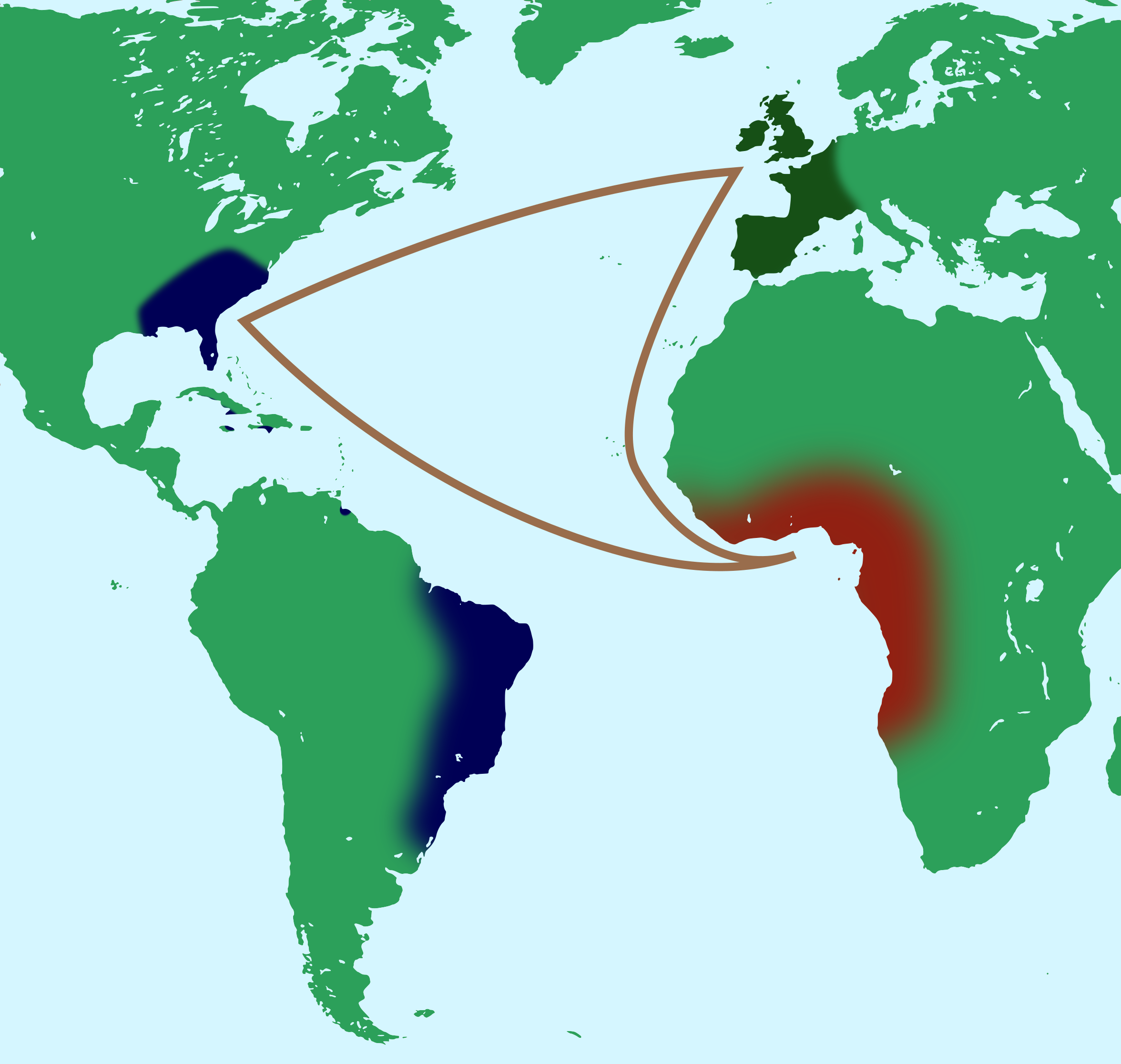
English: Triangular trade between western Europe, Africa and Americas. Français : Commerce triangulaire entre l'Europe occidentale, l'Afrique subsaharienne et les Amériques. |
| Date | (UTC) |
| Source | |
| Author |
|
| This is a retouched picture, which means that it has been digitally altered from its original version. Modifications: vectorized. The original can be viewed here: World map - low resolution.svg:
|
Licensing[edit]
This file is licensed under the Creative Commons Attribution-Share Alike 3.0 Unported license.
- You are free:
- to share – to copy, distribute and transmit the work
- to remix – to adapt the work
- Under the following conditions:
- attribution – You must give appropriate credit, provide a link to the license, and indicate if changes were made. You may do so in any reasonable manner, but not in any way that suggests the licensor endorses you or your use.
- share alike – If you remix, transform, or build upon the material, you must distribute your contributions under the same or compatible license as the original.
Original upload log[edit]
This image is a derivative work of the following images:
- File:Triangular_trade.png licensed with Cc-by-sa-2.5,2.0,1.0, Cc-by-sa-3.0-migrated, GFDL
- 2007-04-14T19:51:46Z Sémhur 1032x730 (159299 Bytes) == Description == {{Information |Description= {{fr|Commerce triangulaire entre l'Europe occidentale, l'Afrique subsaharienne et les Amériques}} {{en|Triangular trade between western Europe, Africa and Americas}} |Source=Œuv
- File:World_map_-_low_resolution.svg licensed with Cc-by-sa-3.0
- 2009-08-04T01:26:44Z Andrew c 950x620 (67282 Bytes) {{Information |Description=Low resolution world map. |Source=photosubmission |Date= |Author= Al MacDonald [http://hyper-metrix.com]/ twitter account @F1LT3R |Permission={{OTRS|2009062710028634}} |other_versions= }} [[Categor
Uploaded with derivativeFX
File history
Click on a date/time to view the file as it appeared at that time.
| Date/Time | Thumbnail | Dimensions | User | Comment | |
|---|---|---|---|---|---|
| current | 22:59, 29 July 2020 | | 2,352 × 2,233 (1.38 MB) | Hogweard (talk | contribs) | Map without anachronistic borders |
| 14:24, 28 December 2011 |  | 494 × 406 (200 KB) | Jkwchui (talk | contribs) | trade route | |
| 14:21, 28 December 2011 |  | 494 × 406 (199 KB) | Jkwchui (talk | contribs) | == {{int:filedesc}} == {{Information |Description={{Multilingual description |en= Triangular trade between western Europe, Africa and Americas. |fr= Commerce triangulaire entre l'Europe occidentale, l |
You cannot overwrite this file.
File usage on Commons
The following 3 pages use this file:
File usage on other wikis
The following other wikis use this file:
- Usage on ar.wikipedia.org
- Usage on cy.wikipedia.org
- Usage on en.wikipedia.org
- Usage on es.wikipedia.org
- Usage on eu.wikipedia.org
- Usage on fi.wikipedia.org
- Usage on fr.wikipedia.org
- Usage on he.wikipedia.org
- Usage on ja.wikipedia.org
- Usage on ko.wikipedia.org
- Usage on la.wikipedia.org
- Usage on pl.wikipedia.org
- Usage on pt.wikipedia.org
- Usage on rm.wikipedia.org
- Usage on sc.wikipedia.org
- Usage on tr.wikipedia.org
- Usage on uk.wikipedia.org
- Usage on vi.wikipedia.org