File:Plan de Paris 1180 BNF07710746.png
Jump to navigation
Jump to search
Size of this preview: 739 × 600 pixels. Other resolutions: 296 × 240 pixels | 592 × 480 pixels | 946 × 768 pixels | 1,262 × 1,024 pixels | 1,932 × 1,568 pixels.
Original file (1,932 × 1,568 pixels, file size: 4.38 MB, MIME type: image/png)
Captions
Captions
Add a one-line explanation of what this file represents
Summary[edit]
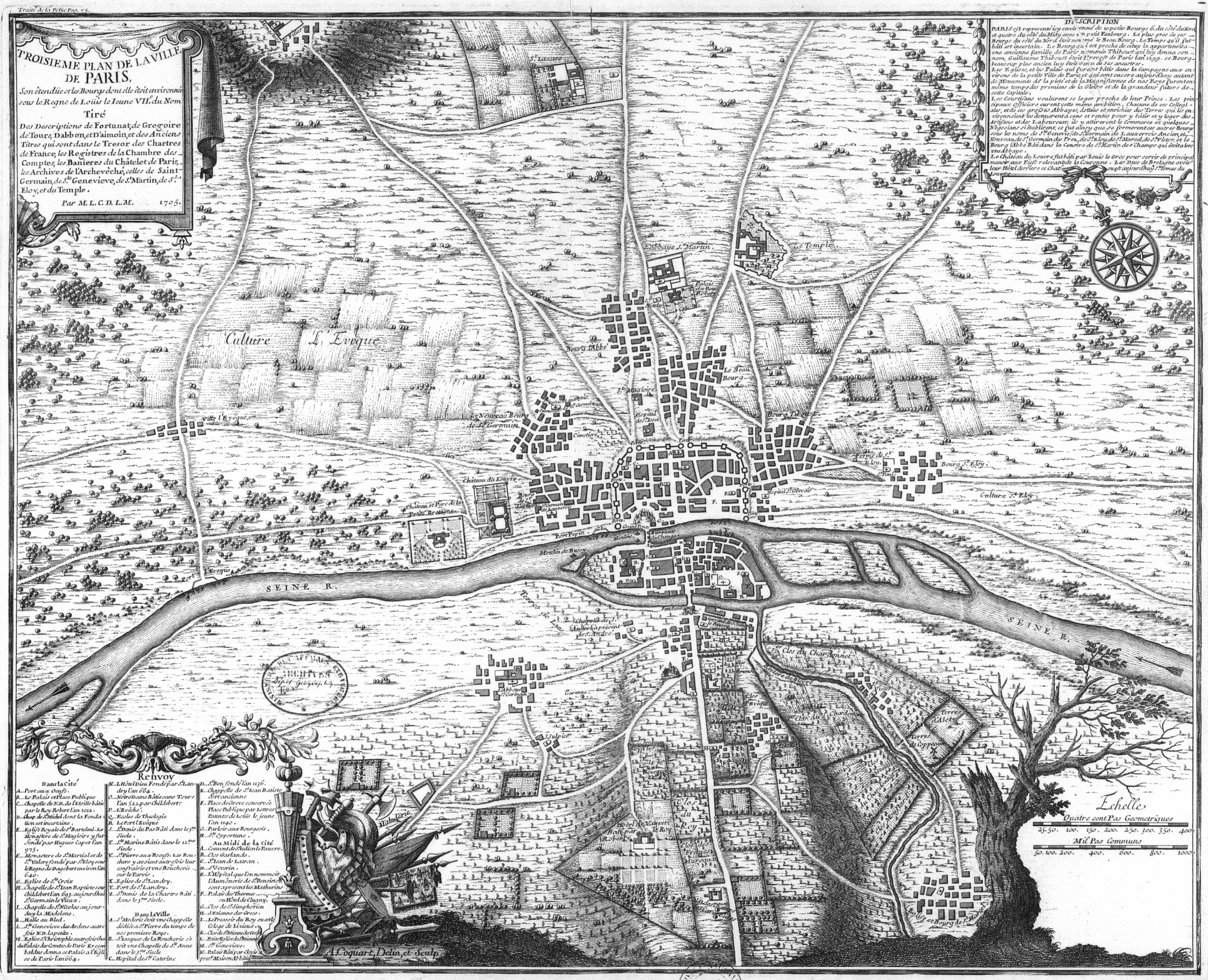
| Troisième plan de la ville de Paris, son étendüe et les bourgs dont elle étoit environnée sous le regne de Loüis le Ieune VIIe du nom [Image fixe numérisée] / Par M.L.C.D.L.M. | |||||||||||||||||||||||||||||||||||||||||||
|---|---|---|---|---|---|---|---|---|---|---|---|---|---|---|---|---|---|---|---|---|---|---|---|---|---|---|---|---|---|---|---|---|---|---|---|---|---|---|---|---|---|---|---|
| Artist |
|
||||||||||||||||||||||||||||||||||||||||||
| Title |
Troisième plan de la ville de Paris, son étendüe et les bourgs dont elle étoit environnée sous le regne de Loüis le Ieune VIIe du nom [Image fixe numérisée] / Par M.L.C.D.L.M. |
||||||||||||||||||||||||||||||||||||||||||
| Description |
Français : Troisième plan de la ville de Paris
English: Plan of Paris about 1180, the third of eight chronological maps of Paris from Traité de la police |
||||||||||||||||||||||||||||||||||||||||||
| Date | Publication : Paris : [s.n.], 1705 | ||||||||||||||||||||||||||||||||||||||||||
| Dimensions | 44,5 x 54,5 cm | ||||||||||||||||||||||||||||||||||||||||||
| Notes |
|
||||||||||||||||||||||||||||||||||||||||||
| Source/Photographer | Gallica | ||||||||||||||||||||||||||||||||||||||||||
| Other versions | Gallica 29/07/2013 | ||||||||||||||||||||||||||||||||||||||||||

Licensing[edit]
| Previous public domain rationale, no longer applicable | ||
|---|---|---|
|
File history
Click on a date/time to view the file as it appeared at that time.
| Date/Time | Thumbnail | Dimensions | User | Comment | |
|---|---|---|---|---|---|
| current | 15:38, 2 October 2005 | | 1,932 × 1,568 (4.38 MB) | David.Monniaux (talk | contribs) | Anville, Jean-Baptiste Bourguignon d' (1697-17). TType : image fixe, monographie Titre(s) : Troisième plan de la ville de Paris, son étendüe et les bourgs dont elle étoit environnée sous le regne de Loüis le Ieune VIIe du nom [Image fixe numéris |
You cannot overwrite this file.
File usage on Commons
The following 3 pages use this file:
File usage on other wikis
The following other wikis use this file:
- Usage on ar.wikipedia.org
- Usage on de.wikipedia.org
- Usage on en.wikipedia.org
- Usage on fr.wikipedia.org
- Usage on gl.wikipedia.org
- Usage on he.wikipedia.org
- Usage on hu.wikipedia.org
- Usage on is.wikipedia.org
- Usage on ja.wikipedia.org
- Usage on ko.wikipedia.org
- Usage on nl.wikipedia.org
- Usage on pl.wikipedia.org
- Usage on pnb.wikipedia.org
- Usage on ur.wikipedia.org
- Usage on vi.wikipedia.org
- Usage on zh.wikipedia.org