File:Netherlands North Brabant location map.svg
Jump to navigation
Jump to search

Size of this PNG preview of this SVG file: 800 × 450 pixels. Other resolutions: 320 × 180 pixels | 640 × 360 pixels | 1,024 × 577 pixels | 1,280 × 721 pixels | 2,560 × 1,441 pixels | 1,000 × 563 pixels.
Original file (SVG file, nominally 1,000 × 563 pixels, file size: 244 KB)
Captions
Captions
Add a one-line explanation of what this file represents
Summary[edit]
| Description |
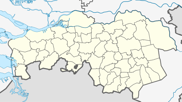
English: Location map of province North Brabant in the Netherlands
Equirectangular projection, N/S stretching 161 %. Geographic limits of the map:
Deutsch: Positionskarte von der Provinz Nordbrabant in den Niederlanden
Quadratische Plattkarte, N-S-Streckung 161 %. Geographische Begrenzung der Karte:
|
| Date | |
| Source | Own work |
| Author | Erik Frohne |

|
This map has been made or improved in the German Kartenwerkstatt (Map Lab). You can propose maps to improve as well.
|
Licensing[edit]
I, the copyright holder of this work, hereby publish it under the following licenses:

|
Permission is granted to copy, distribute and/or modify this document under the terms of the GNU Free Documentation License, Version 1.2 or any later version published by the Free Software Foundation; with no Invariant Sections, no Front-Cover Texts, and no Back-Cover Texts. A copy of the license is included in the section entitled GNU Free Documentation License. |
This file is licensed under the Creative Commons Attribution-Share Alike 3.0 Unported, 2.5 Generic, 2.0 Generic and 1.0 Generic license.
- You are free:
- to share – to copy, distribute and transmit the work
- to remix – to adapt the work
- Under the following conditions:
- attribution – You must give appropriate credit, provide a link to the license, and indicate if changes were made. You may do so in any reasonable manner, but not in any way that suggests the licensor endorses you or your use.
- share alike – If you remix, transform, or build upon the material, you must distribute your contributions under the same or compatible license as the original.
You may select the license of your choice.
File history
Click on a date/time to view the file as it appeared at that time.
| Date/Time | Thumbnail | Dimensions | User | Comment | |
|---|---|---|---|---|---|
| current | 16:46, 1 January 2022 | | 1,000 × 563 (244 KB) | NordNordWest (talk | contribs) | upd 2022 |
| 01:23, 1 January 2021 |  | 1,000 × 563 (247 KB) | NordNordWest (talk | contribs) | upd 2021 | |
| 11:51, 30 December 2018 |  | 1,000 × 563 (247 KB) | NordNordWest (talk | contribs) | upd 2019 | |
| 18:16, 3 January 2017 |  | 1,000 × 563 (248 KB) | NordNordWest (talk | contribs) | upd | |
| 13:11, 7 June 2015 |  | 1,000 × 563 (249 KB) | NordNordWest (talk | contribs) | upd | |
| 18:29, 29 December 2013 |  | 1,000 × 563 (252 KB) | NordNordWest (talk | contribs) | c | |
| 18:28, 29 December 2013 |  | 1,000 × 563 (246 KB) | NordNordWest (talk | contribs) | update 2013 | |
| 14:22, 7 May 2009 |  | 1,000 × 563 (451 KB) | Erik Frohne (talk | contribs) | == Beschreibung == {{Information |Description={{en|1=Location map of province North Brabant in the Netherlands Equirectangular projection, N/S stretching 161 %. Geographic limits of the map: * N: 51.90° N * S: 51.20° N * W: 4.10° E * E: 6.10° E}} |
You cannot overwrite this file.
File usage on Commons
There are no pages that use this file.
File usage on other wikis
The following other wikis use this file:
- Usage on ar.wikipedia.org
- Usage on ba.wikipedia.org
- Usage on bg.wikipedia.org
- Usage on ceb.wikipedia.org
- Usage on cs.wikipedia.org
- Usage on de.wikipedia.org
- Fernsehturm Loon op Zand
- Philips Stadion
- Loon op Zand
- Jan-Louwers-Stadion
- Flughafen Eindhoven
- Rat-Verlegh-Stadion
- Wikipedia:Kartenwerkstatt/Positionskarten/Europa
- Vorlage:Positionskarte Niederlande Nordbrabant
- König-Wilhelm-II.-Stadion
- Mandemakers Stadion
- GS Staalwerken Stadion
- Stadion De Vliert
- Herstaco-Stadion
- Frans-Heesen-Stadion
- Nassau-Dietz-Kaserne
- Hovenring
- Maaspoort Sports & Events
- Dreiband-Weltcup 1999/5
- Dreiband-Weltcup 2000/2
- Dreiband-Weltcup 2001/5
- John-S.-Thompson-Brücke
- Benutzer:Fantaglobe11/Brug Hollandsch Diep
- Gemeentelijk Sportpark Tilburg
- PSV Campus De Herdgang
- De Lelie
- Safaripark Beekse Bergen
- ZooParc Overloon
- Usage on de.wikivoyage.org
- Usage on eo.wikipedia.org
View more global usage of this file.