File:P10-NB-positiekaart2-gemlabels.png
Jump to navigation
Jump to search

Size of this preview: 800 × 458 pixels. Other resolutions: 320 × 183 pixels | 640 × 366 pixels | 1,024 × 586 pixels | 1,780 × 1,018 pixels.
Original file (1,780 × 1,018 pixels, file size: 1.4 MB, MIME type: image/png)
Captions
Captions
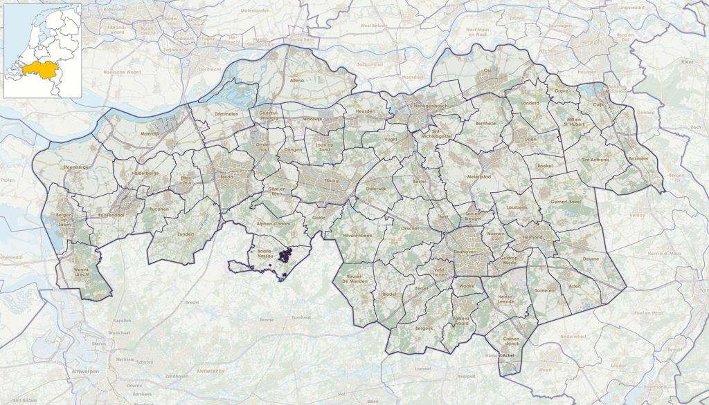
Map of Noord-Brabant, Netherlands
Summary[edit]
| Description |
Nederlands: Positiekaartje van de provincie, variant "gemeentelabels" |
| Date | |
| Source | Own work |
| Author | Janwillemvanaalst |
Licensing[edit]
I, the copyright holder of this work, hereby publish it under the following license:
This file is licensed under the Creative Commons Attribution-Share Alike 4.0 International license.
- You are free:
- to share – to copy, distribute and transmit the work
- to remix – to adapt the work
- Under the following conditions:
- attribution – You must give appropriate credit, provide a link to the license, and indicate if changes were made. You may do so in any reasonable manner, but not in any way that suggests the licensor endorses you or your use.
- share alike – If you remix, transform, or build upon the material, you must distribute your contributions under the same or compatible license as the original.
File history
Click on a date/time to view the file as it appeared at that time.
| Date/Time | Thumbnail | Dimensions | User | Comment | |
|---|---|---|---|---|---|
| current | 15:50, 19 June 2021 | | 1,780 × 1,018 (1.4 MB) | Janwillemvanaalst (talk | contribs) | Map layers update: municipal changes processed |
| 16:41, 1 January 2017 |  | 1,780 × 1,018 (3.5 MB) | Janwillemvanaalst (talk | contribs) | Map layers update, including new municipal borders | |
| 11:13, 17 January 2016 |  | 1,780 × 1,018 (1.31 MB) | Janwillemvanaalst (talk | contribs) | Added NL index frame | |
| 20:11, 11 January 2016 |  | 1,780 × 1,018 (1.34 MB) | Janwillemvanaalst (talk | contribs) | User created page with UploadWizard |
You cannot overwrite this file.
File usage on Commons
There are no pages that use this file.
File usage on other wikis
The following other wikis use this file:
- Usage on af.wikipedia.org
- Usage on arz.wikipedia.org
- Usage on da.wikipedia.org
- Usage on en.wikipedia.org
- Usage on es.wikipedia.org
- Usage on frr.wikipedia.org
- Usage on fy.wikipedia.org
- Noard-Brabân
- Efteling
- Basilyk fan de H.H. Agata en Barbara (Oudenbosch)
- Nooit Gedagt (Woudrichem)
- Woudrichem
- Sint-Martinustsjerke (Woudrichem)
- Berjocht:Posysjekaart Noard-Brabân
- Stasjon Tilburch
- Stasjon Boxtel
- Stasjon Oisterwijk
- Werkendam
- Stasjon Helmond
- Stasjon Best
- Stasjon Deurne (Nederlân)
- Stasjon Gilze-Rijen
- Stasjon Langeweg
- Stasjon Nuenen-Tongelre
- Stasjon Woensdrecht
- Stasjon Wouw
- Stasjon Vught
- Stasjon Moerdijk SS
- Stasjon Roosendaal
- Stasjon Tilburch Reeshof
- Stasjon Tilburch Universiteit
- Stasjon Helmond Brandevoort
- Stasjon Helmond 't Hout
- Stasjon Helmond Brouwhuis
- Stasjon Lage Zwaluwe
- Usage on id.wikipedia.org
- Usage on lb.wikipedia.org
- Usage on li.wikipedia.org
- Usage on nds-nl.wikipedia.org
- Usage on nl.wikipedia.org
View more global usage of this file.