File:Sulawesi map id.png
Jump to navigation
Jump to search
Size of this preview: 543 × 599 pixels. Other resolutions: 217 × 240 pixels | 435 × 480 pixels | 696 × 768 pixels | 928 × 1,024 pixels | 1,492 × 1,647 pixels.
Original file (1,492 × 1,647 pixels, file size: 178 KB, MIME type: image/png)
Captions
Captions
Add a one-line explanation of what this file represents
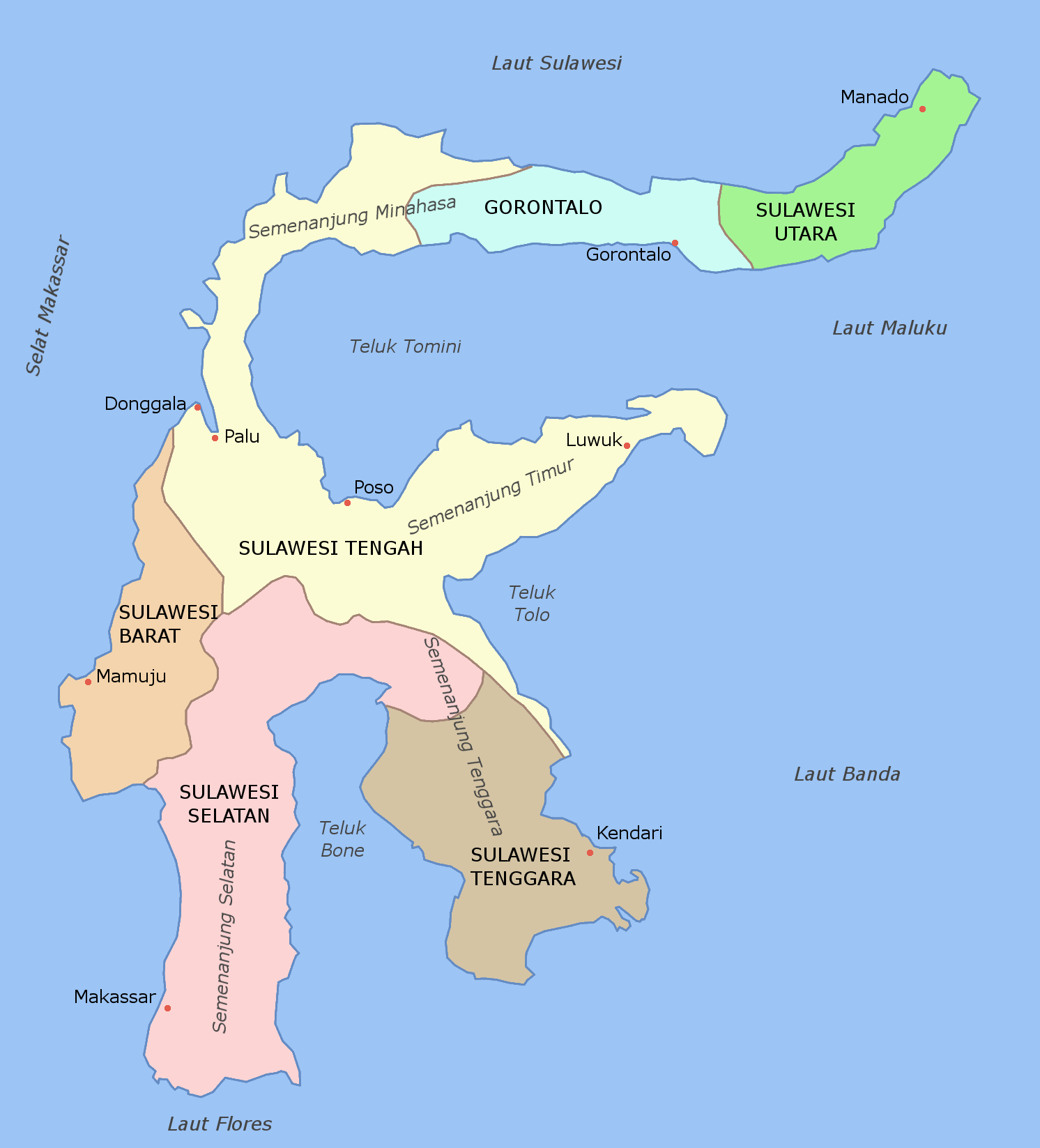
| Description | Map of provinces of Sulawesi labelled in Indonesian |
| Date | (UTC) |
| Source | |
| Author |
|
| This is a retouched picture, which means that it has been digitally altered from its original version. Modifications: added Indonesian labels. The original can be viewed here: Sulawesi map.PNG:
|
This file is licensed under the Creative Commons Attribution-Share Alike 3.0 Unported license.
- You are free:
- to share – to copy, distribute and transmit the work
- to remix – to adapt the work
- Under the following conditions:
- attribution – You must give appropriate credit, provide a link to the license, and indicate if changes were made. You may do so in any reasonable manner, but not in any way that suggests the licensor endorses you or your use.
- share alike – If you remix, transform, or build upon the material, you must distribute your contributions under the same or compatible license as the original.
Original upload log[edit]
This image is a derivative work of the following images:
- File:Sulawesi_blank.PNG licensed with Cc-by-sa-3.0-migrated, GFDL
- File:Sulawesi_map.PNG licensed with Cc-by-sa-3.0-migrated, GFDL
- 2006-03-11T12:11:53Z Roke 1492x1647 (85249 Bytes) fixed borders of provinces
- 2006-03-11T04:55:05Z Roke 1492x1647 (84460 Bytes) Sulawesi showing provinces, their capital cities, a few other cities and some surrounding areas of water. Note that there are other islands in this area which are not shown as this is a map of Sulawesi island itself. [[Categ
Uploaded with derivativeFX
File history
Click on a date/time to view the file as it appeared at that time.
| Date/Time | Thumbnail | Dimensions | User | Comment | |
|---|---|---|---|---|---|
| current | 12:24, 17 October 2010 | | 1,492 × 1,647 (178 KB) | Olaf Studt (talk | contribs) | adjusted Flores Sea position |
| 11:40, 17 October 2010 |  | 1,492 × 1,647 (178 KB) | Olaf Studt (talk | contribs) | {{Information |Description=Map of provinces of Category:Sulawesi labelled in Indonesian |Source=*File:Sulawesi_blank.PNG *File:Sulawesi_map.PNG |Date=2010-10-17 11:33 (UTC) |Author=*File:Sulawesi_blank.PNG: User:Roke *[[:File: |
You cannot overwrite this file.
File usage on Commons
There are no pages that use this file.
File usage on other wikis
The following other wikis use this file:
- Usage on ba.wikipedia.org
- Usage on de.wikipedia.org
- Usage on de.wikivoyage.org
- Usage on de.wiktionary.org
- Usage on eo.wikipedia.org
- Usage on frr.wikipedia.org
- Usage on pl.wikipedia.org
- Usage on pl.wiktionary.org
- Usage on ru.wikipedia.org
- Usage on szl.wikipedia.org