File:Provence-Alpes-Cotes d'Azur region location map.svg
Jump to navigation
Jump to search

Size of this PNG preview of this SVG file: 514 × 456 pixels. Other resolutions: 271 × 240 pixels | 541 × 480 pixels | 866 × 768 pixels | 1,154 × 1,024 pixels | 2,309 × 2,048 pixels.
Original file (SVG file, nominally 514 × 456 pixels, file size: 4.41 MB)
Captions
Captions
Add a one-line explanation of what this file represents
Summary[edit]
| Description |
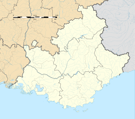
English: Blank administrative map of the region of Provence-Alpes-Côte d'Azur, France, for geo-location purpose.
Français : Carte administrative vierge de la région Provence-Alpes-Côte d'Azur, France, destinée à la géolocalisation. Projection "Géoportail" (projection équirectangulaire à la latitude de référence 46.5° Nord)
|
| Date | |
| Source |
Own work
|
| Author | Flappiefh |
| Other versions |
|
| SVG development |

Licensing[edit]
I, the copyright holder of this work, hereby publish it under the following license:
This file is licensed under the Creative Commons Attribution-Share Alike 4.0 International license.
- You are free:
- to share – to copy, distribute and transmit the work
- to remix – to adapt the work
- Under the following conditions:
- attribution – You must give appropriate credit, provide a link to the license, and indicate if changes were made. You may do so in any reasonable manner, but not in any way that suggests the licensor endorses you or your use.
- share alike – If you remix, transform, or build upon the material, you must distribute your contributions under the same or compatible license as the original.
File history
Click on a date/time to view the file as it appeared at that time.
| Date/Time | Thumbnail | Dimensions | User | Comment | |
|---|---|---|---|---|---|
| current | 16:27, 28 June 2017 | | 514 × 456 (4.41 MB) | Wereldburger758 (talk | contribs) | Valid SVG now. |
| 21:52, 16 May 2015 |  | 514 × 456 (4.86 MB) | Flappiefh (talk | contribs) | Contour d'arrondissement pour l'étang de Berre (et non plus région). | |
| 21:19, 14 May 2015 |  | 514 × 456 (4.86 MB) | Flappiefh (talk | contribs) | User created page with UploadWizard |
You cannot overwrite this file.
File usage on Commons
The following 5 pages use this file:
File usage on other wikis
The following other wikis use this file:
- Usage on als.wikipedia.org
- Usage on cv.wikipedia.org
- Usage on de.wikipedia.org
- Flughafen St. Tropez
- Wikipedia:Kartenwerkstatt/Positionskarten/Europa
- Flughafen Toulon-Hyères
- Stade Perruc
- Stade de Bon Rencontre
- Stade Eugène-Pourcin
- Stade Mayol
- Vorlage:Positionskarte Frankreich Provence-Alpes-Côte d’Azur
- Crystal Kelly Cup
- Flugplatz Le Luc-Le Cannet
- Viadukt von Anthéor
- Siagneviadukt
- Pont de l’Artuby
- Pont de Savines
- Usage on de.wikivoyage.org
- Usage on en.wikipedia.org
- Barcelonnette
- Avignon
- Grasse
- Nice
- Toulon
- Tarascon
- Arles
- Aix-en-Provence
- Cannes
- Orange, Vaucluse
- Brignoles
- Saint-Rémy-de-Provence
- Les Baux-de-Provence
- Vitrolles, Bouches-du-Rhône
- Antibes
- Saintes-Maries-de-la-Mer
- Maillane
- Nice Côte d'Azur Airport
- Gap, Hautes-Alpes
- Menton
- Briançon
- Carpentras
- Villeneuve-Loubet
- Sophia Antipolis
- Martigues
- Aubagne
- Istres
- Sault, Vaucluse
- Saint-Maximin-la-Sainte-Baume
- Châteauneuf-du-Pape
- Saint-Tropez
- Gilette
View more global usage of this file.